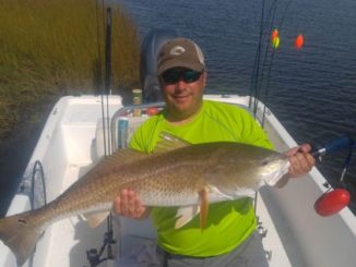
Ask Captain Paul
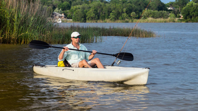
Ask Capt. Paul: Pointe aux Chien kayak waypoints
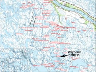
Waypoints in the Point aux Chien area of the Pointe-aux-Chenes Wildlife Management Area.[…]
Waypoints in the Point aux Chien area of the Pointe-aux-Chenes Wildlife Management Area.[…]

As a longtime fisherman of the Lake Borgne area, I had a vast library of locations to fish – and more than 160 of these are included in the Lake Borgne Edge file.[…]
According to Wikipedia, the Rigolets is an east-west 8-mile long strait connecting the northern part of Lake Pontchartrain and Lake Borgne. “Rigolets” comes from the word rigole, which is French for “trench” or “gutter.” The name is locally pronounced “RIG-uh-leez.” […]
I refer to the Lafitte Edge area as the location in the Southeast Louisiana marsh in St. Charles, Lafourche and Jefferson parishes between the Bayou Segnette launch in Westwego, Lakes Cataouatche and Salvador, areas in the Lake Salvador Wildlife Management Area, southwestward to Bayous Gauche and des Allemands, Lac des Allemands and Bayou Boeuf and eastward toward The Pen and Bayou Du Pont, then continuing south to the northern part of Barataria Bay.[…]
This area is actually where Capt. Paul’s Fishing Edge got started. The interest generated from this location allowed me to start marketing waypoints for 21 different areas, including Barataria Bay, Lake Borgne, Hopedale to Bayou Terre Boeufs, Bayou Bienvenue, Port Sulphur, Lake Pontchartrain, Lake Borgne and many more.[…]

The Vermilion Bay Fishing Edge consists of 205 different waypoint positions. Many locations were once land points or islands that are now submerged, in addition to other visible and key navigation spots. […]
This St. Bernard Parish area is one of the prime inshore fishing spots in all of the Louisiana coastal marshes, with many weather-protected fishing locations. […]
As a help in fishing the area, I have complied fishing waypoint positions throughout the area. Captain Paul’s Fishing Edge of GPS waypoints for Cocodrie ~ Dulac has over 165 GPS waypoints in and around the area.[…]
The Pearl River Wildlife Management Area is located between the Pearl River at the Louisiana-Mississippi state boundary, and the West Pearl river from the east end of the Rigolets by the Mississippi Sound to a point where I-59 crosses its boundary. […]
The Calcasieu Lake area is located almost entirely in Cameron Parish south of Lake Charles. It is part of the estuary of the Calcasieu River, and is just north of the Gulf of Mexico. It is more commonly referred to as Big Lake.[…]
The Biloxi Marsh area located in St. Bernard Parish encompasses the general area north of the Mississippi River Gulf Outlet (MRGO) Canal to the Mississippi Sound, and from Lake Borgne to Chandeleur Sound.[…]
The Myrtle Grove area provides one of the most diverse spots for fishing in the Louisiana coastal marshes. Wintertime fishing is great, but it also offers good fishing year round. […]
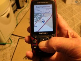
A friend of mine advised me not to carry my GPS handheld unit while hunting, as he claims that his smart phone can provide all the information that he needs. What about maps? Where can I get some hard copy ones? What is your view on this and why? […]
Dear Capt. Paul:
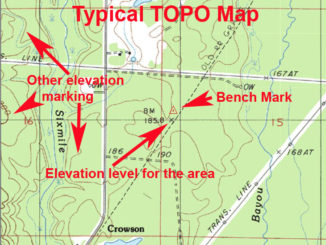
I am interested in joining a geocaching club. Part of the activities are finding benchmarks shown on topographical maps, taking a photo of the benchmark and logging it and the photo in a club book. I have several topographical maps that show specific numbers next to a small X. Is that the benchmark for that area?[…]
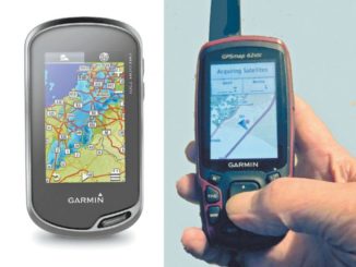
I am in the market for a newer GPS unit, but I am not sure to get one where the controls are activated via a touch screen or one that requires a rocker button. Of course, cost is a concern, but I am not sure which way to go. Is there a difference in weather protection? […]
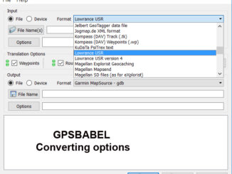
I have a Garmin GPS map 76 handheld, Lowrance hook 5, Lowrance elite chirp 7, and a Lowrance HDs 9 on my various boats. When I purchase your Fishing Edge files, will standard .gpx files work on all four or do I need Lowrance- and Garmin-specific files? […]