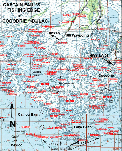
Knowing where islands were located is critical for angling success now
As a help in fishing the area, I have complied fishing waypoint positions throughout the area. Captain Paul’s Fishing Edge of GPS waypoints for Cocodrie ~ Dulac has over 165 GPS waypoints in and around the area. It is one of 21 different Edge Fishing Areas offered. The Edge offers anglers a way to quickly locate some of these fishing locations in and around the area.
This Captain Paul’s Fishing Edge of GPS Waypoints of the Cocodrie ~ Dulac area is located from Point au Fer Island, Four League Bay to the east side of Cocodrie from the Gulf of Mexico by Isles Dernieres to Lake De Cade by Bayou DuLarge. It is located in the southern part of Terrebonne Parish.
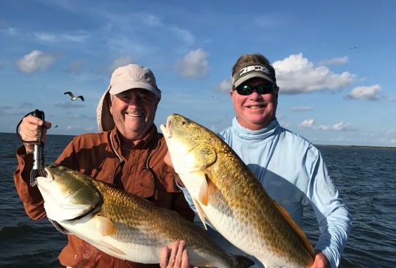
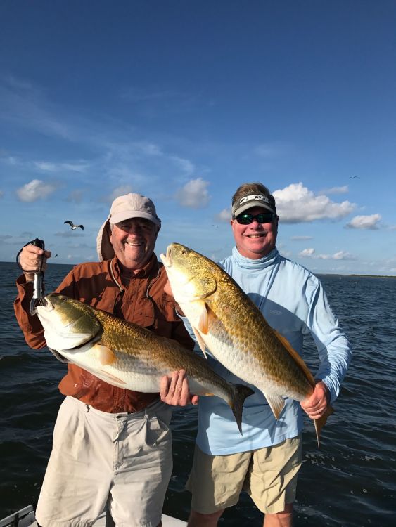
This area is known for the producing a variety of fish including trophy sized speckled trout and redfish, white trout, flounders, croakers, sheepshead, black drum, and of course catfish.
The southern area by Last Islands (Isles Dernieres) and the Gulf of Mexico is a favorite fishing area. These barrier islands once consisted of Wine Island, East Island, Trinity Island, Whiskey Island and Raccoon Island. Most have eroded away, but it is an invaluable tool for the avid angler to know where they were.
Waypoint CODRE 298 in Coupe Juan Pass at 29°03.7278’ North Latitude ~ 90°41.5423’ West Longitude between Trinity and East Island had deeper water than other locations in the area.
To the west, Waypoint CODRE60 indicates a shoal at 29° 02.9948’ N. Lat ~ 90°52.7825’ W. Long. It’s between Whiskey and Raccoon islands, and is a great area to fish (or avoid when cruising that area.)
In addition, this area also shows the U.S. Geological Survey (USGS) Benchmark for “Coon Point,” which was at one time the western part of Raccoon (Isles Dernieres), which is shown as CODRE117 at 29°03.5490’ N.Lat ~ 90°57.6655 at the west end of the island where sandbars are constantly moving.
Also featured is the “Sunken Barge” on Grand Bayou Dularge that is located near a Red Light (plotted at 29°12.986’N. Latitude ~ 090° 56.9630’ W. Long.) on the east side of the bayou almost in Caillou Lake.
The barge, shown as Edge Waypoint CODRE 34, is very near the Red 4 marker. The sunken barge is plotted as being at or about 29°12.9860’ N. Latitude ~ 090° 56.9690’ W. Longitude. The structure had been holding a decent catch for the first few boats that reach it after daylight.
But use caution in the area. This is a motor buster. Fish around the structure, and between it and the Red 4 marker. Again, I must say, use caution around this site as this barge has been the premature demise of many of an outboard’s lower unit.
To the north you will find many, many other Edge locations.
CODRE105, shown as a position in Lake Raccourci at 29°21.2201’N Lat ~ 90°56.7125’W Long., is where an island was once located. Find the current reef and shallows and fish the area.
Another favorite is CODRE99 at 29°17.4706’ N. Lat ~ 90°57.9570’ W. Long. It is the location of the reef which was once Hog Point in Lake Mechant. Knowing where this point was can give you a real EDGE when in the area.
Captain Paul’s Fishing Edge
As you know, GPS data such as waypoints can now be electronically installed in most GPS units in just a matter of minutes. Each Edge file has an electronic data file that can be downloaded into a variety of GPS brand units. All of the EDGE programs are sent as an email attachment. To help those of us who are not computer savvy, each download has a general map of the area in 1:100,000 scale, and individual information on each waypoint. These map images cannot be installed in the GPS unit, but offer a location of the waypoints and their descriptions, as well as READ ME and INSTRUCTIONS files. They show the latitude~longitude value of the waypoints, and in some instances a “How to Fish” tutorial for the location. I keep a hard copy of this PDF file aboard my boat as a backup.
Presently, Captain Paul’s Fishing Edge is available for 21 different areas, including Barataria Bay, Lake Borgne, Hopedale to Bayou Terre Boeufs, Delacroix to Point a la Hache, Bayou Bienvenue, Port Sulphur, Lake Pontchartrain, Lake Borgne, Calcasieu Lake, Pearl River WMA, Lafitte, Leeville East and Leeville West, Vermilion Bay, Empire-Buras, the Rigolets and the MRGO.
I always suggest that you have a reliable compass and a map of the area whenever you venture outdoors. Please show respect to other anglers around you, and do not trespass. All positions are determined using WGS datum and are stated as degrees, minutes and ten-thousandths of a minute (DDD, MM.mmmm)
To order an Edge file, you must have an email address that accepts attachments. All of Captain Paul’s Fishing Edge files can be found in Louisiana Sportsman’s Outdoor Store (www.sportsmangear.com). Remember that you must state your brand of GPS unit, your email address and the selected area. The Edge files are NOT brand name interchangeable, so be sure to make the correct GPS unit selection.