Turkey hunters: Waypoints aren’t just for fishing
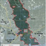
The Pearl River Wildlife Management Area is located between the Pearl River at the Louisiana-Mississippi state boundary, and the West Pearl river from the east end of the Rigolets by the Mississippi Sound to a point where I-59 crosses its boundary.
It offers a variety of outdoor sports activities, a nature trail and hunting for numerous game, and includes a shooting range and camping facilities by one of the many boat launch locations. Naturally, with all of the criss-crossed small rivers and bayous, it is a great location for freshwater fishing — and the southern part of the river estuary is a great location for salt and brackish water species of fish. I have hunted deer, turkey, squirrels, waterfowl and hogs as well as have fished the WMA. Wildlife and Fisheries has a rough map of the area, and a list all of the regulations as to when and how to make use of the area which can be found on the Louisiana Wildlife and Fisheries website.
Note that there are procedures when the river level reaches 16.5, with all hunting except waterfowl closed.
The Capt. Paul’s Fishing Edge is a natural for the WMA. The Edge has over 135 fishing and hunting locations in and around the area.
It has bass fishing spots, such as Peach Lake, WP# PR46 at the Middle Pearl River and Peach Lake at 30°18.9230’N.Lat. ~89°41.3546’ W. Long., and WP # PR53 at Steamboat Bayou at Middle River at 30°15.9133’N. Lat. ~ 89°39.4273’ W. Long. and Johnson Lake WP#PR50 at 30°18.1913’ N. Lat. ~ 89°40.3780’ W. Long. Naturally the deeper West Pearl and Pearl River are excellent catfish locations. The Rigolets at East Pass of the Little Lake at WP# PR68 at 30°09.7380’ N. Lat. ~ 89°37.5347’ W. Long. is great saltwater fishing along the northwest side by the old pilings.
Hunting spots
Hunting locations such as Holden Pond at Gobbler Bayou at WP# PR15 at 30°21.8131’ N. Lat. ~ 89°40.4987’ W. Long. and Murdock Eddy Lake, shown as WP# PR38 at 30°23.6482’N. Lat. ~ 89°40.6723’W. Long. offer excellent turkey and deer hunting, as does many of the rolling slews. Squirrels also can be around throughout the hardwoods adjacent to these slews.
Naturally those Edge locations in the land areas are designed for hunting on foot, and those in or at water junctions are designed to be reached via boat.
I have hunted on foot via the Old Highway 11 access road, but I prefer to access the WMA via boat. It allows for a day that consists of a morning hunt and a fishing afternoon.
But I suggest that you actually check out the area before trying to make an actual hunt. Remember to bring a compass and a hard copy of a map of the area along, as you will need it to navigate safely.
U.S.G.S. Topographical maps Nicholson, Miss-La. #30089-D6-FT-024 and Rigolets LA. #300089-B6-TF-024 should cover most of the WMA.
As always, please show respect to other anglers around you and obey all of the WMA regulations.
All positions are determined using WGS datum and are stated as Degrees, Minutes and ten thousandths of a minute (DDD, MM.mmmm).
Capt. Paul’s Fishing Edge of GPS waypoints has this and many other locations statewide.
Get the Edge
All of the EDGE programs are sent as an e-mail attachment for your computer via your address. This data download enters all of Capt. Paul’s waypoints into your unit in a matter of seconds.
To order an Edge file, you must have an e-mail address that accepts attachments. All available Fishing Edge files can be found in the Louisiana Sportsman’s Outdoor Store (www.sportsmangear.com.)
In addition, there are several links throughout Louisiana Sportsman’s website which will bring you to the Edge ordering page.
Remember that you must state your brand of GPS unit, your email address and your selected area. The Edge files are NOT interchangeable with different brand name units, so be sure to make the correct selection for your GPS.
Capt. Paul’s Fishing Edge of GPS Waypoints will give you a big edge in navigating, hunting and fishing the area.
– Capt. Paul


