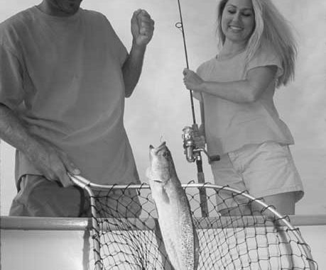
Stop throwing those croakers back, and toss them in your ice chest. You’ll be so glad you did when you get home.
Dear Capt. Paul:
I am a subscriber to the magazine. I would like three locations if posible. I am looking for 5 Wells, Pogo Rig and the Cement Rig.
Thanks, Alvin Beaubouef
Captain Paul’s Response:
The area called Five Wells is oval in shape, and is about .6 of a mile in diameter. There are two larger wells and three smaller platforms.
I believe that all of the platforms are still at the location, but the oil companies are removing some of the non-producing platforms in that area, and one or two may have been removed.
The group is located about 4.5 miles almost due south of the end of the rock jetty on the southern side of the Mississippi River Gulf Outlet (MRGO). The end of the rock jetty is located at or about N29 37.738/W89 19.295.
The northernmost of the wells (KM-BS-SL-1227-9) is located at or about N29 33.855/W89 19.198. The southernmost of the wells (KM-BS-SL-1227-6) is located at or about N29 33.399/W89 19.446.
All of the wells are visible from either of these two positions.
The Pogo Rigs are in Chandeleur Sound between Grand Gosier and Curlew Islands. They are about 25 miles east-southeast of the short rocks by Gardner Island, and some 15 to 20 miles east of Bay Eloi.
The westernmost one, POGO-BS-23-7896-1, is at or about N29 35.230/W89 01.882, and is located in Breton Sound Leased Block 23.
The easternmost one, POGO-BS-24-7792-2, is at or about N29 35.115/W89 00.070, and is located in Breton Sound leased block 24.
Another set of rigs relatively close in the same general area are the Concrete Rigs, sometimes called the Cement Rigs. I, however, cannot personally vouch for these two locations.
The information that I have on the Concrete Rigs is at N29 41.072/W89 17.849. The westernmost is at N29 41.417/W89 19.800.
Unless otherwise specified, all positions are stated as H,DDD,MM.mmm, and were determined using WGS 84 datum. All headings, bearings and courses are stated in magnetic degrees.
Dear Capt. Paul:
I just purchased a Garmin 168 Sounder. I know you recommend the U.S. Topo software if fishing in the Louisiana marshes.
My question: If you download the topo software plus the waterways software, which software does the Garmin recognize? Does it combine the information from both data bases? Please advise.
Thanks, Kaye Florane
Capt. Paul’s Response:
The unit is designed to recognize the maps that you select in the configuration menu.
Check page 33 of your owner’s manual. On that page it shows a setting for the map configuration tab. Under that tab, there is a setting for turning the Basemap or Mapsource maps on or off.
By selecting the Mapsource option, you can select any of the maps that you entered in your unit. I have the lights and waterways loaded along with the U.S. TOPO mapping software, and all of the navigation aids show on my map screen. When venturing in an area where there is no topo coverage, I still have the NavAids showing for assistance.
Be careful when loading any maps as the unit will accept only the last maps that were loaded. In other words, installing a new set of maps in the unit will erase the maps already installed in the unit. You have to combine all of the maps together in a bundle and then install them all at one time into the unit.
Dear Capt. Paul:
What are the waypoints for the Dope Boat in Black Bay?
Thanks, Grenes Meyaski II
Captain Paul’s Response:
The Dope Boat is located at or about N29 34.371/W89 16.033.
It is located on the south side of the Mississippi River Gulf Outlet (MRGO) spoil bank. It is south of ATON Green No. 43 and west of ATON Green No. 41 in the MRGO. Most people cross the rocks at the Black Bay cut by ATON Green No. 59 and then run parallel to the MRGO on the south side for a distance of about 5 to 6 miles until they reach the Dope Boat.
Use caution, in the area as the last time I saw the boat only a very small part of the ship’s mast was above the water. In addition, there are other wrecks and obstructions in the area.
Check out NOAA chart No. 11363-Chandeleur and Breton Sounds and chart No. 11364- Miss. River, N.O. to Venice; they will cover most of the area of your interest. When shopping for these charts, be sure to get the most recent version.
In addition you may also want to have some of the other frequented fishing spots in that same area.
The Central Rig is one of about eight platforms of the Kerr-McGee series of rigs in the area north of the MRGO. It is about 5 miles directly north of Red No. 22 buoy in the MRGO channel. It is about 3.8 miles northwest of the Gosier Islands, or what is left of the islands, and is about 6.5 miles north-northeast of North Point Island of the Breton Islands, which are south of the MRGO.
The Central rig, KM-BS-SL-1998-56, is located at or about N29 34.692/W89 07.034. It is about 39 miles from Breton Sound Marina.
And, of course, don’t pass up the end of the rocks on the north side of the MRGO. That location is at or about N29 40.767/W89 23. 255.
All of these positions except the end of the rocks, are locations that are in the open waters of either Black Bay, Chandeleur or Breton Sounds. Use extreme caution when venturing into these waters as weather conditions can make the area very dangerous for a small boat.
All positions are stated as ddd,mm.mmm, and were determined using WGS 84 datum.
Got a question for Capt. Paul? You can ask it at www.louisianasportsman.com.
")
