Let Mother Nature tell you where to target specks and reds this month.
Capt. Paul:
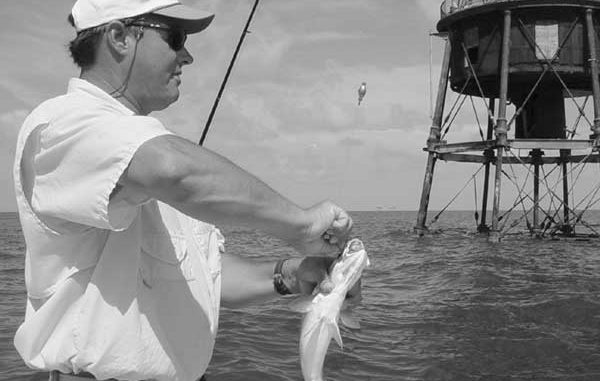
What are the GPS coordinates of the Ship Shoal Lighthouse?
Thanks, CG
Captain Paul’s response:
The old abandoned Ship Shoal Lighthouse is located about 30 miles east of the Morgan City approach channel at land’s end at a bearing of about 141 degrees. The abandoned lighthouse is near the western end of Ship Shoal, and is at or about N28 54.901 x W91 04. 272. The water on the shoal around the old lighthouse is 10 to 12 feet deep.
It can be viewed on NOAA chart No. 11356-Isles Dernieres to Point au Fer. Get the latest chart available (2002), as there is considerable amount of shoaling and some wrecks that are different from earlier versions of the same chart.
The following story by Wendell Usie may interest you:
“Lighthouses, and aids-to-navigation in general, have logically been associated with the economy of the nation.
“The safety of our coasts and harbors has been attractive to shippers, and has undeniably benefitted our international trade. The free flow of shipping, with foreign-bound consumer products or inbound raw materials, allowed the young nation to advance economically at a fast pace.
“Environmentally the light warned shipping of dangers, averting groundings or wrecks that could cause pollution.
“Charts from the early 1800s show Ship Shoal as an island some 20 miles south-southwest of Raccoon Point.
“On Dec. 17, 1847, the Revenue Cutter McLane was recalled from Mexican War duty to report to New Orleans “without delay … to dismantle her …” for transformation into a lightship. The original cost of the vessel was $12,774.67.
“The Ship Shoal Lightship was anchored in 1849 to guide vessels between the shoal and Raccoon Point.
“Visible for about 12 miles, the two red lanterns were 30 feet and 45 feet above the waterline. Each lantern held eight wicks and reflectors. The vessel was anchored inside the west end of the shoal in about 30 feet of water.
“In 1859, the lightship was replaced by the Ship Shoal Lighthouse. The 125-foot iron skeleton tower was placed on screw piles in 15 feet of water, its large lens making one revolution every 30 seconds.
“By 1866, several lighthouse keepers had become sick or paralyzed at this light, and as the reputation spread, new keepers became hard to find.
“Sickness continued for several years until it was discovered that leaded red paint was being washed into the rainwater tanks, which were also coated with leaded paint. The old paint was removed entirely and the tower coated with hot coal tar. Health at once improved.
“Erosion of the foundation became a major concern by the early 1870s, when the tower began tipping slightly and the water depth on one side increased sharply.
“Granite blocks shipped shortly afterward to Fort Pickens, Fla., for transshipment to Ship Shoal were not delivered to the light until 1896, but luckily the tower had stabilized.
“Now extinguished, the brown skeleton tower is the Ship Shoal daytime landmark and the last remaining lighthouse off the Terrebonne Parish coast.”
Capt. Paul:
I am having trouble finding coordinates for rigs that are 3 miles and closer to the coast. I’ve tried the website www.gomr.mms.gov, which you’ve recommended in the past; however, I cannot find any close-in rigs.
Does the mms.gov website only have rigs in federal waters? Do you know where I can get rigs in state waters?
Thanks, Ryan
Captain Paul’s response:
You are correct about the MMS having only those sites that are in federal waters.
Those sites that are in state waters are logged and recorded by the Louisiana Department of Natural Resources. Their web site may be found at www.dnr.state.la.us/
From the home page, access the SONRIS button at the top right of the web page. Once on the SONRIS home page, you can select any of several ways to access the information on platforms in Louisiana state waters.
By using the “Lite” page, you can access the sites by parish, by map section, by well name, by Lambert Coordinates, as well as a sundry of other search criteria.
By selecting the SONRIS “GIS ACCESS to INTERACTIVE MAPS” button at the bottom of the page, you can select any location you want from the displayed state map.
By using the + and – buttons, you can zoom into the specific area of your interest. Then by selecting the OIL/GAS wells button, all of the wells in that area will be shown as an overlay on the map.
By selecting the circled “i” tool (identify), you can retrieve the data for that particular icon. When the “identify” window appears, you will have to click on the “well details” button to get all of the specific data on the site.
The entire SONRIS program is a terrific tool for identifying wells and sites in Louisiana. This includes the state waters as well as all inland locations.
When looking at the sites displayed on the map, remember that some of the “dry holes,” “removed platform,” “shut down well” categories may be more productive for holding fish than a working platform, as the shell and aggregate footings are usually left in place.
Armed with a GPS position fix for these sites could produce a bonanza.
Some of my Capt. Paul’s Fishing Edge files include some of this data as waypoints that can be downloaded into and then from a GPS manufacturer’s mapping program into your GPS unit.
")

