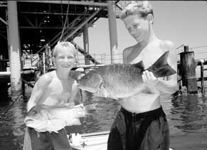
Dear Capt. Paul:
I just resently bought a 22-foot boat, and I would love to start fishing Grand Isle for mangrove snapper. Could you give me some coordinates to some good rigs close in?It would be appreciated, and God bless all those recovering from the storms.
Sincerely,
Rob
Capt. Paul’s response:
A 22-footer may be a little light for some of these locations, so keep that in mind when planning your trip.
Here are several locations that could produce your mangroves. I can’t guarantee any of them at a specific time will be producers, so keep that in mind.
From the green No. 1 Aid to Navigation (ATON) at the beginning of the Barataria Pass entrance channel in the Gulf of Mexico (N29 14.436 x W89 54.753) to the Green Monster is about 21 miles at a bearing of 102 degrees.
There are several rig platforms in the Sandy Point area, but the all-time favorite rig is referred to as the Green Monster, WD-23-3 CMP, which is located at or about N29º 10.547 x W89º 34.555.
Although still called the Green Monster, I have been told that it is now painted gray.
The closest platform, to the Empire Jetty in the Gulf is MX-WD 24-4. It is at or about N29º 12.538 x W89º 32.375, and is about 4.9 miles from the red No. 2 ATON at the jetty.
Near the above platform, there is a “flare” platform, MX-WD 24-FLARE No. 1, at or about N29º11.962 x W89º 32.172.
The southernmost of the series of platforms, MX-WD 24-5D, is at or about N29º 10.707 x W89º 32.044.
The easternmost of the series, MX-WD 192-8, is at or about N29º 11.451 x W89º 30.411.
Two of the most popular locations are near the southwest section of the group.
MX-WD 23-3 is located 5.2 miles at a bearing of 159º from ATON red No. 2, and is at or about N29º10.524 x W89º 34.559.
The other, MX-WD 23-FLARE No. 3, is at or about N29º 10.489 x W89º 33.099, and is about 6.2 miles at a bearing of 146º from red No. 2 ATON.
All of these features may be viewed on NOAA charts 11358-Barataria Bay and Approaches and 11361_1 Miss. River Delta.
As for the immediate Grand Isle area, the Department of Wildlife and Fisheries has an extensive listing of all the Louisiana artificial reefs on their web site. Check it out by going to louisianasportsman.com, then click on the LDWF tab at the left side of the web page in the dark green banner section of the page.
Once on the LDWF site, you can navigate through the fishing information selection to the section on artificial reefs. Once there, you will note that they have offshore artificial reefs listed by area. There are numerous locations throughout Louisiana’s coastal waters, including Grand Isle.
If nothing else, it is very interesting to read the information about the reef program. But the big advantage is that they list the latitude and longitude for all of the artificial reef locations.
However, please note that the LDWF site lists coordinates as degrees, minutes and seconds, and these coordinates are shown using NAD 27 datum. If your GPS is set to DD-MM.MMM, or another datum, you must convert them to the same format as your GPS or the GPS to their format.
To convert seconds (SS) to thousandths of a minute (.MMM), divide the seconds by 60. To convert thousandths of minutes (.MMM) to seconds (SS), multiply by 60.
The old Freeport-McMoRan Sulphur Platform, which was located off the coast of Grand Isle, is the center of one of the artificial reefs. The site is about 3.9 miles from the green ATON light No. 1 at the beginning of the entrance to the Barataria Pass channel, just south of Grand Isle.
The rig site is now an underwater reef. Freeport-McMoRan donated the sulphur rig to the state of Louisiana for use as an artificial fishing reef. It was partly disassembled, and is now completely submerged below the water. The site is about 30 feet below the surface.
This Grand Isle reef is now marked with five buoys. The northernmost of the five buoys. FISH FLRA-27-B HAVEN, is located at or about N29º11.6223 x W89º 53.670.
Another buoy, FLRA-27-A, is at or about N29º11.597 x W89º52.990. It is about 3.8 miles south of Barataria channel marker NUN RED 2.
The center buoy of the three southernmost buoys is at or about N29º10.948 x W89º 53.335.
Another set of offshore platforms in the Grand Isle area is the Exxon-Mobil Offshore Platforms.
These are located to the southwest of ATON Green No. 1 at the Barataria Pass channel at a distance of about 11 miles at a bearing of 202 degrees. They have been known to be productive at certain times of the year.
“L” Center Platform, has living quarters, fish for mangroves (N29 06’05.2 x W89 58’41.7).
“BB” Platform, fish for reds (N29 09’15.6 x W90 01’07.3)
“CC” Platform (N29 10’37.5 x W89 59’ 31.02)
“9M” Platform (N29 10’37.2 x W89 52’30.5)
“019” Platform (N29 08’59.5 x W89 53’50.7)
“J” Platform, fish for mangroves (N29 06’02.8 x W89 59’40.0)
“P” Platform (N29 06’31.1 x W89 58’09.2)
“Q” Platform, fish for mangroves (N29 05’48.9 x W89 05’40.4)
“R” Platform (N29 07’21.7 x W89 57’58.3)
“S” Platform (N29 09’ 10.9 x W89 58’02.7)
“T” Platform (N29 06’39.3 x W90 01’26.2)
“U” Platform, fish for mangroves (N29 05’48.9 x W89 57’52.7)
“W” Platform (N29 05’41.2 x W89 56’31.6)
Note: The positions are stated in degrees, minutes and seconds. No datum was listed, but most such platforms are listed using NAD 27 datum.
Unless otherwise specified, all positions are stated as H,DDD,MM.mmm, and were determined using WGS 84 datum. All headings, bearings and courses are stated in magnetic degrees; all distances are stated in statute miles.
")

