


The Red River today bears little resemblance to the roiling one explorers discovered centuries ago.
Today, the Red River is a fishing mecca. Both largemouth and white bass prowl around its rock jetties, huge catfish lurk in the deep holes and crappie school up on the oxbow lakes.
The Red River is truly a beauty to behold and a Sportsman’s Paradise. When enjoying the tranquil water today, it is hard to believe that until recently, the mighty Red was one of the nation’s last untamed rivers.
The Red River posed problems for Louisianians beginning in prehistoric times. Its geological quirks made it an oddity among Louisiana streams, and its murky water could be downright treacherous. It was not until the J. Bennett Johnston Waterway was completed in the 1990s that the river was finally tamed.
Fed by two branches in the Texas Panhandle, the Red River is Louisiana’s second-largest stream. It flows 1,360 miles across the border of Texas and Oklahoma, through Southwest Arkansas and across North Louisiana to empty into the Atchafalaya and Mississippi rivers near Simmesport.
Reddish sediment suspended in the water gives the river its name. More than 200 years ago, explorer C.C. Robin entered the Red from the Mississippi River, and noted, “The waters of the Red River are seen long before one comes to the River. The Red River water is dark and reddish … .”
Robin also claimed that local inhabitants at the time believed the muddy water had great power, perhaps because of the rich farmland that lay along its banks.
“They attribute to it the capacity for increasing fertility … and especially of increasing the frequency of the occurrences of triplets,” he said.
An unusual river
Early explorers such as Robin discovered the Red River was unique in three ways. First was the water’s peculiar salty taste. Around 1800, both Robin and James Pitot wrote that it was “brackish,” and Pitot claimed one could barely drink it when the river was low.
Both men correctly identified an underground salt dome as the culprit. Far upstream on the Texas-Oklahoma border, the river flows over a salt dome and picks up just enough salt to make the water brackish.
This salt content frustrated Louisiana farmers for generations because crops do not tolerate salt well. Using Red River water for irrigation on a regular basis meant farmers were slowly killing their own fields.
The Red River was also the only river in Louisiana that had whitewater rapids. Over eons of time, it cut through a formation of sandstone at modern-day Alexandria, and created a series of rapids that stretched about three-quarters of a mile. When French explorers encountered the rapids, they named the area (and later parish) “Rapides.”
The rapids were a great obstacle to early explorers because they had to make a difficult portage around them. Once above the white water, they encountered the river’s third unique feature — the Great River Raft.
The Great River Raft was a huge logjam that clogged the Red River and made boat passage impossible. Starting around Boyce, it stretched for perhaps 150 miles upstream.
It is not certain when the raft formed, but it may have been around 1100-1200 A.D. It probably was the result of floods causing the bank to collapse and dumping trees into the river, which then became snagged on sandbars. Or it might have been created by a massive Mississippi River flood that caused the Red River to reverse course and become blocked by debris.
Whatever the cause, the raft grew as annual floods deposited more trees into the river. Records indicate the raft grew approximately three-quarters of a mile every spring.
While the Great River Raft posed immense problems for early settlers, we would not have some of our most productive lakes today without it. Whenever the logjam backed up past the mouth of a bayou, it acted as a dam and prevented the stream from draining into the Red. As a result, the bayous backed up and created lakes in low spots.
These so-called raft lakes are unique to Louisiana’s Red River. They include Lake Bistineau, Black Lake, Saline Lake, Iatt and Nantachie. When the Great River Raft was cleared in the 19th century, these lakes drained away and had to be reconstructed in the 20th century with modern dams.
Early exploration
French explorers first traveled on the Red River in 1700 when the Sieur d’Bienville and Louis Jucherau de St. Denis came down it after hiking across North Louisiana to visit the Natchitoches Indians. For the next 100 years, settlers, soldiers and traders used the river to move back and forth from the Natchitoches settlement and New Orleans. But it was not until the early 19th century that scientific explorations were made and detailed accounts were written of the river and its valley.
In 1804, at the same time Lewis and Clark were sent into the upper Louisiana Purchase, President Thomas Jefferson ordered William Dunbar and George Hunter to explore the lower purchase along the Ouachita River. With 19 men, Dunbar and Hunter entered the Red on Oct. 17 in what was described as a “Chinese-style vessel.”
Hunter wrote, “This river is of a reddish muddy colour owing to a clay or Marle of that colour suspended in its water, which is said to give an amazing degree of fertility to the ground overflowed by it. … We have already seen a great many flocks of wild Geese & Brandt, although still shy, a few ducks, many large Alligators.”
The following day, Dunbar observed, “The banks of the river are luxuriantly clothed with peavine and several kinds of grasses yielding seed, of which geese and ducks are very greedy.”
The Dunbar-Hunter Expedition only explored the lower Red River. Once the men reached modern-day Jonesville, they entered the Black River (so named by the French because its rather clear water was such a contrast to that of the Red) and then the Ouachita.
The Freeman-Custis Expedition
Two years later, Jefferson sent a full-fledged expedition to explore the entire Red River. Its purpose was to see if the river could be used as a route to Santa Fe and to make contact with the western Indians.
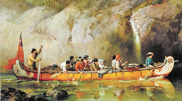
Thomas Freeman and Peter Custis led 22 men and two flat-bottomed boats and a pirogue out of Fort Adams, Miss., on April 19, 1806. More soldiers and guides were picked up later.
These explorers found that simply entering the Red was dangerous. At its mouth, the river’s current not only converged with that of the Mississippi, but the Atchafalaya also pulled water out of the same place.
C.C. Robin had examined this area a few years before, and warned travelers who entered the Red from the Mississippi to stay along the bank opposite the Atchafalaya’s outlet.
“One must be certain in going from one river to the other that the weather is good and the wind moderate, for while the water is quiet near the banks, in the center of the river, where the two currents flow together, the water is extremely choppy, and with the slightest wind, very dangerous.”
Freeman took time to measure the treacherous spot and found the Red to be 84 feet deep at its mouth.
Quickly moving upstream, the men soon noticed what every other explorer had written about the Red River — the area’s fertile soil was a result of frequent overflows that deposited sediments on the valley floor. Watermarks 14 to 20 feet high were seen on trees. One of the worst of these floods occurred in 1788-89 when the water got so high it caused Bayou Boeuf to back up and flood the entire Atakapas district to the south.
Of these frequent floods, one man wrote, “Someone told me that he had camped [on high ground] when the river was in flood and had found a large number of rabbits, which had been forced up on it by the water, and they could be taken by hand.”
Some travelers were not so fortunate to find dry ground to camp on for the night, and were forced to tie up to logjams and build fires “on the gently heaving platform.”
After witnessing the river overflow, Freeman later wrote, “[F]ew men can be found hardy enough to stand the poisonous effects of Half dried mud, putrid fish & Vegetable matter-almost impregnable cane brakes, and swarms of mosketos — with which these low lands abound after the waters are withdrawn.”
When Freeman and Custis reached the rapids, they made detailed observations about the unusual feature. Freeman noted there were two separate stretches of white water where the river flowed over strata of clay. The two rapids were about three-quarters of a mile apart, with the upper one being near the modern-day U.S. Highway 167 bridge.
Freeman reported the lower rapids were very swift and that the water dropped about 10 feet over a distance of 50 yards. In his report, Custis claimed there also was a 4-foot vertical waterfall they had to portage around.
The upper rapids had about the same rate of drop, but Freeman noted the water was swift for approximately 550 yards above the rapids.
Portaging around the rapids, the expedition soon passed the site of modern-day Boyce and reached a fork in the river. It was here that the Great River Raft began.
The left (western) fork was known as Cane River because of the numerous cane brakes along its banks. The right (eastern) fork was considered to be the main Red River channel, but local inhabitants called it the Riviére de Petit Bon Dieu (River of the Little Good God).
The name was said to be a reference to a priest losing his “images” there years earlier. Although the circumstances are not known, he may have lost a small statue of the baby Jesus that Catholics often possess.
Guides informed Freeman and Custis that the Riviére de Petit Bon Dieu was too clogged with logs to pass through. As a result, they entered Cane River, and headed toward Natchitoches.
Paddling up Cane River, the expedition began to encounter more and more people. Freeman wrote, “The inhabitants are a mixture of French, Spanish, Indian, and Negro blood, the latter often predominating, and live in small cottages on the banks and near the river.”
This region was the first part of Louisiana settled by the French. When explorer St. Denis was sent up the Red River to establish a trading post in 1714, he, too, was forced into Cane River to avoid the Great River Raft, and built his post at the Natchitoches Indian village.
Continuing up Cane River from Natchitoches, Freeman and Custis reconnected with the Red River just below the high bluffs known as Grand Ecore.
When the Great River Raft was cleared several decades later, the Red was able to flow freely down the Riviére de Petit Bon Dieu, leaving Cane River almost dry during times of low water. As a result, a small town sprang up at the Grand Ecore bluffs that served as Natchitoches’ river port. Eventually, Cane River was dammed to form the 26-mile-long lake that fishermen know so well.
Today, the old Riviére de Petit Bon Dieu is part of the J. Bennett Johnston Waterway’s Pool Three, and is a popular fishing area. A public boat landing at St. Maurice is located at the mouth of Saline Bayou, and allows access to the bayou, both the old and modern Red River channels and numerous oxbow lakes.
Another one of today’s popular fishing spots Freeman and Cusits noted was Bayou Pierre, which flows into the Red just upstream from Grand Ecore. Although they did not explore the bayou, the pair reported that it was the main route of travel for people heading west toward settlements located in Spanish territory.
When Freeman and Custis reached Campti, they began to encounter a series of log jams, and realized just how massive the Great River Raft was.
Freeman wrote, “The first raft is not more than 40 yards through. It consists of the trunks of large trees, lying in all directions, and damming up the river for its whole width, from the bottom, to about three feet higher than the surface of the water. The wood lies so compact that, that [sic] large bushes, weeds and grass cover the surface of the raft.”
At Campti, Freeman noted there were huge cottonwood trees in the area and reported one was 5 feet in diameter and 141 feet tall. Such huge trees had impressed the men throughout their journey. Near the rapids, Custis discovered Chinquapin trees that measured up to 30 feet high and 7 feet in circumference (a blight in the 20th century killed most of Louisiana’s wild Chinquapin trees).
A second raft encountered upstream from Campti was so thick the men could walk on it. With great difficulty, they finally cut a path through the mass, but then encountered a third log jam.
An exasperated Freeman wrote, “The labor incident to the formation of a passage, through these small rafts, is so great, that the navigation of this part of the river is never attempted; for it would require to be repeated every time a passage was attempted.”
Soon, the expedition was forced to detour into a small stream known as Bayou Datche because the raft so clogged the river it was impossible to continue any farther. One of the guides assured Freeman that Bayou Datche would take them around the raft and allow them to reenter the Red farther upstream. The guide claimed no one in the last 50 years had even tried to ascend the Red River beyond that point.
Freeman noted Bayou Datche was an Indian term meaning a “gap eaten by a Bear in a log.” It supposedly was named by the first Indian who passed through the region and saw a bear gnawing on a log. Today, we know it as Bayou Dorcheat.
It is difficult to trace the expedition’s route accurately from this point until they reentered the Red River. Although Freeman and Custis referred to geographic names we still recognize today, waterways have changed over the last 200 years, and their exact route is not known.
Paddling up Bayou Datche, the party soon entered Lake Bistineau, and was awed by its splendor.
Freeman reported, “This beautiful sheet of water extends, from the place we first entered it, seventy miles in a northwestern direction; and, as far as we saw it, is beautifully variegated with handsome clumps of cypress trees thinly scattered on it. … It is called by the Indians Big Broth, from the vast quantities of froth seen floating on its surface at high water.”
From Lake Bistineau, the men continued on through a labyrinth of sloughs, lakes and bayous they called the “Great Swamp.” One of the bodies of water was known as Swan Lake, and may have been located south of modern-day Bossier City. Some years later, another explorer noted there were a large number of huge alligators in this lake that “roared like great bulls.”
One of the most difficult stretches of water for the men was Red Chute Bayou in Bossier Parish. The current was so treacherous they had to tie ropes onto trees and bushes and pull the boats upstream (the same process had to be repeated coming downstream to maintain control of the boats). Increasing the danger was a large number of dead trees that came crashing down whenever a boat bumped them.
From Red Chute Bayou, the boats entered an area Custis called “Badtka.” This may have been Bodcau Swamp, and Freeman claimed it was filled with rotten trees that made passage difficult because extreme care had to be taken not to run into one. In some places the vegetation also crowded around the boats so thick the men could barely see beyond the bows.
After much difficulty the expedition finally made it to modern-day Swan Lake and then reentered the Red River by way of Willow Chute near Benton. While visiting the Coushatta Indians who lived in the area, Freeman wrote, “Cat Fish were taken at the camp near the village, of from 15 to 70 pounds weight. . . .”
From the Coushatta village Freeman and Custis continued upstream into Arkansas and points west. However, they never made it to the river’s headwaters. Spanish authorities in Mexico sent soldiers to intercept them in what is now Bowie County, Texas. In August 1806, Freeman and Custis were forced to turn around and head back to Natchitoches.
Despite their failure to complete the mission, Freeman and Custis made the first scientific study of the Red River. They discovered the Red River Valley was rich in wildlife and fertile soil, but the upper valley remained largely unsettled for many years because the rapids and Great River Raft denied easy access to the region. These impediments were eventually cleared, but it would take nearly 200 years to tame the river completely.
Part II of River Wild will appear in the August issue.

