“Where are the rocks?” I asked Tracy Bayles.
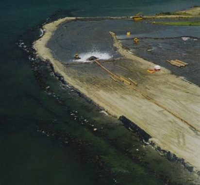
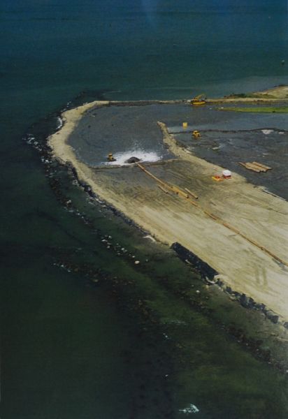
“You’re over them,” was Bayles’ plain-spoken reply. “All these wellheads were once protected by East Timbalier Island.
“The island and the rocks disappeared storm by storm.”
He explained that, from his understanding, the rocks that protected the island were barged down the Mississippi River from Arkansas by Texaco Oil Company to armor the island, which in turn protected the wells, all of which were inshore of the barrier island.
Texaco, he said, started cutting costs, and in the early 1990s, stopped bringing in more rocks as those in place sank beneath the sand.
Coastal land loss is disturbing anywhere it occurs, but when whole barrier islands begin to disappear, it is devastating. Some coastal land loss is a natural process. The Mississippi River has moved its mouth and its delta back and forth at least five to seven times in the last 4,000 to 7,800 years (The variation depends on the expert consulted).
As one delta is abandoned by the river, its land area begins to erode, some by direct wave action but mostly by subsidence. The earliest of these deltas — some call it Sale Cypremort, others Maringoin — was located in the area stretching from present day Atchafalaya Bay out to Ship Shoal.
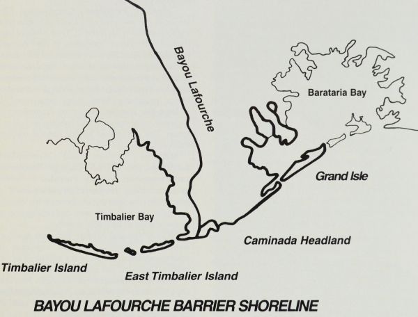
Nothing above water remains of this delta. It disappeared entirely by natural means. The most-recent delta before the river took its present course was the Lafourche Delta. Bayou Lafourche is what remains of the river’s course from that period.
The arc-shaped headland that fishermen call Fourchon Beach and geologists call the Caminada Headland holds vast quantities of sand deposited by the Mississippi River over the many hundreds of years it took to build the Lafourche delta.
Under natural geological processes — without human interference — wave action from the open Gulf of Mexico would attack the headland and currents would carry its eroded sands downcurrent to nourish the beaches downstream.
In simple terms, the sand from Fourchon would feed the island of East Timbalier at the same time that longshore currents would move sand from that island downcurrent to replace the sands naturally being eroded from West Timbalier.
If man didn’t interfere, this would go on until the Caminada Headland eroded far enough to lose its base of sand.
But man has interfered. It an attempt to protect the headland from coastal erosion, humans first placed huge sand-filled socks (immediately dubbed “boudin bags,” because of their resemblance to the sausage) and followed up by sinking rock-filled barges off of the headlands beach.
Land loss at the headlands was stopped. Very little more sand moved downcurrent to East Timbalier Island. Unfortunately, normal erosion processes continued to eat at that island, with its sand moving to West Timbalier. Sand loss was worsened by hurricanes undermining and burying the huge rocks that once protected the island.
West Timbalier stayed relatively intact, receiving sand from East Timbalier. But East Timbalier has shriveled to a shadow of its former self.