Louisiana waterfowl hunters laud the arrival of each cold front for brisk winds, falling temperatures and hopes of new migrators riding along.
As a by-product of these fronts and associated northerly winds, however, hunters along the Gulf Coast often face falling water levels as higher tides are blown offshore. With enough frequency, this can result in growing mud flats, making for treacherous navigation and the potential for getting stuck. Water that’s falling quickly can leave your favorite pond without enough water to even float a decoy, if you made it there safely.
 Such is the life of a Louisiana duck hunter in our tidal marshes, always taking on challenges in pursuit of our passion. However, with today’s abundance of tidal stations and some forethought in hunt planning, hunters can nearly avoid such scenarios altogether.
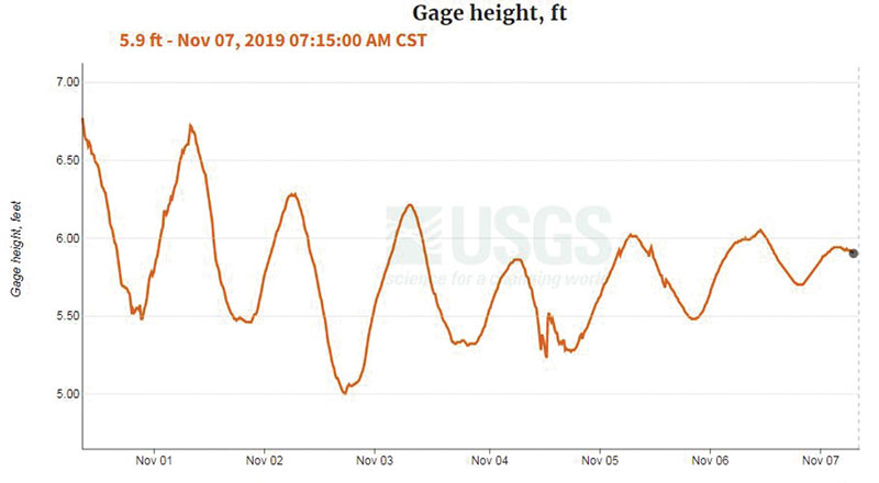
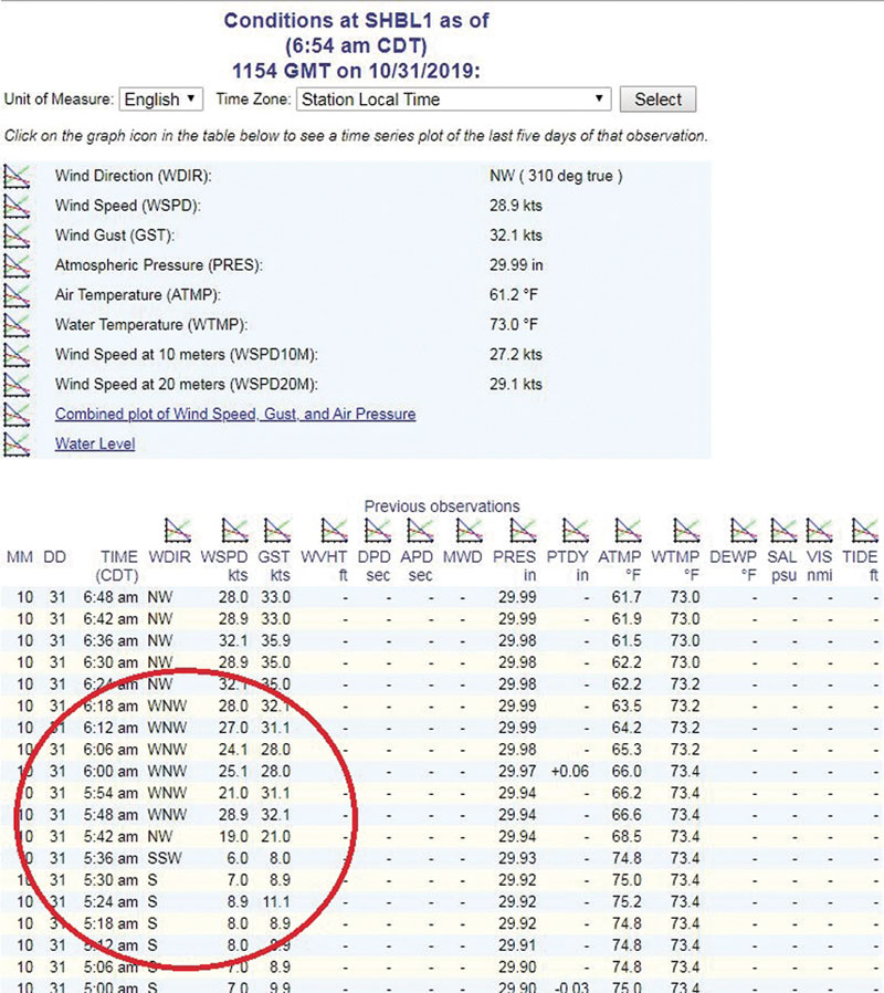
Water-level gauges are widely accessible across the coast, offering real-time data on current tidal conditions near your hunting area. Routine monitoring of these stations via your phone or computer on days you are on the water can build a reference for what your canals and ponds look like at a given water level on the gauge, ideally early in the season.
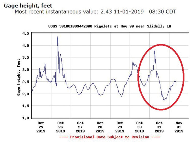 This will be critical for planning late-season hunts where the gauge reading may be a foot or more below levels on November’s opening weekend. If your favorite pond is only a foot deep or less, obviously, plans should be made for an alternate, deeper location.
Wind and water
Wind gauges are just as critical, going hand-in-hand with water-level monitoring to understand what the current conditions are and where they may be trending. For example, steady southerly winds can serve to artificially increase the water level in a marsh system. Just the same, post-frontal passage conditions can serve to lower water levels in a hurry, especially when paired with a falling tide.
 It is these relationships that must be monitored throughout the season for effectively planning a hunt. The headaches saved from avoiding sticking a boat on a mud flat or becoming stranded in a shallow pond are well worth it.
For example, should you face a falling tide in the morning with a strong cold front having passed overnight, you should expect rapidly falling water in the morning. The flight might be hot with new birds, but water levels should be monitored closely, even if that means leaving them flying.
Windy conditions
 It’s also not always wise to bank on a rising tide to regain access to a favored, shallow location if stiff northerly breezes are occurring. Depending on the tide range and wind strength, the wind can actually stonewall a rising tide, only to really pull the plug once the rise gives way to the fall. Depending on what side of the Mississippi River you might frequent, easterly or westerly winds can also be just as, if not more impactful, on tide levels than those breezes from the north or south.
It’s also worth noting that though our region has some excellent resources for recovering stranded boaters, these services have limitations. Each season, hunters find themselves stuck in remote areas, far from deeper water, only to learn that the recovery services are also unable to access that location, making for dangerous situations during cold weather. Some forethought in monitoring predicted wind strength and direction, combined with a close eye on water level gauges can serve to prevent both inconvenience and even dangerous situations this season.