
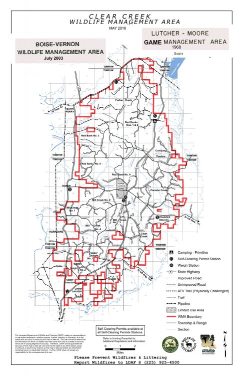
Public area is now Clear Creek WMA
Dear Capt. Paul:
After reading your column about the Dewey Mills / Saline WMA in the Louisiana Sportsman magazine, I had an idea that you could possibly help solve a family mystery that has plagued our family, since the death of our hunting grandfather.
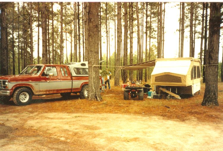
He was an avid deer hunter, and we would always enjoy the accounts of his trips. He and his buddies liked to hunt and camp on the game management areas.
He hunted throughout central Louisiana, and he always tried to capture the excitement of the hunt by taking pictures of him and his hunting buddies. One of the photos, still hanging on his wall, was of him and a very nice buck he harvested in the 1960s. The rear of the photo frame was marked, “180-pound 10-point buck taken November 1966 at Lutcher Moore GMA.” We do not know where that area was or is located.
Can you help? Thanks for considering my request for future hunters.
— Alex A.
Capt. Paul’s response:
Alex, yes, I can. Ah, your request brings back fond memories of hunting that game management area. Our group hunted and camped in the primitive camp grounds, and I do mean primitive, on the GMA before the state changed their controlled game areas from game management area to wildlife management area.
And you are in luck, as it still exists today — with a different name.
The Lutcher & Moore Lumber Company was a very successful Cypress harvesting company located in Lutcher. It started harvesting timber in the Manchac area.
This timber area was later acquired by Boise Cascade, which continued the state lease. The WMA was renamed Boise Vernon.
In the early 2000s, Cascade Corporation sold the property to Madison Dearborn Partners, a private equity investment firm located in Chicago. The area was then named after one of the major creeks in the area: Boise Vernon WMA became Clear Creek WMA.
You can obtain information about Clear Creek WMA at http://www.wlf.louisiana.gov/wma/32654.
The current owner is Forest Capital Partners. It consists of about 54,269 of rolling hill acres roughly located west of Leesvile and Deridder. It is between state Highway 8 and U.S. Highway 190 on the north and south; and Louisiana Highway 111 on the west, with Bayou Anacoca on the eastern side. Louisiana Highway 464 basically splits WMA east from west.
The following positions are located in and around the Clear Creek WMA:
• Camp Grounds (Highway 464) — N 31.05111511, W 93.40170532
• Highway 464 (Double Bridge Road) — N 31.01777876, W 93.41221767
• Double Bridge Road at Redbank Creek — N 31.03320537, W 93.44169245
• The Cow Pens — N 31.01293730, W 93.44061356
• Food plot 1 — N 32.02263454, W 93.44704713
• Food Plot 2 — W31.01804514, N93.42831919
• Food Plot 3 — N 31.00333410, W93.45613011
• Food Plot 4 — N 31.03640724, W 93.42831753
• Food Plot 5 — N 31.00935893, W 93.44470516
• Food Plot 6 — N 31.00007655, W93.44254754
• Self clearing check (Hawk Road) — N 30.95798991, W 93.40248700
• Self clearing check (Highway 8 at Forker Creek Road) — N 31.09069927, W 93.44778100
• Self clearing check (Highway 464 by Lower Junction) — N 30.88238328, W 93.49960712
• Self clearing check (Highway 464 at campgrounds — N 31.05142570, W 93.40178527
• Self clearing check ( Highway 464 at weigh station south of Fal) — N 30.96930330, W 93.43655313
• Weigh station (Highway 464 south of Fal) — N 30.96864800, W 93.43615375
— Capt. Paul