If you want to catch a hodgepodge of fish without burning a lot of fuel, head for this Lake Hermitage-area water body.
Dear Capt. Paul:
I was wanting to know if you had the GPS location for a sunken sub that leaks diesel fuel in about 90 feet of water about 50 miles out of Cocodrie.
My dad went fishing there last weekend, and I would like to return there to dive and spear fish. He did not get the location, but gave me the closest information he had.
Thank you for your time.
Matthew Cummings
Oxford, Miss.
Capt. Paul’s response:
I do not believe the info I found is the site that you asked about, as your information indicated that it was in about 90 feet of water.
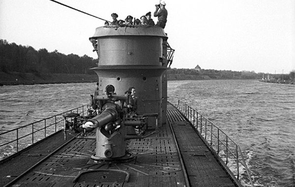
The only submarine that was sunk in WWII in the Gulf of Mexico near the Louisiana coast was the U-166.
The exact site of the wreck has not been published, as it has been declared a war memorial site, but it is listed as being in about 5,000 feet of water and about 45 miles south of the end of Southwest Pass of the Mississippi River in the Mississippi Canyon area.
The following PR NEWS WIRE release was published on June 8, 2001, concerning the site:
Oil companies BP and Shell today announced discovery of the long-sought undersea wreckage of the German World War II submarine U-166 in the Gulf of Mexico.
The discovery was made as the companies were surveying a planned underwater pipeline route, and was reported to the U.S. government, which confirmed the find and notified the government of Germany.
The U-166 was the only submarine sunk in the Gulf of Mexico during the war.
The discovery was made by an unmanned, remotely-controlled submarine, or autonomous underwater vehicle (AUV), operating in waters almost one mile deep.
Named the Hugin-3000, the vessel was developed and operated by C&C Technologies, Inc. on contract to BP and Shell. The AUV utilizes sonar and other equipment to provide detailed images of the sea bottom needed for determining optimum pipeline routes.
The U-166 lies near another casualty of World War II, the American passenger freighter S.S. Robert E. Lee, which was sunk by a torpedo from the U-166 on July 30, 1942.
Twenty-five passengers and crewmembers on the Robert E. Lee died as a result of that attack. The U-166 was sunk shortly afterward by the U.S. military, resulting in the loss of all 52 members of the submarine crew. Both vessels are resting in approximately 5,000 feet of water about 45 miles from the mouth of the Mississippi River.
The site of the sunken Robert E. Lee was previously known.
Last week, BP and Shell voluntarily funded a video investigation of the sunken vessels, using an Oceaneering, Inc., remotely operated vehicle. The video captured detailed images of the wreckages and provided information needed by archeologists to document the discovery of the U-166.
BP and Shell are continuing to work with the U.S. and German governments to provide information about the discovery, in an effort to help bring closure to these events from nearly 60 years ago.
U-166 was a type IX-C German submarine that sank 7,593 tons of Allied shipping during its first patrol before the submarine was itself sunk in the Gulf of Mexico.
The Navy patrol vessel PC-566, escorting Robert E. Lee when it was sunk on July 30, 1942, immediately dropped depth charges on a suspected submarine after sighting a periscope. An oil slick appeared after the depth charges exploded.
The U.S. Coast Guard is credited with sinking U-166 on August 1, 1942, two days later, after a patrol plane sighted a submarine on the surface and then dropped a depth charge seen to explode nearby.
The discovery of what appears to be U-166 near the Robert E. Lee may spur renewed interest in this chapter of World War II maritime history, and help determine exactly how U-166 was sunk — the only German submarine lost in the Gulf of Mexico during the war. German submarines operating there sank 56 Allied ships.
The wreckage of U-166 lies upright, approximately 5,000 feet northeast of the Robert E. Lee wreck site, in approximately 5,000 feet of water. The submarine’s bow section apparently separated during the sinking, and is lying 500 feet away from the main hull. The submarine is facing north.
The U.S. passenger freighter S.S. Robert E. Lee was torpedoed and sunk in the Gulf of Mexico by the German U-boat U-166 on July 30, 1942. The ship, headed for New Orleans, had more than 400 passengers and crew onboard. Ten crewmembers and 15 passengers were killed, with the remainder rescued by US Navy ships PC-566, SC-519 and the tugboat Underwriter.
Dear Capt. Paul:
Do you have the coordinates for the Little Central Rig in Breton Sound. I have the coordinates for the Central Rig. There have been several fishing reports referring to both the Central and Little Central, and they seem to be different places.
Thanks,Ned
Capt. Paul’s response:
Sorry Ned, I don’t have any data for the Little Central Rig in Breton Sound.
The Central Rig is one of about 8 platforms of the Kerr-McGee series of rigs in the area north of the MRGO. It is a possibility that someone is calling one of the other, smaller platforms in the area the Little Central Rig.
The Central Rig is north of the MRGO, about 5 miles directly north of Red No. 22 buoy in the MRGO channel. It is about 3.8 miles northwest of the Gosier Islands, or what is left of the islands, and is about 6.5 miles north-northeast of North Point Island of the Breton Islands, which are south of the MRGO.
The Central rig, KM-BS-SL-1998-56, is located at or about N29 34.692 x W89 07.034. It is about 39 miles from Breton Sound Marina.
Unless otherwise specified, all positions are stated as H,DDD,MM.mmm and were determined using WGS 84 DATUM. All headings/bearings/courses are stated in magnetic degrees.
If you find the location of the Little Central Rig, please let me know.
")

