Web site lists platform locations
This month’s column is based on a question that I have encountered several times on louisianasportsman.com.
Capt. Paul:
Is there an up-to-date book showing current locations for oil and gas platforms in the Gulf of Mexico? If not, where can I get such information?
— J.T., Lafayette
Response:
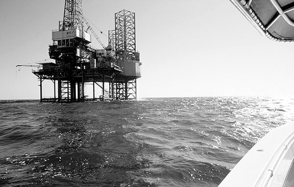
I do not know of any one book that has up-to-date information on the location of production platforms in the Gulf of Mexico because platform locations are constantly changing as new ones are added and old ones moved or removed. But there is a way to get the information that you want.
The United States Department of the Interior is the government agency that monitors, leases sea bottom tracts and inspects mineral resources of the Outer Continental Shelf. The Minerals Management Service (MMS) is assigned to manage these resources. The Gulf of Mexico Outer Continental Shelf Division controls the services for the Gulf of Mexico.
The agency compiles a weekly updated Web site that lists such information, and it is provided by your tax dollars. Yes that’s right, it’s free.
Free that is, if you accept the downloads that are available in a text document (PDF format). Unfortunately the download is not in a database format, and there are no common or nick names for the sites. You will have to view the data in the format that is provided by MMS (PDF), and it will require several steps to get all of the information. If not, you can order a printout or CD disk of the data for a set cost.
Here is the scoop on the Web access.
The Northern Division of the Minerals Management Service Public Information Office is located at 1201 Elmwood Park Boulevard, New Orleans, LA 70123-2394 or call (504) 736-0557 or (800) 200-GULF for information. Other district offices may be reached as follows: Houma District (504) 868-4033; Lake Jackson District (979) 265-7147; Lake Charles District (337) 480-4600; Lafayette District (337) 262-6632; Corpus Christi Subdistrict (361) 888-3241.
You can normally reach the MMS agency via the internet at http://www.gomr.mms.gov/, or at their various local offices. But because of a U.S. court decree involving the Interior’s accounting of mineral royalties involving the Bureau of Indian Affairs, the site has been legally enjoined from operating as a official government site. The court has allowed a private organization to duplicate the site and provide nearly up-to-date updates to the site. The information on this temporary site is usually updated each week.
The temporary MMS web site is located at http://www.temporarygomr.com/index.html. MMS will probably be using the temporary site until sometime this summer.
In order to understand some of the terms that the MMS uses, I suggest that you first access the MMS web page that lists the codes and abbreviations that are used in their reports. It is available at http://www.temporarygomr.com/homepg/lsesale/lsesale.html and by then clicking on the “Codes and Abbreviations” icon marked as “this document.” Print out the page, as you will need it later. This will allow you to understand the symbols and abbreviations that are used by the MMS.
Now with the abbreviations in hand, you will have to go to two sections of their Web site to get specific information about a platform.
First access the “Products and Free Data” icon on the Web page of the MMS site or enter http://www.temporarygomr.com/homepg/pubinfo/piindex.html
Then click on the icon, ”Reports in PDF” or enter http://www.temporarygomr.com/homepg/pubinfo/pdfindex.html
In order to locate a specific platform in a leased block, you would have to access the icon under the “Platform Inspection System Complex/Structure List,” then select the “Platform Inspection System Complex/Structure List by area Block ~ 3010 Available Free in PDF format.” Or enter http://www.temporarygomr.com/homepg/pubinfo/repcat/platform/pdf/3010.pdf
The document lists the platforms sorted by Area /Area Block. After loading the PDF document, you can scroll through the listings, print it or even save it to a computer file.
In this document, locate the MMS Region/District, the complex ID number, the structure number, leased area, the leased area block, platform number and code number, water depth and miles to shore, the type, accommodations and features of the platform of your interest. The list will consist of all current production platforms in the Gulf of Mexico since 1975.
Now, go back to the “Reports in PDF” web page (http://www.temporarygomr.com/homepg/pubinfo/pdfindex.html) and select the icon for “Platform Structure Locations” or enter http://www.temporarygomr.com/homepg/pubinfo/repcat/platform/3060.html, then select the “3060 Available Free in PDF Format” icon or enter http://www.temporarygomr.com/homepg/pubinfo/repcat/platform/pdf/3060.pdf
This document will allow you to locate the platform that you have previously selected by ID number and/or the structure number. All production platforms currently residing in the database are listed. It includes the MMS Region/District, the complex ID number, the structure number, area block, the north/south direction, east/west direction (X/Y coordinates), and the longitude and latitude degrees of each location. By finding the platform you want, it will show the latitude and longitude of the location. Note that the platform locations are shown as whole degrees (dd.dddddd) and not in degrees, minutes, seconds or degrees, minutes and thousandths of minutes. You must convert the figures if you are using another type of position format.

")
