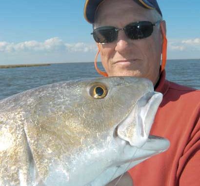
Got the wintertime blues? Then get out on Calcasieu Lake this month for some very good cold-weather action.
Dear Capt. Paul:
I am heading to Grand Isle with my son this weekend. I am looking for the coordinates to the Southwest Canal.
Thanks.
Chet BoudreauxCapt. Paul’s response:
The waterway that is commonly called the Southwest Canal in the Leeville/Grand Isle area is a canal that is about 9.4 miles in length west of Caminada Bay. The western end of the canal, which is officially listed as the Southwestern Louisiana Canal, at its opening to Little Lake north of Hackberry Bay is at or about N29 14.630 x W90 15.299. It continues eastward, crossing Bayou Lafourche in Leeville, at or about N29 14.921 x W90 12.502, and ultimately ends at the junction of the canal with Bays Desespere and Lizette. That eastern end of the canal is at or about N29 15.940 x W90 06.263.
It offers an easy west or east egress into the surrounding marshes from the Leeville area. It also offers outstanding fishing along the bays, lagoons and bayous that are adjacent to its banks.
Good luck with your trip.
Dear Capt. Paul:
I am thinking about buying a Garmin GPSMAP 430 for my boat. I fish inside waters in Southeast Louisiana.
I want to know what type of detail will the factory-installed maps provide me. Will I need to buy a card and topo software to use this unit in new areas with confidence? Also, how does this unit work with my desktop computer as far as backing up routes, tracks, points, etc.
Thanks in advance for your input.
Pete
Capt. Paul’s response:
The Garmin GPSMAP 440 and the 440S (sounder) are two of Garmin’s new marine GPS receivers that offer outstanding features. I especially like the 1,500-waypoint capacity and how you can add a network and sonar at a later time.
The 440 comes loaded with a base map of the entire U.S., and detailed mapping of some 300 “most-popular inland lakes.”
To quote Garmin, “The 430 comes preloaded with detailed maps for U.S. inland lakes, including 5,300 lakes with shoreline, depth contours, navaids and more. Over 300 of these lakes are enhanced with extra Inland Lakes Vision features. For areas outside the U.S., the 430 has a worldwide basemap with satellite images in place of more traditional maps, and its SD card slot makes it easy to add additional maps without connecting to a computer. With fewer keys and a simple, intuitive interface, the 430 makes navigating your way through the water easy. The 430 boasts advanced Inland Lakes Vision features for 300 of the most popular lakes.”
Unfortunately, I don’t believe that these 300 lakes refer to any of the coastal Louisiana marsh lakes, bayous, lagoons or bays. For that, you will need one of the supplemental mapping programs available from Garmin.
Presently, the only supplemental mapping for the 440 is the Garmin BlueChart g2 Vision. I have briefly used the new mapping software, and it is terrific. It offers marine charts, a 3D look, auto guidance and high-resolution satellite images.
The Blue Chart g2 Vision is available on a Garmin secure digital (SD) memory card that is broken down into sections of the world. Check it out at www.garmin.com/cartography/g2vision/
For the use that you specified, I suggest that you check out the card labeled Mobile to Lake Charles, AUG 07 mapping referred to as “ US013R.”
It covers the Gulf and the coastline from Mobile, Ala. through Calcasieu Lake, including New Orleans, the Mississippi River Delta, Lakes Pontchartrain and Maurepas, over to Vermilion Bay. It should give you the coverage you need for the Southeast Louisiana coastal marshes.
I am not sure if the GPSMAP 430 will work with Garmin’s Mapsource Trip and Waypoint Manager, but you will need something like that to back up the track, routes and waypoints. Contact Garmin Support at (800) 800-1020, and ask them the back-up question.
Check out the mapping and the unit at a Garmin dealer to ensure that both will meet your needs.
Got a GPS-related question for Capt. Paul? You can ask it at www.lasmag.com, and he’ll get you an answer promptly.