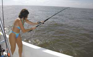
Variables are coming together to make May the perfect month for trophy trout at Calcasieu Lake
Dear Capt. Paul:
I have a GPSmap 188c, and am going to be fishing offshore and some inshore. Can I install both the Blue Chart and the MapSource on the same data card?I have a 64mb data card, and have used very little room, but didn’t know if the unit was capable of switching back and forth. I already have the MapSource software installed, but would purchase the bluechart to add to the card if this is possible. Thanks!
Jim
Capt. Paul’s response:
You can install both types of MapSource mapping on the memory card, but be careful. The card is designed to erase the card of all old memory when installing the new maps, unless they are installed together at one time.
You cannot load one then load another. The second installation will erase and replace the first installed maps on the card. So if you purchased a MapSource data card with the Blue Chart maps already installed, and you try to install the US Topo maps, you will erase the Blue Chart maps on your card.
If you have a MapSource Blue Chart program on a CD and a MapSource US Topo on another CD, you can install them in your computer and load portions of both programs as maps on the data card provided that you select and load them on the data card together as one.
If you purchased the Blue Chart already on the card, I would buy another memory card from Garmin along with their reader/writer (Garmin’s USB Data Card Programmer, part #010-10363-00) and install only the topo maps on that card.
When needed you can switch cards in the unit from the Blue Chart to the topo. If that is the route you take, get a card with about 128MB of memory. (Garmin Data Card, 128 MB, part # 010-10226-03).
One that size should accommodate all of your topo mapping needs for southern Louisiana. Keep the second card in a water-proof non-metal case in a safe place onboard your boat, and use it as necessary.
Dear Capt. Paul:
Would you happen to have numbers for “The Reef?” This recently lost area is in California Bay between Whiskey Bay and Telegraph Point, due east of Fusich Bayou in Breton Sound.
Any help would be appreciated.
Thanks,
Steve Swartley
Capt. Paul’s response:
The area is loaded with what were small islands that are now no longer visible above the water. Most of these islands are still there as small reefs and shoals.
One in particular may be the site you described as it is in California Bay about 4.5 miles east of the mouth of Bayou Fusich at a bearing of 83 degrees magnetic, 2.2 miles west of Telegraph Point at a bearing of 262 degrees magnetic, 1.1 miles due north (0 degrees) of Sunrise Point and about 2.3 miles north-northwest at a bearing of 288 degrees magnetic from the remnants of Pelican Point.
It is — or, rather, was — at a position of N29 30.755 x W89 34.198.
For a comprehensive listing of many of these types of formations as well as some navigation positions of that area, I suggest that you get a copy of Capt. Paul’s Fishing Edge for Delacroix to Pointe a la Hache, which is available at the Louisiana Sportsman Outdoor Store.
The link button may be found in red on the left side of the home page (www.lasmag.com), or you may cut and paste www.lasmag.com/catalog/ in the address bar of your browser.


