After Katrina and Rita, experts predicted several lean duck years, but the habitat has rebounded remarkably well, and this season may be one for the ages.
Dear Capt. Paul:
Would you happen to have the GPS coordinates for a rig that once stood in Main Pass 68? I’ve been looking around for it, and can’t seem to locate the coordinates.
Thanks!
Captain Paul’s response:
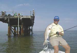
I have located a platform in Leased Block 68 of the Main Pass area.
The Noble Energy Inc. platform SAMEDAN-MP is indicated at N29 17.257 x W89 03.496.
The MMS Offshore Lease section of the Department of the Interior shows the site in about 30 feet of water.
NOAA charts also indicate an underwater wreck that is about 300 yards to the west (270 degrees magnetic) of the platform.
The above position was determined using WGS 84 datum, and is stated in H,DDD,MM.mmm.
Dear Capt. Paul:
Do you have any information on the Lowrance iway 500c? Does it work well in marine applications?
Thanks, Michael
Capt. Paul’s response:
The iWay is designed for use in an automobile, but certainly can be used in a variety of conditions.
In contacting the Lowrance Technical Support section, I was advised that the iWay 500C is a weather “sealed” unit, and could be used in a marine environment; however, they recommend you first look at the iWay 500 Marine unit.
The iWay 500 Marine should be released this week. It has all the features of the iWay 500C as well as mapping and software (tides, etc.) that relate to marine use.
The Marine version will do “over the road” routing as the iWay 500 C does, but will have the additional marine software and maps.
Remember that the iWay units cannot use the Lowrance MapCreate mapping software. These units must use the NAVTEQ Mapping program. Updates for this internal mapping are available for purchase at LEI-Extras. Yearly updates are available for a list price of $77.99.
Check out the info on the Lowrance web site at www.lowrance.com.
Dear Capt. Paul:
In the September issue, Lake Pontchartrain reef coordinates were given in a different format than my Garmin 178c, e.g. Louisiana Sportsman — N30 16′ 17.39”, W90 3′ 44.6400″; my Garmin 178C — N39 01.4661′, W095 07.076′
How do I convert?
Thank you, Ken
Capt. Paul’s response:
The Lake Pontchartrain reefs that you inquired about are shown in hemisphere, degrees, minutes and hundredths of seconds (H,DDD,MM,SS.ss).
There are several ways to convert these positions to another format.
One way is to use your GPS unit to do the conversion.
First, you can access the MENU screen by pressing the MENU button twice in rapid succession. Then select the SET UP tab. When that appears, select the UNITS as a sub-menu, and then the POSITION FORMAT tab.
Once that drop-down box appears, select the format of H,DDD,MM,SS,s, and enter the coordinates as they appear in Louisiana Sportsman. In doing so, you will see that your unit will only accommodate the seconds position to ONE decimal position after the point (SS.s). So you must round off the position. As a note, in latitude, 1/10th of a second (SS.s) change (SS.1 to SS.2) equals about 10.8 feet. One hundredth of a second (SS.ss) change SS.01 to SS.02) equals 1.08 feet.
Then go back to the Position Format box and change the format BACK to your setting of H, DDD,MM.mmm. By the way, each change in the last position of the minutes setting (MM.001 to MM. 002) equals about 6.8 feet.
The GPS software will convert all of the positions for you. See page 84 in your owner’s manual for the instructions on changing the Position Format.
Got a GPS question for Capt. Paul? You can ask it on the reports page of www.lasmag.com, and he’ll get you an answer just as quick as he can.
")

