A 1983 tragedy generally gets the credit for GPS going public. Shortly after Korean Airlines flight 007 experienced navigational errors, strayed into restricted Russian airspace and was shot down by Russian fighters, President Reagan declassified GPS, allowing it to be used by civilians for more accurate navigation.
Since then, both the system and the civilian receivers designed to use it have seen generations of improvement.
Today, GPS is used for land, sea and air navigation, for tracking commercial trucks, trailers, rail cars and emergency vehicles, for precision agricultural plowing and even for leading emergency service responders to us when we call 911 on a cell phone.
Hand-held GPS receivers are sometimes called personal navigators because they bring us the benefits of GPS in a format as convenient as a wristwatch. The typical hand-held is designed to be operated with one hand and fits easily in a shirt pocket. Models are available with a wide variety of features, but even the simplest and most inexpensive hand-held can save positions and direct you back to them. This can help you find your way back to the car in a stadium parking lot, to a favorite fishing spot out in open water or to a hunting blind in predawn darkness.
Mid- to high-end models usually include a built-in electromagnetic compass that indicates direction while you are standing still (GPS by itself can’t do that) and a built-in barometric altimeter to measure altitude (GPS generally doesn’t measure altitude as accurately as latitude and longitude). Some hand-helds can be loaded with highly detailed map data for use on the water, in the woods, on city streets or for turn-by-turn highway navigation.
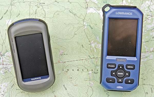
Some of Garmin’s Oregon-series models can share data wirelessly and can take pictures with built-in digital cameras. Garmin Rino models have built-in 2-way radios (with NOAA weather alert) and each can display the other’s position. Astro hand-helds from Garmin use special collars to track and display the locations of up to 10 dogs as far away as seven miles (line of sight) from the receiver. Some Lowrance Endura models can play MP3 and WMA music, display digital pictures and play MPEG, AVI and WMV videos. You can find hand-helds with either keypad or touch-screen controls, most are waterproof and some even float.
Most hand-helds can be temporarily mounted nearly anywhere with factory or after-market accessory brackets. They can be used in the family vehicle, boat, personal watercraft or RV and on bikes, motorcycles and four-wheelers.
Hand-helds are great performers and are often used by serious boaters as backups for their main marine navigation units. Specific hand-held models are sometimes chosen because they can share way points and routes with the boat’s main unit or at least with a home computer where irreplaceable information like favorite fishing spots and safe routes recorded by both the hand-held and marine unit can be combined and stored safely. Some hand-helds transfer data through a dedicated cable, and others use memory cards to shuttle information back and forth.
When shopping for a hand-held unit, ask to take it outside so you can see how it looks in bright daylight and in direct sun when viewed through your favorite sunglasses (all hand-helds look great inside). Play with the controls and run through a unit’s menu system enough to get a feel for how it works. Then, choose the one with the operating system that makes the most sense to you and will therefore be the easiest to use.
Prices start at less than $100 for a basic model, and you can expect a full-featured mapping unit to be priced in the $300 to $500 range. If top performance is important to you, stay away from clearance-sale models with older technology. The newest models will use the latest mapping software and have the best antennas and receivers, the most memory and the fastest computers.


")