
When the two things are the same thing!
In most places you’ll fish, the desirable fishing hotspots and the underwater hazards you may have to traverse to get to them are two entirely separate things. But in Louisiana’s inshore and nearshore waters, the two are often one and the same.
This is partially due to the uniqueness of Louisiana’s coast. Our rapidly eroding coastline means that many structures that were onshore just a few years ago are now submerged and pose an underwater hazard. And it’s partially due to shifting sandbars caused by strong coastal winds, tides and storms. And then there’s the hazards left behind by some negligent oil companies that continues to wreak havoc on boat hulls, lower units and lives.
One of the areas where all of these hazards combine is East Timbalier Island, one of Louisiana’s few remaining and rapidly dissappearing barrier islands. Located just off the southeastern coast of Terrebonne Parish, the island is one of few that separates Timbalier Bay and the fragile marshes of Louisiana’s mainland from the Gulf of Mexico.
A mere sliver of its former self, erosion and hurricanes have battered the island to near extinction.
Hundreds of rocks were dropped
Back in the 1980s, the U.S. Army Corps of Engineers attempted to buttress the island by dropping piles of huge breakwater rocks along the 6 mile stretch of the gulf side of the island. Those rapidly sank, and today none of them protrude above the surface. Most now sit deep enough to safely navigate over. But in some spots they lurk just enough below the surface to be undetected except on very low tides.
These rocks have collected many a lower unit as they remain shallow enough to be a serious hazard.
When the big rocks sank and the shoreline retreated, more, somewhat smaller rocks were dumped a good distance behind them to slow the erosion. Most of those also sank and pose additional underwater hazards, though in some places you can see them peeking just above the surface.
Add to that the huge concrete slabs that once anchored cell towers, a couple or three submerged walls of sheet pilings, numerous pipes and pilings and constantly shifting sandbars, and you have an entire submerged obstacle course.
The rocks barely under the surface are best
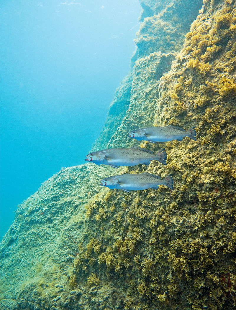
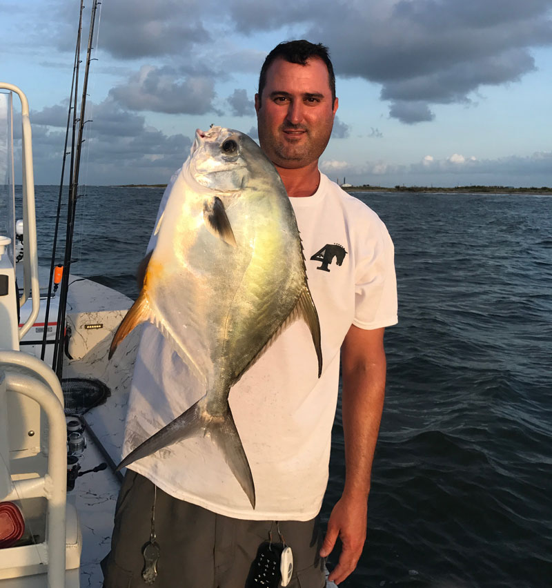
But what we deem underwater hazards, fish consider underwater habitat. That very same maze of rocks and sandbars and oilfield debris is home to some of the best speckled trout and redfish fishing in the state. Here in Louisiana, the hazards are the hotspots!
Today the sliver that’s left of East Timbalier is broken almost in half, with a huge gap between the two parts.
Capt. Aaron, of Aaron Pierce Charters (985-637-9720), fishes the area regularly and is well aware of its underwater hazards.
“I tell everyone unfamiliar with the area to exercise extreme caution,” Piercesaid. “There are rocks and debris just below the surface that’ll tear up your hull, rip off a lower unit and possibly cause someone serious harm.
You have to cut off your motor and troll carefully over 100 yards out from the island, and study your depthfinder. You’ll see the hump when you pass over the deeper rockpiles, and those are good places to fish. But the barely-under-the-surface rocks are often the best spots of all. The key is to find them before they find you,” he said.
How do you do that?
“Slowly and carefully,” he said. “And once located, back as far off from them as you can while still able to reach them with a long cast.”
Coordinates of the known shallow hazards:
Submerged breakwater rocks
29° 04’ 06.68” N, 90° 18’ 09.55” W
Submerged rocks
29° 04’ 05.12” N, 90° 18’ 56.23” W
29° 04’ 02.05” N, 90° 19’ 06.41” W
29° 04’ 11.21” N, 90° 18’ 32.97” W
29° 04’ 10.30” N, 90° 18’ 41.46” W
Submerged sheet piling walls
29° 04’ 11.71” N, 90° 18’ 24.53” W
29° 04’ 10.73” N, 90° 18’ 27.96” W
Submerged Breakwater Wall
29° 04’ 31.3280” N, 90° 16’ 51.4319” W
29° 04’ 30.4496” N, 90° 16’ 52.4136” W
29° 04’ 27.0343” N, 90° 16’ 59.3864” W
29° 04’ 23.6194” N , 90° 17’ 09.5060” W
29° 04’ 19.8246” N , 90° 17’ 22.3408” W
29° 04’ 16.4845” N, 90° 17’ 30.0289” W
29° 04’ 16.1458” N,90° 17’ 32.0464” W
29° 04’ 14.2885” N, 90° 17’ 34.9868” W
29° 04’ 13.8000” N, 90° 17’ 36.8999” W
29° 04’ 11.7998” N ,90° 17’ 43.3000” W
29° 04’ 10.9229” N, 90° 17’ 53.2831” W,
29° 04’ 10.1687” N, 90° 17’ 57.3043” W
29° 03’ 59.4738” N, 90° 18’ 26.7156” W
29° 03’ 51.9023” N 90° 18’ 58.8510” W
29° 03’ 44.6890” N, 90° 19’ 31.9051” W
29° 03’ 37.2881” N, 90° 19’ 55.5766” W
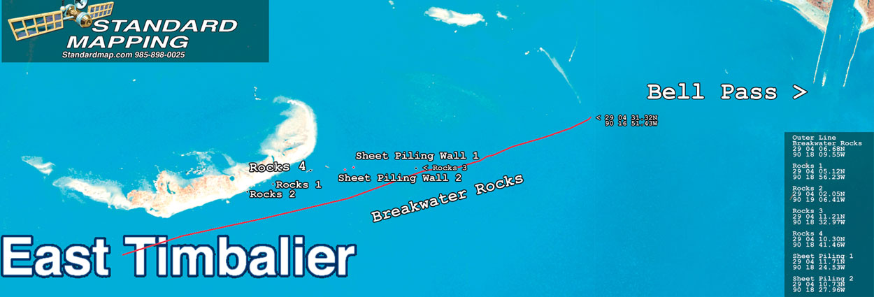 NOTE: All these coordinates are approximate and taken from the center of the hazard, and danger can extend out from the center in all directions for a good distance.
The Louisiana Dept. of Wildlife and Fisheries said they do not have the coordinates of any of the hazards in the area, and none of them are marked with poles, signs or buoys.
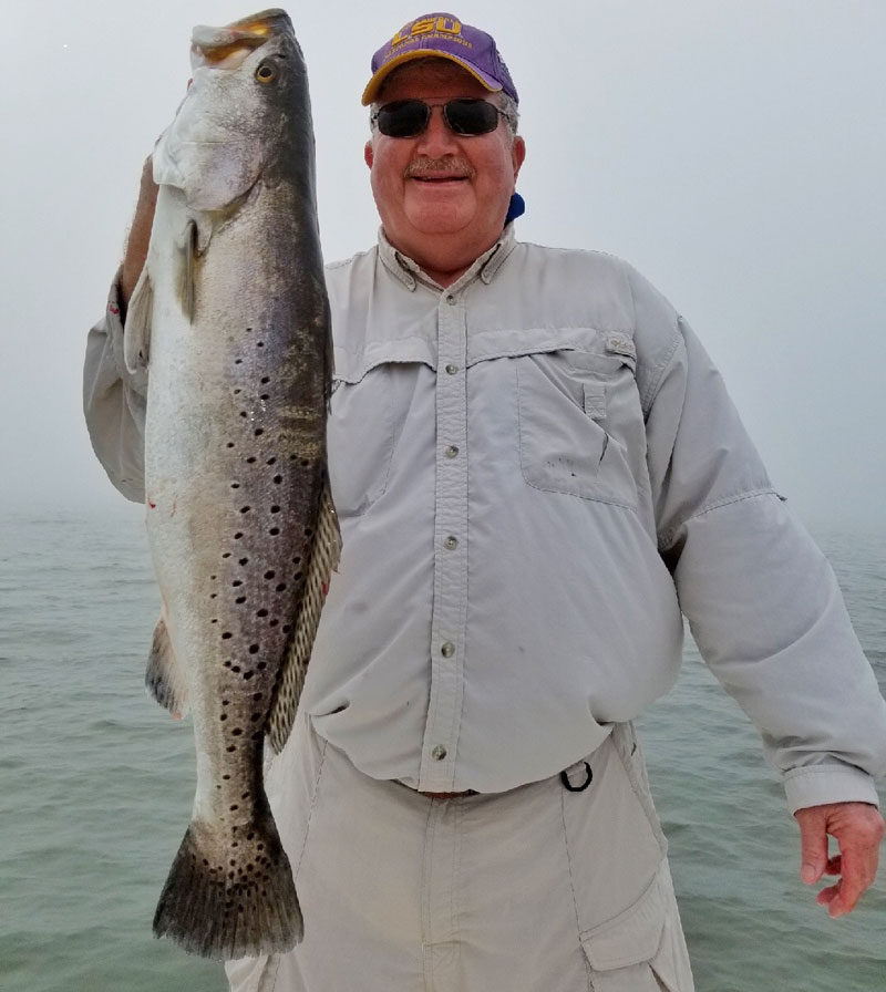
Capt. Chuck Comeaux of the Region 6 office in Thibodaux calls it a very hazardous area, but one that is already producing big trout.
He advises boaters to enter the area slowly and cautiously, or better yet, go with someone experienced and familiar with the area.
A good anchor spot is key
Pierce said you’ll ideally want to use the anchor feature on your fancy trolling motor because it’s too deep for a power pole, and while you can anchor off in the sand, positioning the boat presents the challenge.
“Since I went to the i-Pilot I can position my boat right where I need to be and stay on that spot,” he said. “When you have to use an anchor you just never seem to be able to fall in the right position.
“Next, the most important thing is a cork you can toss a long distance, and live bait under it, either croakers, shrimp or pogies.”
Pierce is also something of a fishing tackle entrepreneur, and co-founder of the 4 Horsemen corks, made for multiple applications but perfect for casting far distances such as here and known for the loud “popping” noises they emit.
“You can’t bottom fish without snagging, but you can also try freelining a live bait, and if you’re careful you can try throwing soft plastics, just cast and retreive,” he said.
Pierce says his go-to soft plastics are Matrix Shad’s in either the Lemonhead or Green Hornet colors, but he said when the fish are there they’ll pretty much hit anything you throw.
“But no matter how you fish it, be prepared to lose some tackle,” he said.
Winds and seas
Pierce says the biggest challenge is actually the weather.
“The fish will be there, and they’ll eat up baits when you can get out there, but the winds make our windows of opportunity so limited,” he said. “The area is so wide open in the gulf waters, there is just no protection from winds and seas.
“That means you have to pick your days. West winds are the worst for muddying up the water, and if a strong west wind has been blowing for days, it’ll take at least two to three days for the water to clear up enough to fish. Ideally you want to fish winds of 5-10 mph. Up to 15 is iffy, over 15 forget it.”
Pierce says he prefers fishing rising tides because they bring in clean gulf water, but falling tides will produce also.
Bayside
Pierce says the bayside of the island is too congested with oilfield activity, shallow sandbars and debris to even bother.
“There are a numerous wellheads and platforms I fish a good ways off the bayside, and they produce trout and reds,” he said. “But by far the best action and biggest fish are on the gulf side.”
And, he added, don’t be enticed to fish under the birds out there because all you’ll catch is sailcats.