Roy Williams is the owner and producer of Nevalost LLC. His original company, Drafting Etc., was started in 1985 and focused on engineering drafting and technical drawings, with a little oilfield mapping as well.
The detailed oilfield maps attracted the attention of Williams’ fishing friends. Any map accurate enough to place a multimillion dollar oil well was accurate enough for fishing. Plus, he was an avid coastal fisherman himself.
Williams produced his first professional map purely for fishing in 2000. These maps were large, laminated sheets hand-drawn from aerial photos he purchased from Stennis Space Center in coastal Mississippi. He preferred these over the satellite shots of the day because they were photographed at lower altitudes and showed more detail.
Williams sold some of his maps directly to the public, but most of them were marketed through the near-legendary New Orleans Map Company on St. Bernard Avenue.
“It was one of the few places a person could find any map that anyone could want,” noted Williams. “Wayne Dunn either had it or could get it.”
In the turmoil following Hurricane Katrina in 2005, Williams decided to completely computerize his map production, and since fishing maps now dominated his business, he renamed the company Nevalost in 2006.
New Orleans Map Company itself became a Katrina casualty. The company changed hands and moved its location, then finally closed. Williams resorted to selling his maps in marinas and tackle stores, as well as directly to the public.
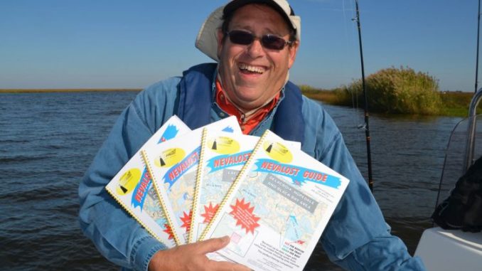
But he felt that more was needed than large, hard-to-handle sheet maps. The resulting brain child was the Nevalost Guide series. Constructed of 27 to 32 pages of highly detailed maps, the 8 ½- by 11-inch books are much easier to handle in an open boat than are large sheet maps.
Each book contains the information from several sheet maps. Although the pages are waterproof, they can be marked with any type of permanent marker, allowing for detailed planning the night before a fishing trip. The guides are flip bound so that they can easily lie flat.
A feature that Williams feels make the books especially valuable for fishermen is that prime fishing spots are marked off by color code: blue for speckled trout, red for redfish, and green for largemouth bass.
This information was gleaned from other fishermen, marina operator interviews, personal experience, and from production of the maps for Trout Masters Too: How the Pros Do It.
The 4 books in the series are as follows:
• Delacroix, Hopedale and Black Bay Area
• Lake Borgne, Upper Biloxi Marsh Area
• Lafitte, Grand Isle, and Empire Area
• Buras, Venice, Southwest Pass Area
In addition to detailed maps, each book contains knot tying instructions, boat launch locations, and fishing and boating regulations.
The guide books may be purchased for $30 each, plus handling and shipping, by calling 504-228-6517 or e-mailing roy@nevalost.com.
The books are printed on demand. As marsh topography changes, Williams makes the changes on his computer, so each book reflects those changes and is the most current possible.
One other service that Nevalost offers is custom maps that can include information normally found on 3 or 4 of the large sheet maps. Williams simply needs east-west-north-south boundaries, or other descriptive physical boundaries.