Restoration proposals raise tough questions
The future of some Louisiana coastal communities would be in doubt under proposals produced as part of an environmental design competition under consideration by the state.
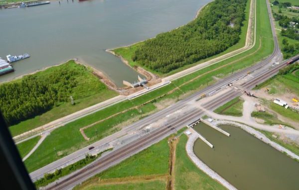
The state has lost nearly 1,900 square miles of coast since the 1930s due to a variety of factors, including building levees that interrupted the land-building processes of the Mississippi River and allowing oil and gas drilling to take place in wetlands.
One of the more common suggestions was already approved by the Coastal Protection and Restoration Authority Board at its Oct. 21 meeting. But local wetlands advocates say the reports are idealistic environmental studies unencumbered by political pitfalls or financial restrictions that are meant to guide, but not direct, decisions by the state’s coastal restoration board.
Still, with billions expected to be spent on restoration and protection projects within the next decade, local and state officials are advising coastal communities and river industries to pay attention.
Changing course
The Changing Course design competition started in 2013 to get opinions about the best way to rebuild the coast and protect against storms, according to the Houma Daily Courier. The finalists from across the country produced similar proposals.
Suggestions include moving the mouth of the Mississippi River north to build upon existing land instead of trying to salvage land that is disappearing faster than can be replaced. Other submissions center around focusing on upstream river diversions. Lower diversions and the ones that state has planned in its 2012 Master Plan would only harness half of the river’s resources, said Rob Nairn, executive director at Baird & Associates, a Changing Course finalist.
“Under that plan the Delta would only be half the size,” Nairn said.
They agree that subsidence coupled with a rising sea-level will overcome much of the wetlands and the Delta along the lower river, meaning drastic work must be done to save communities in those areas or evacuation discussions need to happen soon.
The scope of the design competition was aimed specifically at the Mississippi River and areas surrounding New Orleans, but designers said they continued to evaluate Lafourche and Terrebonne parishes because of the wide-reaching effects of the proposals.
John Hoal, who led the Studio Mizi-Ziibi team, another Changing Course finalist, said his team evaluated several ideas using barrier and bay islands and reefs to limit wave action along coastal communities that would connect with wetlands from south of New Orleans to the Atchafalaya Basin.
The Baird report is similar to the 2012 Master Plan, diverting flow from the river to rebuild the Delta in western Terrebonne. Using the Atchafalaya River might produce enough sediment to protect Houma and Morgan City.
What does it mean for us?
Designers say they evaluated ways to keep unprotected communities above water — if only for a while, as the water gradually overtakes the communities. But the proposals call for their long-term evacuations, an idea often mocked by politicians.
“We’re not saying that people can’t live outside of the levee protection, you’re going to have to know that evacuation routes and houses need to be elevated,” Hoal said.
Nairn added, “Eventually those communities will have to build higher and higher levees or slowly transition inland.”
Even though it’s a “hard conversation,” Restore or Retreat Executive Director Simone Maloz said, it’s a necessary one given a landscape that’s “not always changing for the better.” Some people are having that talk, she said pointing out the anecdotal evidence of businesses and families moving up the bayou.
“It’s not easy for anyone,” Maloz said. “There’s this emotional factor to it. This is not moving just a house, it’s people, it’s families and everything important to them.”
Changing Course isn’t meant to supplant the state’s Master Plan, former CPRA Chairman Jerome Zeringue said, instead they’re meant to guide any future amendments to the plan.
“From a scientific exercise in a purely objective evaluation of what the river can achieve, I can understand that approach,” he added. “You have to layer or superimpose the reality of what currently exists.”
Zeringue said the state’s plan is to build on what’s there, while creating sustainable areas for the next five decades without relocation.
“The lower Delta is not sustainable. The further north you make the opening, the possibility of creating and sustaining land is enhanced,” Zeringue said.
Industries that could be affected by the diversions and amending the river, such as fisherman and the navigation industry, should be involved in the discussion. Because of the scope and projected impact of the proposals there will be a “substantial amount” of environmental analysis. The public will have multiple opportunities to get involved, Zeringue said.
“We need to get them engaged and be part of the discussion so when we do choose to move forward they’ll have enough understanding to be able to provide input,” he said.
Fourchon’s future
The biggest hurdles to future work are decisions to colonize along Bayou Lafourche and build Morganza to the Gulf too far south, the designers said. Proposals also beg the question: What happens to communities like Grand Isle, Leeville or Port Fourchon outside of major protection rings?
Bayou Lafourche was an exceedingly difficult challenge, designers said. More freshwater should be flowing through the bayou, but it is almost impossible to get the necessary amount because towns in the parish are centered along the bayou.
For years, talks have lingered to create an alternative route in the bayou bypassing Donaldsonville, but the cost of the project – up to $3 billion – has always been a deterrent.
Zeringue said current efforts of the Mississippi River Reintroduction to Bayou Lafourche project should make an impact though it’s too early to tell if it will be enough.
The Morganza and south Lafourche levee systems present a “unique” challenge, designers said. Some suggest they would have to convert some land inside the levees into wetlands with a series of high-volume pump stations and locks.
“There’s kind of enough proof that if you don’t allow this natural connection, you’re really killing the ecology inside that protective area,” Hoal said. “At the same time, you have the potential to facilitate the sinking of land there as well.”
“How do you…build land within those areas protected by levees? Our concept of natural delta building, it has some challenges within levee systems,” Nairn added.
Zeringue and Maloz brushed off the notion those protective systems are too far south.
“You really think they would have drawn that line if it wasn’t in the best interest?” Maloz said.
Even though Port Fourchon is outside the levees, the designers said they understand its importance and both proposals would protect the port in various ways, even as land behind it disappears.
Fourchon is already one of, if not the, most resilient community along the coast, officials said.
But without money or commitment, those communities close to the coast will eventually wash away. Zeringue said the situation doesn’t have to be that dire.
“The reality is unfortunately you’re going to lose them anyway,” Zeringue added speaking long-term. “But it’s worth the fight and the commitment. The significance that (Fourchon) plays….it’s not just a parish, or a state issue, it’s a national issue.”
Where do we go from here?
Earlier this month, the state coastal panel voted to continue work on two diversions to flush sediment and freshwater into estuaries on the east and west sides of the Mississippi River in an effort to create 40,000 acres of land over time. With the board’s approval, the state can now move on to working out engineering and design problems and seeking federal permits. Officials said they expect to spend up to three years designing the diversions.
It’s during that time that even more of Changing Course’s submissions will be reviewed for implementation.
“There are going to have to be decisions, tough decisions being made to ultimately get to the point where we were are implementing projects that will create that sustainability,” Zeringue said.
Residents can have a say in how the coast will shape up with their vote for the next Governor.
“This next decade is going to determine the literal physical landscape of Louisiana, it’s that impactful,” Maloz said.
Editor’s Note: Houma Daily Courier senior staff writer Jacob Batte filed this report.
")