When you absolutely need help, who do you call?
Many people in the outdoors suddenly and unexpectedly find themselves close enough to the grim reaper to smell his breath. If it happens to you, how will you call for help?
Many of us figure our cell phones will work and, if we are lucky, they will. But most of us have been out in the boat or back in the woods and seen the dreaded “No Service” message on our phones. This can happen offshore, inshore, on inland lakes and rivers and on dry land. It also doesn’t take much imagination to come up with an on-the-water emergency that gives your phone a dunking. How water resistant is yours?
Saltwater anglers often count on their VHF radios, especially now that they are equipped with Digital Selective Calling (DSC) that can speed and automate mayday calls and even use other DSC radios as repeaters to leapfrog your message to the Coast Guard.
Connect your boat’s GPS to it, and it even sends your position. That is, unless the emergency event damaged your VHF antenna or killed power to the radio. A portable VHF radio with its self-contained power supply might seem like a good alternative, but its lower transmitter power output and smaller antenna limit its range. Still, in on-the-water emergencies in areas protected by the Coast Guard or where VHF radios are commonly used, a portable VHF is handy for communicating with rescuers as they zero in on your position.
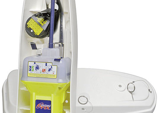
The absolute best option, in my opinion, is to equip the boat with an Emergency Position Indicating Radio Beacon (EPIRB) or equip yourself with a Personal Locator Beacon (PLB). When activated, these devices transmit a distress signal to both of the satellite constellations used by the international COSPAS-SARSAT system.
COSPAS is derived from the Russian phrase, “Cosmicheskaya Sistyema Poiska Avariynich Sudov,” which translates into something like “Space System for the Search of Vessels in Distress”. SARSAT stands for Search And Rescue Satellite Aided Tracking in plain old English.
Your signal first reaches the Low Earth Orbit Search And Rescue (LEOSAR) network, which consists of Russian and U.S. satellites in pole-to-pole orbits roughly 500-600 miles high. The satellites orbit the earth about once every 100 minutes and stay in view of a point on Earth for about 15 minutes during each pass. The satellites employ Doppler shift technology to fix your position, and the whole process may require more than one satellite pass.
The distress signal from your EPIRB or PLB then reaches the Geostationary Search And Rescue (GEOSTAR) satellites orbiting about 22,000 miles up. Since these satellites appear to hang in one spot in the sky above a position on Earth, your emergency beacon signal reaches them in the blink of an eye.
Unfortunately, since the lone satellite you contact is stationary, it can’t fix your position. If you were smart enough to pick an EPIRB or PLB that includes a built-in GPS receiver, it will send (and keep sending) your exact position along with your distress signal.
When you buy a beacon, you should register it with the National Oceanic and Atmospheric Administration (NOAA) at beaconregistration.noaa.gov (you can call 888-212-7283 with questions about registration). Registration is critical to the next step in this chain of events.
Both satellite systems relay your distress message to an earthbound Local User Terminal that forwards it on to a Mission Control Center. The Control Center matches your registration information to your beacon’s I.D. number, and sends everything on to the Rescue Coordination Center. The RCC contacts the appropriate local rescue agency and immediately directs responders to your GPS- or Doppler-derived position. Thanks to your registration information, rescuers know who and what they are looking for.
How does all this translate into time-to-rescue? U.S. Coast Guard literature lists the average time to receive your position so they can launch rescuers as about 70 minutes without a GPS location included in your signal and less than 10 minutes with GPS. The U.S. has recorded 6,439 persons rescued between September 2010 and when the system was formed in 1982.
A leading fishing tournament director, touched by the deaths of two NFL football players and their friend about a year ago in the Gulf of Mexico, is requiring all anglers participating in the third-annual Ft. Myers Beach Kingfish Shootout to carry an EPIRB or PLB onboard. The incident triggered a search covering 16,000 square miles and cost an estimated $1.6 million. The three men did not have a distress beacon aboard.
Beacons sell roughly in the $300 to $800 range, but you can also go to boatus.com/foundation/epirb and rent one for $65 a week. The day before departing Crescent City, Calif., the shore-bound father of one of three crewmembers aboard the 32-foot catamaran sailboat Catalyst wanted to ensure his daughter was safe, so he went online and rented an EPIRB.
On the 4th of July, with winds gusting over 50 mph in rough seas, the EPIRB was activated. The boat capsized in massive waves, and the crewmembers lashed themselves to the overturned boat before hypothermia set in. A U.S. Coast Guard helicopter homed in on the EPIRB signal, dropped a rescue swimmer in the water to recover the three people and carried them on a life-saving flight to the hospital.
The EPIRB signal was the only distress message received by the Coast Guard from Catalyst.
If you are a gambler interested in odds, the rental program is 14 years old with more than 5,000 EPIRBs being rented and 62 lives saved. All of the rescued victims, of course, thought it couldn’t happen to them, but were smart enough to take precautions anyway.
For more information on the EPIRB/PLB system, visit sarsat.noaa.gov. For more info on the beacons, visit acrelectronics.com or mcmurdo.co.uk.
Next month we’ll look at SPOT, a commercial alternative to PLBs that’s extensive enough to fill a whole column. We’ll also look at sending messages with SPOT and PLB units.