A giant logjam nearly two centuries age left behind some of the best fishing lakes in Northwest Louisiana.
Standing on the banks of the Red River today would be a marked departure from standing there a couple of centuries ago. Red River circa 2006 features a series of long lakes separated by locks and dams, all of which have created some of the state’s best fishing holes. To view the Red River circa 1800 would be to see it as a completely different stream.
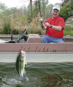
One day a couple of decades ago, I got a geography lesson while fishing Black Lake with the late Al Lindsey, who was at that time a professor of geography at Louisiana Tech.
Lindsey, whose love for geography was superceded only by his love for catching bass, told me how the cypress-studded lake we were fishing came to be.
“Black Lake is one of a number of so-called ‘raft’ lakes,” Lindsey told me.
My curiosity was sufficiently piqued so he explained what he was talking about while we cast for bass on Black Lake.
Lindsey shared with me that traffic along the Red River in the early 1800s was treacherous at best because the river was clogged for hundreds of miles by downed trees, logs and such debris that had piled against and on top of other debris that had accumulated along the river.
“Every time there was a period of high water upstream,” Lindsey said, “the soils along the river’s banks, along with everything that grew there, tumbled into the waters and headed downstream. Once it met the upper end of the log jam, it stopped, thereby adding more timber to what became known as the ‘Red River raft.’”
The raft was not stationary, however. As logs worked free at the lower end of the jam, more were added at the upper end, resulting in the raft moving northward at the rate of approximately one-fifth mile a year, according to Lindsey. The raft eventually extended from the Arkansas/Louisiana line to south of Natchitoches.
It took the ingenuity of a man, Capt. Henry Miller Shreve, for whom the city of Shreveport would eventually get its name, to clear the log jam on the river.
“Efforts to begin clearing the river of logs began as early as the 1830s, but it was not until around 1870 that Capt. Shreve, utilizing a ‘snag boat,’ finally got the last log cleared and the river flowed freely again,” Lindsey explained.
Clearing of the log raft allowed steamboat traffic to become a common sight along the Red River. However, after the logs were cleared, the channels became deeper and resulted in rich alluvial soils along the river being eroded into the stream. This deposit of soils downstream created shoals, which eventually rendered the river virtually useless for steamboat travel.
While all this was going on along the river, something else was occurring unnoticed. A number of low-lying areas adjacent to the river filled with water over time, creating marshy, swampy sloughs. Once the raft was cleared, these areas were cut off by the now free-flowing river, and they remained as something akin to primitive lakes. Cypresses, tupelo gum and other water-loving trees began growing, and would be replenished by the river during times of high water, much like the active oxbows today along the Mississippi River.
While a number of these low-lying areas eventually filled and lost their identity as small lakes, several were eventually dammed and became the lakes we know today as Red River raft lakes. You’ll recognize some of these names as lakes where you’re likely to have fished.
Raft lakes that eventually earned names were Lake Iatt in Grant Parish, Clear-Black Lakes in Natchitoches Parish, Saline Lake in Winn Parish, Nantachie Lake in Grant Parish, Wallace Lake in Caddo and DeSoto parishes, Lake Bistineau that brushes against Webster, Bossier and Bienville parishes and Caddo Lake in Caddo Parish.
There are several characteristics shared by all of the Red River raft lakes. They are all old lakes, and they feature a profusion of trees, cypress and tupelo gum in particular, that do well in wet, low-lying areas. One could speculate that some of the ancient and gnarled old cypresses growing in these lakes today were sprouts before the giant raft was cleared over a century ago.
These lakes vary in their attraction as fishing hotspots today. Several are among Louisiana’s premier fishing lakes, Black-Clear, Bistineau, Saline and Caddo in particular.
Let’s take a look at these ancient lakes as far as their individual features and how they stack up today as prime fishing areas. We’ll start with those lesser-known impoundments.
Lake Iatt
With the exception of activity from locals living near the water body, 7,100-acre Iatt Lake located just north of Colfax is not heavily fished.
Jerry Collins, fisheries technician with the Pineville LDWF District Three office, says while the lake has good fish populations, getting to them is a challenge.
“Iatt has a little bit of everything — bass, bream and crappie — but there is a pretty serious grass problem in the lake making navigation a problem,” he said. “Our department recently released 7,500 grass carp in the lake to try and see if they can help control the vegetation.”
When “grass carp” is mentioned, especially in regards to a public lake, there is some cause for concern among anglers. They remember too well what took place several years ago on 5,000-acre Caney Lake, the state’s premier trophy bass fishery, when more than 12,000 grass carp were released to help curtail the problem with the exotic plant, hydrilla. The carp were apparently overly efficient because within a couple of years, practically every sprig of vegetation of any kind was gone, leaving the fish nowhere to hide.
“We’re being more conservative on Iatt,” said Collins. “We released about one carp per acre, whereas more than twice that number per acre were released on Caney.”
As the carp do their work, anglers might find areas formerly inaccessible suddenly becoming prime spots for catching fish.
In addition to fishing Iatt, the U.S. Forest Service has cleared canoe trails on the lake and a walkway for birders and other nature enthusiasts to enjoy.
Nantachie Lake
This 1,500-acre lake is located near Montgomery. A serious problem with hydrilla has occurred, but because the lake level is basically the same as the Red River, lowering the lake to curtail the hydrilla has been an impossibility until now.
Collins noted that a new water-control structure has been installed that allows the lake to be lowered.
“We had a drawdown last winter on the lake, and were able to knock back a good bit of the hydrilla. The lake is in fairly good shape today,” said Collins.
Nantachie became a lake in 1964 when a dam was constructed on Nantachie Bayou. The construction of the dam inundated the original 300-acre lowland that formed as a result of the ancient log jam on the Red River.
When the dam was constructed, the original 300 acres had enough fish that the “new” lake was stocked naturally, and a quality fishing situation was immediate.
Nantachie is known as one of the better lakes in central Louisiana for redear sunfish, while bluegills, crappie and bass are readily available to anglers.
Saline Lake
The mention of “Saline Lake” can cause a bit of confusion among the state’s anglers, and their first question might be: “Which one?”
There are at least three Saline Lakes in the state; however, only one could be classified as a “raft” lake.
This Saline Lake is located along the boundary of Winn and Natchitoches Parishes, and consists of approximately 9,000 acres. The lake was officially formed in 1959 when a dam was constructed across Saline Bayou to form the lake.
Saline was one of the lakes I fished while growing up in Goldonna, 10 miles or so from the lake. I remember the cypresses and pockets in the moss where bass and big chinquapins were easily caught.
Initially, a single water-control structure governed both Saline Lake as well as Black Lake, which lies adjacent.
Ricky Moses, fisheries biologist, noted that separate water-control structures have been built so water levels on each lake can be controlled independent of each other.
“Saline Lake water level is about 3 feet higher than on Black Lake, so this created a problem when both were using the same control structure. Today, that problem has been taken care of; you can actually draw Saline down 8 feet now, whereas in the past, that would have been an impossibility,” said Moses.
Saline continues to have an abundance of aquatic vegetation, and last year, 7,500 grass carp were introduced into the lake to help control the grass.
“We put radio transmitters in 52 of the carp to enable us to monitor movement of the fish around the lake, and to see if they leave the lake over the dam during high-water periods,” he added. “This lake has been regularly stocked with Florida bass, and every year, we see several bass caught weighing over 10 pounds on Saline.
“Bream, catfish and crappie fishing has been good here for a long time, and we expect it to continue.”
Black-Clear Lake
The lake with a compound name is actually a single body of water. In general, the northern section of the lake is known as Black Lake; the southern portion as Clear Lake. This 13,800-acre lake has long been known for its great fishing with eye-popping catches of bass, crappie, bream and catfish being common occurrences.
At one time decades ago, the lake was known nationally as the “School Bass Capitol of the U.S.” as evidenced by acres of bass breaking the surface as they chased shad and anglers traveling from all over the country to fish for them. As a high school student, I vividly remember sitting in a boat near the old abandoned railroad trestle, tossing topwater lures into the breaking schools of bass and catching them until my arms ached.
“We had a drawdown on Black Lake last year, and will have another beginning in mid-summer this year,” said Moses. “This will not only help control vegetation, but will also allow leaf litter and such debris to decay, providing improved spawning habitat for fish once the water returns.”
Wallace Lake
There is a good chance that anglers from sections of the state other than Northwest Louisiana have never heard of this lake, and with good reason. It is better known for good duck hunting than as a fishing lake, although biologists say it has a fairly good population of game fish.
Jeff Sibley, fisheries biologist with the Minden office, noted that the lake is actually a flood control area manned by the Corps of Engineers.
“The lake can fluctuate from 3,000 acres to 9,000 acres, depending on whether or not there is a high water situation,” he said. “Wallace Lake has a single main channel, and it’s hard to navigate elsewhere because of a serious infestation of water hyacinths.
“The lake has a decent population of fish with some fairly large bass, but because other more popular lakes are not far away, not many anglers fish here,” said Sibley.
The lake is located just south of Shreveport and touches Caddo and Bossier parishes.
Lake Bistineau
Lake Bistineau, which covers some 17,200 acres, is one of the more popular fishing lakes in Northwest Louisiana. Bass, bream, crappie and plenty of outsized flathead catfish are in abundance on this lake.
The lake was created back in 1938 when an earthen dam was constructed over Bayou Dorcheat some 10 miles west of Ringgold.
According to Sibley, the lake has undergone a drawdown the past two years for the main purpose of firming up the lake bottom.
“With so many cypress and tupelo gums in the lake, there has been a build-up over the years of litter on the lake bottom, which has limited the spawning of game fish,” he said. “The drawdowns the past two years have exposed this material to sunlight and oxygen, which has aided its decomposition. Once the water covers the area again, the fish will have some quality areas in which to spawn.”
Caddo Lake
This 32,500-acre lake is another gem, particularly when it comes to catching big bass and plenty of hand-sized bream. The lake, located northwest of Shreveport, forms the border of Louisiana and Texas in that area.
Cypress and tupelo gum trees along with plenty of aquatic vegetation provide just the right combination of cover for game fish.
Two legends have been talked about for centuries as to how the lake was formed. One was that the giant raft on the Red River completely cut off the river’s channel, causing flooding that lasted for years, long enough for the lake to be formed. The other has to do with an earthquake along the Madrid fault that occurred around 1811. Legend has it that after the earthquake, an Indian village disappeared and in its place was a lake — Caddo Lake.
Which ever story is true regarding Caddo Lake, each of these seven lakes has its own story to tell. Plan a trip to any one of these raft lakes, and you’ll be in the middle of a nice slice of history.


