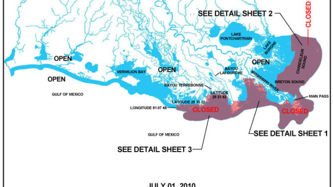
Fishing was shut down again in some areas across the Southeast Louisiana coastline as a precaution “due to strong east to southeast winds and higher than normal tides influenced by Hurricane Alex and the proximity of oil in portions of inshore and offshore state waters, ” the Louisiana Department of Wildlife and Fisheries reported today (July 1). The closures – which impact fishing in Breton and Chandeleur sounds, Barataria Bay, and the Cocodrie and Dularge marshes – went into effect about 10:15 a.m.
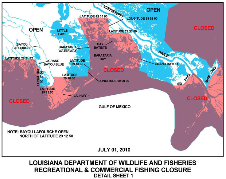
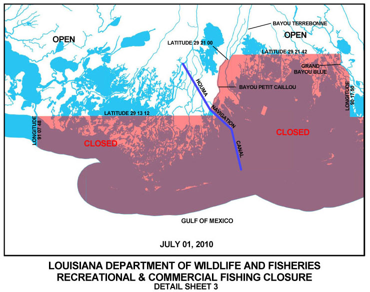
Click here for an updated LDWF map of all state closures. A more-detailed map of the latest closures in the Breton and Chandeleur sounds is here, while the Barataria map is here. Click here for the detailed map of the Cocodrie/Dularge area.
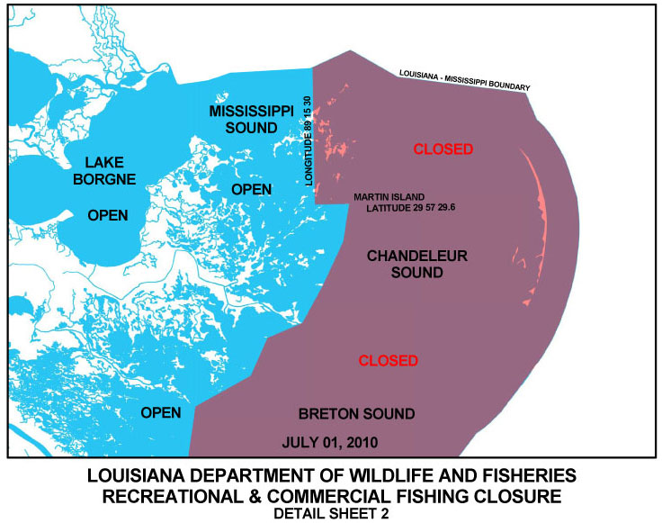
Closed east of the Mississippi River are the open waters of Breton and Chandeleur Sounds as described by the double-rig line and all state outside waters east of the Mississippi River.
In Terrebonne and Lafourche parishes, officials closed inshore waters south of 29 degrees 13 minutes 12 seconds north latitude from the Houma Navigation Canal red buoy line west to the eastern shore of Oyster Bayou and the portion of state outside waters from 90 degrees 46 minutes 01 seconds west longitude westward to 91 degrees 07 minutes 48 seconds west longitude near the eastern shore of Oyster Bayou.
Inshore Barataria Basin waters south of 29 degrees 16 minutes 00 seconds north latitude from 90 degrees 07 minutes 00 seconds west longitude westward to the eastern shore of Bayou Lafourche also were closed.
All other closures remain in effect, and any changes will continue to be posted on LouisianaSportsman.com.
")