More places than ever to punch your ticket for speckled trout
About 5,000 years ago, silt coming down the Mississippi River encircled and trapped a section of the Gulf of Mexico, creating a brackish estuary. That ancient entrapment left a giant bowl we now call Lake Pontchartrain.
Lake Pontchartrain stretches 41 miles long by 24 miles wide and spans 630 square miles. It averages 12 to 15 feet deep. Over the years, people dredged parts of the lake, but most of the bottom remained a smooth, mostly featureless mudflat. Except for a few shell beds and some seagrass growing along the shorelines, the lake contained little to hold fish until people started building bridges across it.
The Lake Pontchartrain Causeway, the longest bridge continuously over water in the world, runs 24 miles generally north to south in two parallel spans across the widest portion of the lake. Interstate 10, U.S. Highway 11 and an ancient railroad trestle cross the narrower eastern part of the lake. With thousands of barnacle-encrusted pilings, these bridges create miles of hard structure to attract fish.
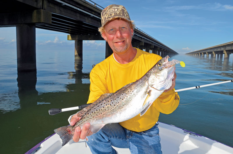
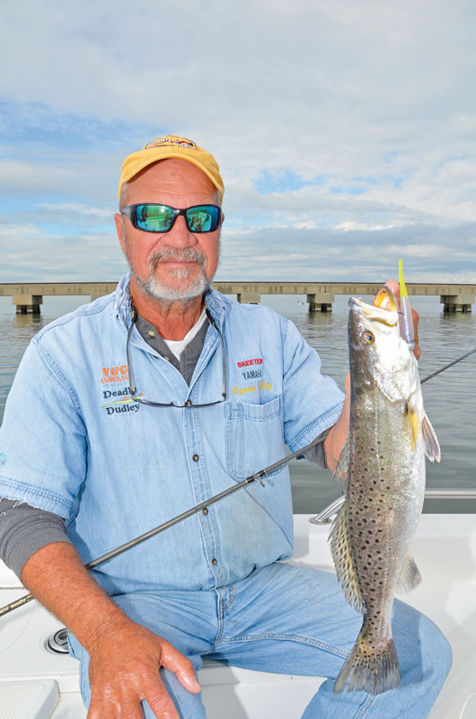
“On any day in Lake Pontchartrain, any bite could produce the new state record speckled trout,” predicted Dudley Vandenborre, (985-847-1924) a Slidell guide who already put a 10.50-pound speck in the Louisiana record book. “Over the years, I’ve had my best success fishing the railroad trestle along the south shore. Highway 11 has the biggest trout, but not as many of them.”
Highly visible
While the bridges create abundant excellent fish-attracting structure and can produce great catches, everyone knows about them and probably fished them for decades. Sitting on the edge of the most heavily populated part of Louisiana, these highly visible structures receive enormous fishing pressure.
“I’ve been fishing those bridges since I was 5 years old,” said Kenny Kreeger of Lake Pontchartrain Charters (985-960-3068, www.lakepontchartraincharters.com) in Slidell. “I’ve seen a lot of changes in the lake in all my years. I’ve seen that train trestle change from creosote wooden pilings to concrete. Where the old I-10 was, there is still a lot of stuff down there to attract fish.”
On any warm weekend when word gets out about fish biting in the lake, people might see a boat anchored next to nearly every bridge piling. When fishing pressure on the bridges mounts, Lake Pontchartrain anglers can still find other places to fish. In conjunction with private organizations such as the Lake Pontchartrain Basin Foundation and the Louisiana chapter of the Coastal Conservation Association, the state established several artificial reefs in the estuary to create fish habitat.
“Everybody knows about the bridges, but people might not know about some of the artificial reefs,” said Mackie Bellott with Wicked Fishing Charters (985-710-2882, www.wickedfishinglouisiana.com) in Mandeville. “The artificial reefs are underwater and might not get as much pressure if people don’t know they are there. If the bridges are packed with people, we can go fish some of the reefs.”
In a way, anglers can continue “fishing the bridges” at some of these artificial reefs. Interstate 10 crosses the “Middle Grounds” in the eastern section of the lake between Slidell and New Orleans East. In 2005, Hurricane Katrina severely damaged the I-10 bridges, commonly called the “Twin Spans” or “Twin Bridges. This necessitated taking what remained of the old spans down and building new ones slightly east of the old bridges. Part of the old Twin Spans still exists as public fishing piers in St. Tammany Parish on the Northshore.
New habitat
Some good can come out of the destruction caused by hurricanes. These powerful storms leave massive debris fields in their wake. Rather than simply sending this material to landfills, the state repurposed some of it to create fish habitat in Lake Pontchartrain and elsewhere.
“We used old bridge rubble from the Twin Spans to build three reefs in Lake Pontchartrain,” said Mike McDonough, the Artificial Reef Program coordinator for the Louisiana Department of Wildlife and Fisheries in Baton Rouge. “We didn’t use whole spans. When the hurricane knocked down the Twin Spans, the fallen spans were recovered and broken up into rubble with the rebar removed. Two reefs are between the U.S. Highway 11 bridge and the new I-10 bridge, one in the north and one in the south. A smaller reef is between the two old spans that were converted into fishing piers on the north end of the lake.”
One of the reefs honors the Vandenborres. The Dudley and Kim Vandenborre Reef sits in about 12 feet of water near Slidell. It covers about four acres and rises about six to eight feet off the bottom.
The state established several limestone, concrete and “reef balls” in other places to attract fish throughout the lake. Reef balls, concrete domes with holes in them, stand about three feet high. The holes allow water to flow through them. Fish and bait can get inside the structures.
“Artificial reefs create some hard structure that attracts fish,” McDonough said. “Inshore reefs are made from a variety of materials, but mostly limestone or clean recycled concrete. Whether it’s from a hurricane or not, we need to inspect the material in a yard and see if it’s a size that’ll fit into the reef sites we have in mind. Most of that stuff is pretty clean by nature, but we still want to make sure.”
Consisting of crushed limestone, the first artificial reef in Lake Pontchartrain dates to 2001, four years before Katrina. It sits about two miles east of the New Orleans Lakefront Airport and covers about two acres. Another reef sits off Williams Boulevard in Kenner along the south shore. A third reef sits in Orleans Parish east of the Causeway.
Most artificial reefs exist in the eastern half of the lake, but one in St. John the Baptist Parish waters sits in the far western part of the lake. Two more ball reefs sit in St. Tammany Parish, one south of Goose Point and another south of Madisonville. Others sit off the mouth of Bayou Lacombe and off Mandeville about five miles south of Fontainebleau State Park.
Shell pads remain
In the 1970s, oil companies placed several platforms in Lake Pontchartrain off the mouth of Bayou Lacombe. The companies removed those platforms many years ago, but the old shell pads they created as foundations for the structures remain for anglers who know where to find them. These old shell pads still hold fish.
“One shell pad about a half-mile off Goose Point is pretty good in late summer,” Bellott said. “It can hold redfish. It’s hit or miss, but when it’s on, it’s on! We’ve limited out on reds there a few times. It’s a blast when the fish are there. Another reef is about a mile west of the Causeway and three miles from the Northshore. Trout move through there from time to time.”
The oldest “artificial reef” didn’t start out to be one. It dates back about two centuries. Just south of where the Rigolets enters Lake Pontchartrain in Orleans Parish, the “Hospital Wall” remains a popular fishing destination.
Completed in 1826, Fort Pike served as an active military outpost during the Civil War. A hospital on the lake shoreline served soldiers assigned to the fort. After 200 years of storms and erosion, the lake shoreline retreated. Little remains of the old hospital, except rocks, rubble and other debris now under several feet of water. The submerged debris can hold good numbers of trout, redfish, sheepshead, black drum and other fish species.
“The reefs definitely attract fish,” Bellott said. “April is normally a pretty good time to fish. We always fish the reefs on the bottom. We use the depth finder to make sure we’re in the right spot and get within casting distance of the reef. For trout, we throw jigheads and bounce them off the bottom. If the trout are there, we can catch them on plastics as well as we can on shrimp. We keep moving with the fish and keep checking the reefs.”
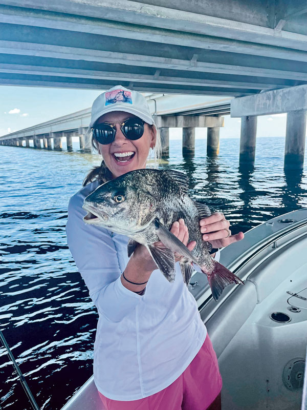
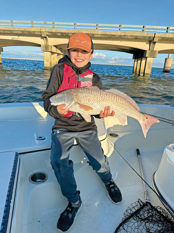
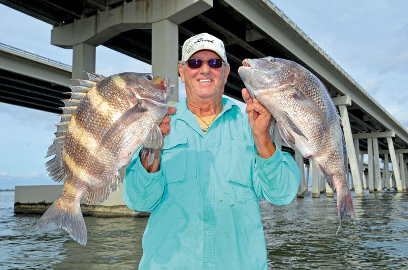
The bridges and reefs both provide excellent structure for varied species. Anglers can usually find good fishing for different species on these structures at some point during the year. Sheepshead love to crunch the barnacles attached to the hard structures, one of their favorite foods. Speckled trout, white trout, black drum, redfish, croakers and other species also hang around the structures. In the winter, freshwater blue catfish move into Lake Pontchartrain. At times, big bull sharks, tripletail and jack crevalle cruise through the estuary.
“Sheepshead are always around the bridges,” Kreeger said. “I love catching sheepshead. It’s one of my favorite fish. Normally, spring is a great time to fish. We start seeing good trout around the second week of March. In late October and November until it gets really cold in December, we get a big bull red run of fish that come into Lake Pontchartrain.”
For information on the Louisiana Artificial Reef Program and reef coordinates, see www.wlf.louisiana.gov/fishing/artificial-reef-program. For help planning a trip, contact the St. Tammany Parish Tourist Commission at 800-634-9443. Online, see www.LouisianaNorthshore.com.
A bridge not far
Most people fish the bridges spanning Lake Pontchartrain because these concrete structures provide abundant cover for many species. These bridges include:
- Causeway — The parallel Causeway spans stretch 24 miles across the widest part of Lake Pontchartrain. The first span opened in 1956, followed by the second span in 1969.
- Interstate-10 — In 2005, Hurricane Katrina severely damaged the original “Twin Bridges” crossing eastern Lake Pontchartrain. One new 5.5-mile-long span opened in 2009 parallel to the old bridge. A second span opened in 2010. The remains of the old 1965 bridges were demolished and removed with some bridge rubble used to create artificial reefs. Part of the original twin spans remains as a fishing pier on the north side of the lake.
- U.S. Highway 11 — Officially 4.78 miles long, the “Five-Mile” Bridge opened in 1928 as the Maestri Bridge, named for a former New Orleans mayor. Now it’s formally called the Watson-Williams Pontchartrain Bridge.
- Others — A railroad trestle dating to 1884 spans Lake Pontchartrain near Highway 11. Another railroad crosses both the Chef Menteur and the Rigolets passes near Lake Borgne. In 2008, a new U.S. Highway 90 bridge opened to replace a 1930 bridge that once crossed the Rigolets near Lake Pontchartrain. A car bridge also crosses the Chef Menteur.