
‘We feel they are safe,’ official says
More Cocodrie marshes and Vermilion Parish offshore waters reopened for fishing this evening (June 7) by the Louisiana Department of Wildlife and Fisheries.
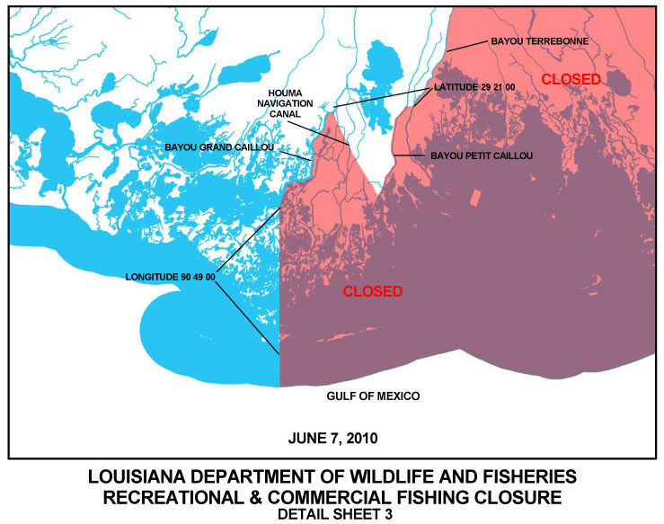
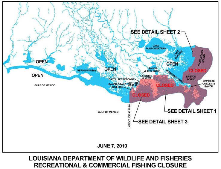
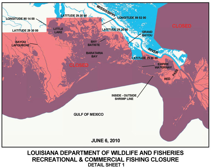
Click here to see the new LDWF detailed map of the Cocodrie area, and view the updated map of all state fishing closures here. A map of the closures in Barataria Bay and the west side of the Mississippi River can be found here, while the detailed map of the closures east of the river is found here.
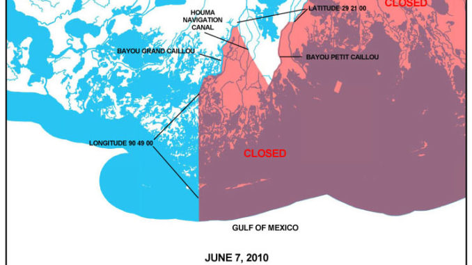
Now opened are inshore waters south of 29 degrees, 21 minutes, 00 seconds north latitude westward from the western shore of Bayou Petit Caillou and east of the eastern shore of the Houma Navigation Canal.
Also reopened were inside waters from 90 degrees, 49 minutes, 00 seconds west longitude westward to the eastern shore of Bayou Grand Caillou.
In addition, state offshore waters from 90 degrees, 49 minutes, 00 seconds west longitude westward to 91 degrees, 20 minutes, 20 seconds west longitude near the southwestern shore of Pointe au Fer island reopened.
Also, the portion of state outside waters from 92 degrees, 18 minutes, 00 seconds west longitude near Freshwater Bayou westward to 92 degrees, 25 minutes, 00 seconds west longitude reopened to recreational and commercial fishing.
All other closures remain in place.
")
")