The numbers don’t lie. They tell us where poult production was good, and where hunters can expect to fill their bags this season.
Dear Capt. Paul:
I was wondering if you knew the location of the 24-Mile Rigs and the exact location of the Midnight Lump.
Thanks, Evan Daves
Capt. Paul’s response:
There is — or rather, were — a series of five offshore platforms, the center of which is about 27.5 miles (23.9 nautical miles) from Red No. 2 Buoy at the mouth of the South Pass channel of the Mississippi River. These platforms are commonly called the 24-Mile Rigs.
Leaving Venice at the Jump, you would proceed down the river to Head of Passes to South Pass, and continue in South Pass for about 13 miles past Port Eads. The beginning of the Aids to Navigation for the South Pass channel is a buoy, which is a bell marked Red No. 2. It is at or about N28 58.695 x W89 06.516.
Four were located in SP Block 62, and one is located in VK Block 900. The rough center of these rigs is at a bearing of 73 degrees, and is about 24 nautical miles from the Red No. 2 at the entrance to South Pass. They are all within a mile and a half of each other, and stand in 300 to 350 feet of water.
There are — or were — three in a northeast to southwest line that is no more than 1.5 miles end to end. The center of these three rigs is at or about N29 05.275 x W088 44.011. The other platforms are located to the southeast and southwest of these three rigs.
I was told by Capt. Scott Avanzino of Paradise Outfitters (985-845-8006) that there are now only two platforms that are visible in SP Block 62. The other two did not survive Katrina, but they are still there below the surface. So use caution when navigating these waters.
The trip to the beginning of South Pass Red No. 2 is about 30 miles from Venice in the Mississippi River. Adding the 24 miles to these rigs makes the one-way trip about 55 miles. A conservative estimate would be a distance of about 130 miles from Venice to these rigs and back. You may want to think about refueling or “topping off” at Port Eads if fuel is available. Also remember that you may be out of range of cell-phone communication, so a marine VHF radio is a must-have safety item.
While in the area, there is another rig called Amberjack at or about N28 51.880 x W088 55.847, and is about 13.4 miles at a bearing of 127 degrees from the Red No. 2 nun, and another platform is at or about N28 44. 482 x W088 49.520, and is about 23.8 miles at a bearing of 135 degrees from the Red No. 2 nun.
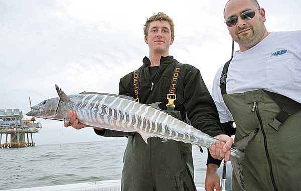
The official name of the Midnight Lump is the Sackett Bank. It is a draw for tuna and wahoo during certain times of the year. The Midnight Lump has become very popular in the last decade. Sometimes there are more than 100 boats a day in the active part of the season.
You will need a deepwater depthfinder to actually find and “see” the exact location. The seabed rises from about 60 fathoms to 33 fathoms at the Lump. Picture a series of truncated cones rising from the seabed.
Gulf currents push water over the top of the Lump, causing smaller baitfish to be pushed against and over the Lump. Amberjack, tuna, marlin, snapper, grouper and wahoo usually gather there to eat. Usually fishing one side of the Lump is better than the other. The currents will determine which side is better to fish.
The approximate center of the Lump is at or about N28 38.122 x W89 33.249. The location is about 20.5 miles from Southwest Pass at a bearing of 201 degrees, and is about 35.2 miles at a bearing of 192 degrees from the end of the breakwater (N29 08.233 x W89 26. 184) at Tiger Pass. It is located in Block 148 of the South Addition of West Delta.
Bring plenty of anchor line as you will need every foot of it. Most anglers suggest that you use a minimum of 600 feet of anchor line with anywhere from 10 to 30 feet of chain. The chain will greatly enhance your anchor’s ability to set. Your anchor needs will vary greatly, but a medium-sized vessel (23 to 28 feet) should use at least a 22- to 25-pound anchor. Some captains suggest an anchor point on the Lump at about 250 feet deep.
All of the positions are listed as DD,MM.MMM, and are based on WGS 84 datum. All bearings are stated in magnetic degrees, and unless stated otherwise are shown in statute miles.


