Skip navigation
CLOSE
X
Search
Subscribe
Back To
Submit Reports
Back To
Log In
Back To
Fishing
Back To
Fishing Articles
See All
Freshwater
Bass Fishing
Inshore
Offshore
Tournaments
Weather
Fishing Reports
Fishing Classifieds
Seasons & Regulations
Hunting
Back To
Hunting Articles
See All
Deer
Waterfowl
Other
Hunting Reports
Hunting Classifieds
Seasons & Regulations
Sportsman Products
Back To
New Products
Weather
Back To
Overview
Tidal Ranges
Lunar Tables
Classifieds
Back To
Classifieds Options
View All
Post Ads
Help
Jump to Section
Golf Carts/ATV
Motors
Boats
Hunting
Fishing
Tractors & Equipment
Real Estate
Vehicles & Trailers
RVs & Campers
Household Items
Businesses
Back To
Businesses
Advertise
Media Kit
Magazine
Back To
Learn More
Contents
Digital Issues
Manage Subscriptions
Purchase Back Issues
Gift Louisiana Sportsman
Subscribe
Back To
Submit Reports
Back To
Log In
Back To
April 26, 2024
Home
/ Listings
Listings
Showing 1–20 of 1802 results
A to Z ( title )
Z to A ( title )
Recently added ( latest )
Date added ( oldest )
Most viewed
Less viewed
Price ( low to high )
Price ( high to low )
Add to Favourites
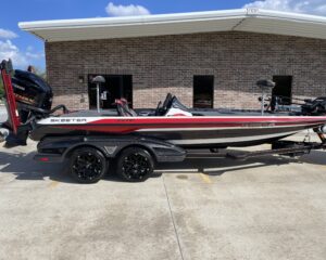
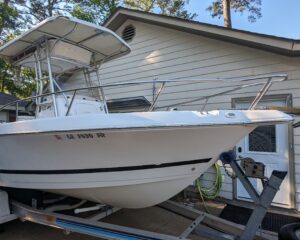
2021 Skeeter Apex 21’
Featured
Top
3 months ago
by Brad Indest
Bass
Breaux Bridge
,
Louisiana
$
75,000
Add to Favourites
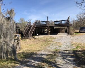
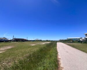
Waterfront – Bayou Dularge – 1.8 acres – Plus partial structure
Popular
Top
2 months ago
by Carroll Parr
Camps for sale
Houma
,
Louisiana
$
185,000
total price
Add to Favourites
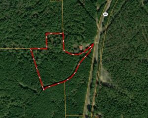
LOTS 1-10, HWY 24, CENTREVILLE, MS – 2 AC M/L $48,800-$68,800
New
4 hours ago
by Murray Land and Homes Realty
Lots for Sale
Natchez
,
Mississippi
$
48,800
Add to Favourites
12097 HWY 563, CROSBY, MS – 9.5 AC – $85,000
New
4 hours ago
by Murray Land and Homes Realty
Lots for Sale
Natchez
,
Mississippi
$
85,000
Add to Favourites
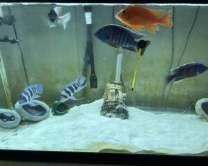
Fish tank and equipment
New
6 hours ago
by Mark mayon
Furniture
New Iberia
,
Louisiana
$
500
total price
Add to Favourites
FOR SALE – 8 lots Poplar Lane, Grand Isle, LA 70358 985-787-3200
New
6 hours ago
by Coastal Realty
Lots for Sale
Grand Isle
,
Louisiana
$
300,000
Add to Favourites
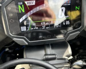
Zx10r
New
6 hours ago
by Mark mayon
Motorcycles
New Iberia
,
Louisiana
$
15,500
total price
Add to Favourites
Keltec PLR16 / AR Pistol
New
7 hours ago
by Chris Coleman
Guns
Marksville
,
Louisiana
$
1,300
Add to Favourites
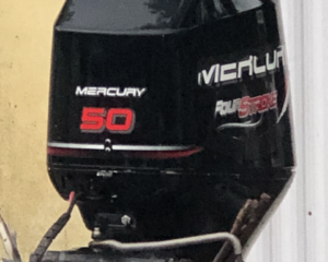
Mercury 50 HP outboard
New
8 hours ago
by Dd74
Other Boats
Morgan City
,
Louisiana
$
2,300
Add to Favourites
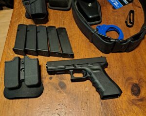
Complete new police duty belt, new glock 17 gen 3.
New
8 hours ago
by Terrance Betts
Guns
Franklinton
,
Louisiana
$
750
total price
Add to Favourites
2007 Pro- Line 21 Sport with Four Stroke Suzuki 175
New
9 hours ago
by Herb Michelli
Offshore/Center Console
Mandeville
,
Louisiana
$
23,500
total price
Add to Favourites
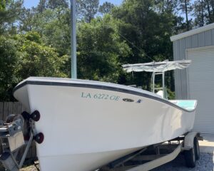
25’ laffites skiff
New
10 hours ago
by Jennifer Roberts
Other Boats
Covington
,
Louisiana
$
30,000
total price
Add to Favourites
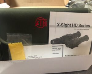
ATN 5-18x Day/Night Smart HD Optics Rifle Scope
New
12 hours ago
by David Mellinger
Hunting Equipment
Sunset
,
Louisiana
$
700
Add to Favourites
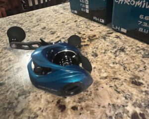
Kistler Chromium Reels
New
21 hours ago
by Larry Fadaol
Rods & Reels
Lafayete
,
Louisiana
$
100
Add to Favourites
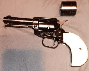
Heritage Rough Rider
New
23 hours ago
by Michael Boyer
Guns
Kenner
,
Louisiana
$
225
Add to Favourites
Trump Glock 19
New
23 hours ago
by Michael Boyer
Guns
Kenner
,
Louisiana
$
900
Add to Favourites
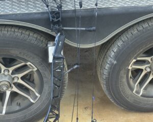
2024 Mathew’s lift 29.5 brand new in box
New
24 hours ago
by Todd Eppinette
Bows
West Monroe
,
Louisiana
$
1,000
Add to Favourites
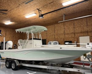
2510 Bay Ranger
New
1 day ago
by Derryl
Bay
Houma
,
Louisiana
$
136,000
Add to Favourites
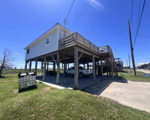
REDUCED 122 Norah Lane, Grand Isle, LA 985-787-3200
New
1 day ago
by Coastal Realty
Camps for sale
Grand Isle
,
Louisiana
$
315,000
Add to Favourites
SADDLE KING OF TEXAS STAMPED LEATHER WESTERN SADDLE
New
1 day ago
by Jessica Cason
Sports & Camping Equipment
Baton Rouge
,
Louisiana
Add to Favourites
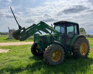
JOHN DEERE 6330 FARM TRACTOR
New
1 day ago
by Jessica Cason
Tractors
Livingston
,
Louisiana
Add to Favourites
2019 YANMAR SA24 FARM TRACTOR WITH FRONT LOADER AND BACKHOE
New
1 day ago
by Jessica Cason
Tractors
Livingston
,
Louisiana
1
2
3
4
…
89
90
91
Log in to post your ad
Search Listings
Search
Filter
Category
Location
Price Range
Apply filters