Skip navigation
CLOSE
X
Search
Subscribe
Back To
Submit Reports
Back To
Log In
Back To
Fishing
Back To
Fishing Articles
See All
Freshwater
Bass Fishing
Inshore
Offshore
Tournaments
Weather
Fishing Reports
Fishing Classifieds
Seasons & Regulations
Hunting
Back To
Hunting Articles
See All
Deer
Waterfowl
Other
Hunting Reports
Hunting Classifieds
Seasons & Regulations
Sportsman Products
Back To
New Products
Weather
Back To
Overview
Tidal Ranges
Lunar Tables
Classifieds
Back To
Classifieds Options
View All
Post Ads
Help
Jump to Section
Golf Carts/ATV
Motors
Boats
Hunting
Fishing
Tractors & Equipment
Real Estate
Vehicles & Trailers
RVs & Campers
Household Items
Businesses
Back To
Businesses
Advertise
Media Kit
Magazine
Back To
Learn More
Contents
Digital Issues
Manage Subscriptions
Purchase Back Issues
Gift Louisiana Sportsman
Subscribe
Back To
Submit Reports
Back To
Log In
Back To
May 4, 2024
Home
/ Listings
Listings
Showing 1–20 of 1775 results
A to Z ( title )
Z to A ( title )
Recently added ( latest )
Date added ( oldest )
Most viewed
Less viewed
Price ( low to high )
Price ( high to low )
Add to Favourites
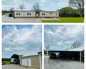
Reduced and Priced to sell.
Featured
Top
2 months ago
by Todd Bordelon
Homes for sale
Cottonport
,
Louisiana
$
275,000
total price
Add to Favourites
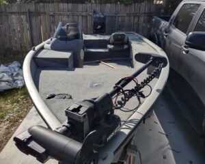
2007 Tracker
Top
1 month ago
by Thaddeus Norris
Bass
Lafayette
,
Louisiana
$
8,500
Add to Favourites
2003 Suzuki 225 outboard
New
2 hours ago
by Sherie Bordelon
Outboard Motors
Marksville
,
Louisiana
$
2,000
Add to Favourites
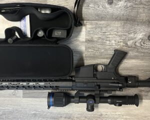
PA10 with thermal
New
2 hours ago
by Cody Ritchey
Guns
Houma
,
Louisiana
$
3,200
Add to Favourites
Beretta pintail
New
3 hours ago
by john lasyone
Guns
Bunkie
,
Louisiana
$
1,200
Add to Favourites
686 onyx
New
4 hours ago
by john lasyone
Guns
Bunkie
,
Louisiana
$
1,600
Add to Favourites
Fiberglass boat repair
New
14 hours ago
by Sandy rabalais
Bay
Folsom
,
Louisiana
$
100
–
$
1,000
Add to Favourites
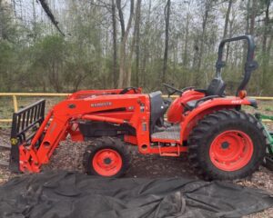
43Hp Kubota Tractor
New
16 hours ago
by Quality Equipment
Tractors
Houston
,
Texas
$
27,000
Add to Favourites
28hp Mahindra Tractor-25 hrs
New
16 hours ago
by Quality Equipment
Tractors
Houston
,
Texas
$
13,750
Add to Favourites
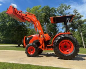
2018 55hp Kubota Farm Tractor
New
16 hours ago
by Quality Equipment
Tractors
Houston
,
Texas
$
27,000
Add to Favourites
47Hp Kubota Tractor-100hrs/HST
New
16 hours ago
by Quality Equipment
Tractors
Houston
,
Texas
$
29,000
Add to Favourites
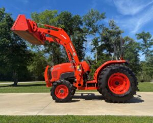
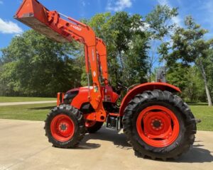
52hp Kubota Tractor-204 hrs
New
16 hours ago
by Quality Equipment
Tractors
Houston
,
Texas
$
27,000
Add to Favourites
Browning a5
New
16 hours ago
by Mark Easley
Guns
Kentwood
,
Louisiana
$
1,100
Add to Favourites
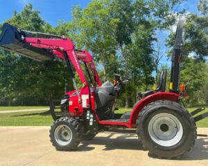
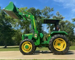
John Deere Farm Tractor
New
16 hours ago
by Quality Equipment
Tractors
Houston
,
Texas
$
25,000
Add to Favourites
85HP Kubota Tractor
New
16 hours ago
by Quality Equipment
Tractors
Houston
,
Texas
$
32,500
Add to Favourites
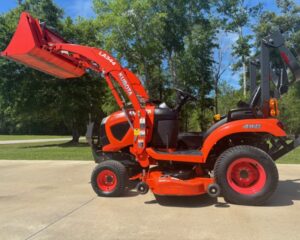
45Hp Kioti Tractor
New
16 hours ago
by Quality Equipment
Tractors
Houston
,
Texas
$
19,000
Add to Favourites
Kubota Lawn Tractor with Removable Deck-90hrs
New
16 hours ago
by Quality Equipment
Tractors
Houston
,
Texas
$
12,500
Add to Favourites
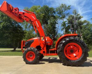
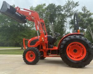
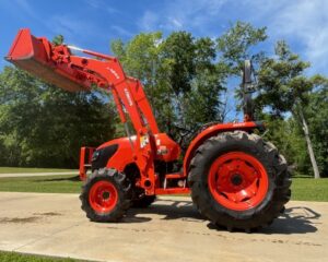
Like New 52Hp Kubota Tractor/HST
New
16 hours ago
by Quality Equipment
Tractors
Houston
,
Texas
$
29,500
Add to Favourites
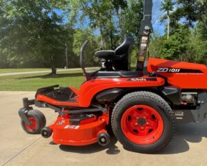
2020 Kubota Diesel Zero turn-50 hrs
New
16 hours ago
by Quality Equipment
Lawn Mower
Houston
,
Texas
$
12,500
Add to Favourites
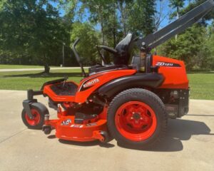
60 inch Kubota Diesel Zero Turn
New
16 hours ago
by Quality Equipment
Lawn Mower
Houston
,
Texas
$
14,000
Add to Favourites
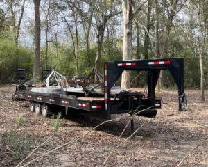
Heavy Duty 32ft Triple Axle Trailer
New
16 hours ago
by Quality Equipment
Trailers
Houston
,
Texas
$
10,000
Add to Favourites
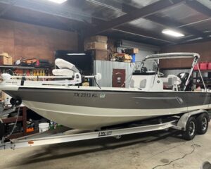
22ft Bay Boat Like New-30 hrs
New
16 hours ago
by Quality Equipment
Bay
Houston
,
Texas
$
39,750
1
2
3
4
…
87
88
89
Log in to post your ad
Search Listings
Search
Filter
Category
Location
Price Range
Apply filters