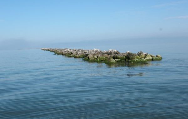
The MRGO “long” rocks were once considered the longest rock jetty in the USA, stretching out for 8 miles to the edge of Breton Sound.
Originally laid in the 1960s when the Corps of Engineers constructed the project, they were intended to help prevent silting in of the deep channel to keep the waterway navigable for ships bypassing the longer route to port through the Mississippi River.
But the Corps soon learned laying the rocks didn’t end their problem: The rocks quickly sank into the soft muddy bottom and vanished beneath the surface.
New loads of rocks had to be regularly added, and the waterway silted in anyway, requiring consistent dredging to remain navigable.
The inconsistent use of the channel by shipping and the fact that the ship channel became an environmental nightmare — injecting saltwater directly from the Gulf of Mexico into a freshwater ecosystem, destroying swamps, killing trees, displacing the natural wildlife, generating erosion and providing a “hurricane corridor” into New Orleans — made it the worst debacle in Corps history.
It’s now nearly 10 years since Hurricane Katrina and parts of Orleans, St. Bernard and Plaquemines Parishes still bear scars inflicted by that storm largely because of the MRGO.
In 2009, a 950-foot-long rock dam was constructed across the MRGO just below Bayou LaLoutre with over 350,000 tons of rock, closing it forever.
Most of the rock used to dam it off was barged in from upriver, but some of the rocks were pulled up from the 8-mile stretch of rock jetty at the end of the ship channel, leaving a big gap in the jetty.
Despite the specious history of the MRGO, both the long and short stretches of rocks at the end of the channel are fish magnets — and have been for decades.
