
Distinct changes in habitat, current and structure create some great fishing opportunities along the long boating channel that is a southeast Louisiana angling treasure.
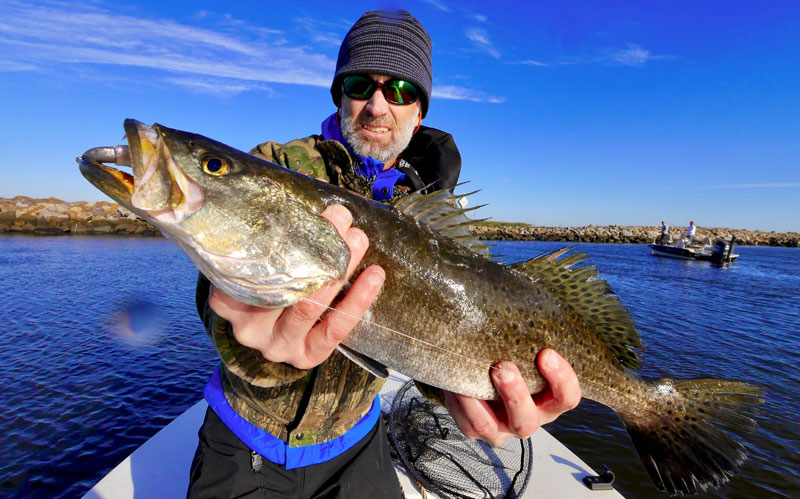
I have spent more seasons of the year catching speckled trout in the Mississippi River Gulf Outlet (MRGO) channel than in any other singular structural feature in southeast Louisiana, not surprising given that the MRGO is a 45-mile north-south channel that bisects the marsh.
It can give us spectacular trout action on a cold, rainy December day beside the $1.1 billion Surge Barrier Wall, aka “The Great Wall of Chalmette”, or on a blistering July day along its southern jetties in Breton Sound. So many specific spots and structural features along the MRGO can be focused on that you may miss the fundamental advantage the channel brings to our fishery: edges.
To define the concept of an edge, consider one classic scenario, the marsh drain. One of the cardinal rules of inshore fishing is to cast baits in the vicinity of moving water. The marsh drain, also known as a cut or a crevasse, is an example.
Where a marsh drain allows a pond to empty tidal water into a bayou, you can effectively fish the flowing water by positioning your boat off the cut in the bayou about three-quarters of a cast from the junction of the cut and the bayou. This allows casting into the cut and either working the bait out with the current or simply letting the current float it out.
Most often the bait will be waylaid by a fish when it moves into the transition zone between the cut and the bayou. The best of these spots have multiple transitions, such as a change in depth, a change in water velocity or a change in water clarity. We may think of these spots as regions of moving water because we can see the flow, but a more helpful mental model of such areas is to see them as edges.
Patrol the edges
Edges are the most-consistently productive features for catching inshore species, and most anglers fish them, although they may not think of them as edges. They are the transition between two or more distinct physical or water chemistry properties, and for various reasons, edges are more ecologically rich than the homogeneous features that form them.
This is also common for many terrestrial animals. For instance, hunters know that they are more likely to find deer moving near the edge of a forest or edges of a forest meadow than in the deepest, darkest parts of the forest. Edges teem with plant, insect and animal life, but inside a forest of tall, deciduous trees, the rich edge is not the forest floor but the canopy — the edge between the treetops and the sky. Therefore, deer mostly pass through the forest on their way to the edges to feed.
One type of obvious edge is the border between a line of submerged aquatic vegetation and open water or the line of rocks along many parts of the MRGO channel. These edges we instinctively understand because they are the plane between cover and open water or safety and danger. If you have ever been on an African safari or in a national park inhabited by bears, you understand the cover your car provides you and the courage it gives you to step out to take pictures of the animals. The baitfish living in the weed bed act the same way, staying close enough for a quick retreat but venturing over the edge to feed on passing organisms. This type of edge will attract speckled trout and redfish, but the fish are more distributed along these edges than some other types of edges.
Watery edges
The types of edges where you are more likely to find concentrations of speckled trout are not the transitions between structural cover and open water, but instead the edges between water characteristics, such as water draining through a cut.

A mental model describing the productivity of the marsh drain is bait swept out of the marsh pond by the fast water and into the grasp of predators waiting where the water slows. However, the more I have studied underwater videos, the less I see baitfish as helpless creatures easily swept along by the current. In fact, they are quite capable of maneuvering quickly through the current in all directions. So why would baitfish hang around in open water where they seem so vulnerable?
To understand, we need to establish a motive for these baitfish, and fortunately, the motivations of fish are rather limited. They are either eating, reproducing, escaping predation or resting. The only activity that seems to fit the bait in the marsh-drain scenario is feeding, so a better mental model is that of the organisms the bait fish are eating being swept helplessly out with the current, and the baitfish are there to consume these smaller creatures.
The organisms in the current create a food chain, starting with the phytoplankton and increasing in size to the baitfish being eaten by the trout. This concept builds an entirely new model in my mind, where organisms in the ecological food chain flourish on the current created edges of that marsh drain. That means I benefit from harvesting greater numbers of trout at this spot because the tiny organisms and the baitfish are concentrated here as a result of the edge between different properties of the water.
The current’s attraction
To best grasp the richness the MRGO brings to the fishery, we need to talk about currents. Inshore anglers are very skilled at identifying tidal currents, referencing the tidal predictions and generally using conditions the tidal currents create to catch more fish. However, there is more water movement in the MRGO than just tidal-driven water. Where there is significant water-depth variation, water also moves vertically due to temperature and salinity, which are both products of a change in water density.
While not as strong as tidal forces, when lighter water — which is warmer or fresher — rises, it carries nutrients from the bottom. Water near the surface has more oxygen but fewer nutrients, and feeding nutrients into oxygen-rich water increases the growth of phytoplankton, which are the smallest organisms in the food chain. Increasing the phytoplankton, in principle, increases the potential of a greater amount of food for trout.
A strong current flow over shallow water in the Mississippi River estuary is interesting, but sometimes it makes the water too turbid for speckled trout. However, the gentle mixing of nutrient rich water near the MRGO channel’s drop-off can create a rich habitat of life without the turbidity. I have often found trout staged near the edges of the MRGO drop-offs in 14 to 20 feet of water, possibly due to their food being concentrated where water with different properties is mixing. This is one example of an edge that the MRGO creates.

One of the features along the MRGO regularly fished in the fall through spring is a flat southeast of the Wall. This section of water is a space between a large, 2- to 3-foot deep bay and the channel, and it tapers from 3 to 6 feet over a few hundred feet before quickly dropping into the 30-foot depth of the channel. It may seem like calling a flat an edge is a stretch of the imagination, but I believe the productivity of this flat is very much due to an edge created by the MRGO. The water of the nutrient-rich channel on two sides of the flat and the oxygen-rich shallow water of the marsh bay very likely increases the richness of life on the flat, making it an ideal cold-water hunting ground for specks and redfish.
Rock dam edges
Another obvious feature of the MRGO is the rock dam near Hopedale, which produces multiple edges due to the complexity of the structure. The richness of life around the dam is often visible in an abundance of baitfish at the surface.
The south side of the dam is especially effective at creating edges on a falling tide. During many months, fresher water from the north side filters through the top of the dam and mixes with higher-salinity water on the south side. This area of the channel is also quite deep, so the water drops quickly from the exposed rocks to 40 feet. I have found that trout can be caught in large numbers without moving your boat due to fish congregating on the edges created by streams of flowing water.
Many anglers talk about the importance of boat position and casting location when fishing current, which I believe is an example of the existence of an edge. This certainly can happen on the south side of the dam, where retrieving the bait down a particular line can produce a trout on every cast. I have found that casting a 3/8-ounce jighead with a paddletail swimbait up to the rocks and letting the current mostly float the bait down the dam can be a recipe for non-stop action.
My approach to fishing the MRGO is to look for irregularities. These can be protrusions of rock along the shorelines, bayous intersecting with the channel, submerged rocks in 10 to 14 feet of water, breaks in the jetties and obvious features like the Wall and dam. I primarily fish the west side of the channel, but there are also excellent spots on the east side. When fishing around the Wall, the trout can congregate anywhere from 25 feet deep to tight against the Wall and the rock shoreline.
Despite the failure of the MRGO as a shipping channel, it has blessed our fishery because it is vastly different from the surrounding marsh. The many differences create edges, which enhance the richness of aquatic life and improves the fishing. When fishing this structure and others, remember to focus on the edges to increase your catches of speckled trout and redfish.
")
")
")