
GPS coordinates for the five locks and dams on the Red
Dear Capt. Paul:
Where is the Red River Pool? Do you have a GPS coordinate for it?
Capt. Paul’s response:
Thanks for the question, but your request is like asking, “What are the coordinates for Highway 1?”
Although the river begins near the Oklahoma-Texas border, it flows south eastward into Arkansas and Louisiana.
The Louisiana part of the Red River begins at the Arkansas-Louisiana border at or about 33° 01.1670’ N. Latitude ~ 93°48.2997’ W. Longitude, and ends where it joins the Lower Old River and the Atchafalaya River at or about 31° 01.1716’ N. Latitude 91°44.9109’ W. Longitude near Simmesport.
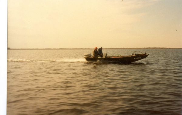
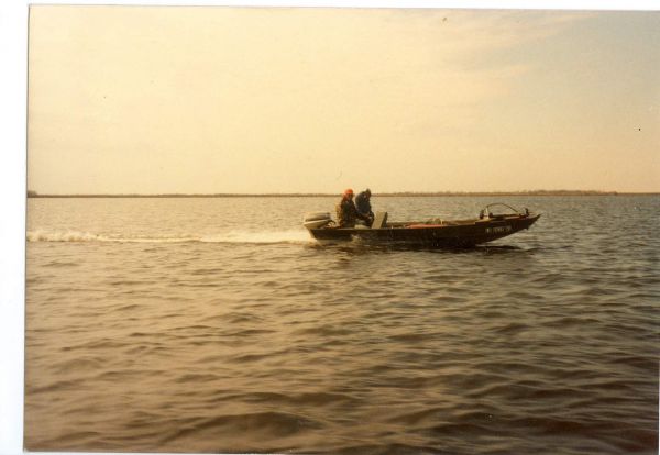
It is officially named the J. Bennett Johnston Waterway, and contains five locks and dams on the Red River. That is a distance of more than 350 miles. In the Louisiana section, the locks/dams are between the Bossier-Shreveport area and the junction with the Atchafalaya River.
The areas between these dams are called pools. The dams and locks, as well as all navigation rules, are administered and complied by the U.S. Corps of Engineers out of their Vicksburg office.
All of the locks standby on VHF channel 16. And there are no telephone numbers listed, so VHF radio is the only way to communicate with these locations.
The river is listed by navigation miles, with its junction with the Atchafalaya River being 0 and the Bossier City-Shreveport area being 235.
As for the pools and the dams they are listed as:
Lock & Dam No. 1, Lindy C. Boggs at Navigation Mile 44. Normal pool elevation above the dam is 40 feet.
It offers bank fishing, trash receptacles, grills, picnic tables, comfort station, an overlook and parking spaces. It is about 11 miles north of Marksville off Highway 452 at or about 31°15.2056’ N. Latitude ~ 91°57.442’ W. Longitude. The west side of the river has a boat ramp.
Lock and Dam No. 2, John H. Overton at Navigation Mile 74.5. Normal pool elevation above the dam is maintained at 64 feet.
It is located east of Chambers and Latanier at or about 31°11.2135’ N. Latitude ~ 92°17.5745’ W. Longitude.
Lock & Dam No. 3 located at Navigation Mile 116.5. Just north west of the Colfax city limits, normal pool elevation is maintained at 95 feet. It is located at or about 31°31.2609’ N. Latitude ~ 92°43.7247’ W. Longitude.
Lock & Dam No. 4, Russell B. Long is located at Navigation Mile 168.5. Normal pool elevation is listed at 120 feet. It is about 10 miles southeast of Coushetta, near Piermon. It is at or about 31°56.3358’ N. Latitude ~ 93°16.2778’ W. Longitude.
Lock and Dam No. 5, located at Navigation mile 200, has a normal pool depth of 145 feet. It is southeast of Shreveport and near Highway 1 by Crosskeys,. It is at or about 32°15.0288’ N. Latitude ~ 93°29.7164’~ W. Longitude.
As you can see, there are considerable distances between the dams, meaning the pools are quite long in length. You should do your homework when planning a trip because there are few service locations along the pools.
The Red River Waterway Commission’s website at www.redriverwaterway.com/rec-areas2.asp?CID=215410832 is an excellent source of information concerning the recreation areas along the river including the dams.
The commission also can be reached at 800-874-9431.
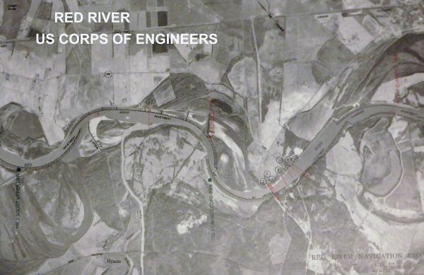
The Corps of Engineers publishes an atlas titled Navigation Maps of the Red Waterway that contains individual maps. This can be purchased by sending a $22 check to F&A Officer, U.S. Corps if Engineers, Vicksburg District, 4155 Clay St Vicksburg, MS 39183.
It is an angler’s must-have hard copy of the aerial views of the navigational part on the Red River from Shreveport to the Mouth of the river by the Mississippi River.
For internal GPS maps of the area, you might have to get the topographical version of mapping for your unit. Most manufactures have that type of mapping and even have some aerial views of the waterway.
However if you have a Lowrance, RayMarine, Simrad GPS system, you are in luck because Standard Mapping produces high-quality, full color, laminated and electronic photo maps.
Standard can be contacted at info@standardmap.com, or call 985-898-0025. The Red River GPS map card can be found at: www.standardmap.com/Red-River-LA-Card_p_332.html.
Unless otherwise specified, all positions are stated as Degrees, minutes and thousandths of minutes (DDD,MM.mmm) and were determined using WGS 84 Datum. All bearings and courses are stated in magnetic degrees.