Your unit has a lot to offer
We are experiencing a revolution in navigation that began with the advent of the Global Positioning System communally referred to simply as GPS. This technology stands with the invention of the compass and the sextant in importance to the navigator.
As with the sextant and compass, an understanding of how they work and how to use them is a must. My previous months’ columns described some of the main settings with which user should be familiar in order to get the most out of their GPS units. I hope you now have a better appreciation of how the GPS works and how the settings you choose affect the use of the unit.
My explanations of the available settings were in no way complete; they only covered the main configuration settings.
In most GPS units, each of the screens has a sub menu that allows a configuration of that screen. This might not be on some of the “entry level” GPS units, as it is a way of keeping costs for these units down. But, for the most part, most of the different screens have configuration settings for that screen.
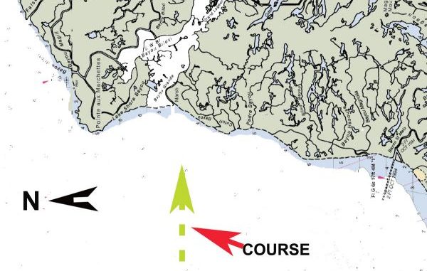
For instance, the menu configuration when on the “MAP” screen allows the user to display the map in several ways. Choices usually include viewing the displayed maps in a “north up,” a “course up” and “track up” view. You can lock in a certain zoom range, and other settings allow you to show — or not show — your tracks, waypoints and routes.
What to use?
There is, of course, no right or wrong answer as how to set your view of the internal maps: It is your choice. You should use whatever display you are most familiar with. But remember that you have the choice.
Another option is your choice of the icon used to indicate a waypoint position. In viewing the menu for that subject, you will find a great variety of images to indicate the position. They range from a simple “x” or circle to an image of a fish, a fuel pump, an anchor, a triangle or square, and many, many others.
In addition, those who have color units, can usually select different colors for the icons and names, as well as the size of the waypoint name. The same also applies to your routes and tracks.
Think how convenient it would be to have your waypoints, tracks and routes all in different colors. You could use one color for summertime fishing and another for winter fishing, etc.
In addition, each screen usually can be configured to show some of the numerous data the unit is constantly figuring and compiling. These data values include heading, course, speed, estimated time of arrival, time of the day, water temperature if so equipped, distance to next point, altitude and many more.
Part of the existing screen is allocated to display data boxes that contain the data you wish to see. You can usually choose between one data box, three, or nine boxes.
It sounds neat, but remember that each box takes away from the major screen. I usually use three boxes: speed, course and distance to next point.
But, here again, you have a choice.
And one of the biggest features of most modern units is that they can communicate with other units and with a computer. This means maps and all of your precious data, waypoints, tracks and routes can be backed up to a file or disk in your computer. This data can then, of course, be edited if necessary and installed back in your GPS unit.
This electronic data transfer is the basis of my “Captain Paul’s Fishing Edge of GPS Waypoints.”
This feature allows the transfer of over 500 waypoints in less than one minute. If you are not using the electronic data transfer feature, you are really not getting all benefits the unit has to offer.
This —in addition to an onboard instant real-time connection to a VHF radio, radar, engine gauges, depth finders and even an auto-pilot — offers an untold coordination of the vessel’s navigation chores.
Get to know your GPS
In my seminars, I tell attendees to purchase a spare power cable for their unit. This allows you to power up the unit in your home either from a battery or from a 120vAc to 12Vdc converter. Using that setup allows you to experiment and make configuration changes from the recliner at your home and not while underway on a fishing trip. It lets you see many of the features in your GPS that would otherwise go unnoticed.
Remember, the more you use your GPS the more you will be able to use it. Get to know the unit.


