New data does not mean restoration Master Plan will be ineffective, Graves says.
Yes, we can. And, by the way: You’re wrong.
That’s how Garret Graves, head of the Louisiana Coastal Protection and Restoration Authority, and some coastal scientists have responded to federal researchers who last week predicted the southeast coast faces the highest rate of sea level rise “on the planet” – 4.4 feet by 2100. At that rate, they said, parts of the state’s coastal Master Plan will be obsolete before they are completed.
“The NOAA folks are just misinformed,” said Graves, summing up a point-by-point email refutation of the claims made by National Oceanic and Atmospheric Administration staffers in an earlier story that stunned local residents and echoed across the nation’s media platforms.
Requests for a response from Graves and others involved with the Master Plan had gone unanswered when the story on the NOAA claims was published. Now they have fired back.
Graves said a central feature of the Master Plan allows projects to be adapted to ever-increasing rates of sea level rise and subsidence, even those higher than predicted in the NOAA scenario.
He referred to an appendix to the Master Plan showing that the Coastal Protection and Restoration Authority predicts the subsidence rates to vary across the landscape and that they may even exceed those estimated by NOAA. He pointed out the appendix had been “publicly available for many months.”
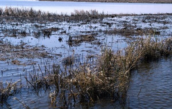
The NOAA researchers’ comments were based on new studies showing that the southeastern Louisiana coast, long known to have one of the highest rates of subsidence in the world, is sinking much faster and more uniformly than previously thought. That’s because it rests on the Mississippi River’s collapsing sediment-starved deltas. When combined with recently released data proving the seas are rising at a faster rate than predicted, those two factors — collectively called “relative sea level rise” — showed the Gulf of Mexico rising 4.4 feet in this area by century’s end.
Tim Osborn, an 18-year veteran of NOAA’s Louisiana coastal surveys, contends that the updated data pose serious new problems for the Master Plan.
“The problem is it’s a master plan for the restoration and conservation of a landscape that is moving downward at a faster rate than we realized when the plan was constructed — a rate faster than any place else we are seeing in the world for such a large land area,” he said.
As regards the NOAA study, in an email sent to The Lens on Wednesday, Osborn stood his ground:
“NOAA has provided the citations for the published research on which its conclusions are based, and that regardless of the numbers, the land subsidence coupled with projected sea level rise and coastal storms will be a continuing issue confronting coastal communities in Louisiana and which we believe everyone is in agreement.”
Graves and others involved in the Master Plan call the NOAA report inaccurate in its description of the plan and question NOAA’s ability to project subsidence rates into the future.
Graves pointed to statements on page 86 of the Master Plan that concede sea level rise rates published after planning work was completed exceed what had been the plan’s worst-case scenario. “As a result, new rates of sea level rise will be incorporated into future project planning and design,” Graves said.
Osborn’s use of subsidence measurements at different sites to project an average for the coast – especially into the future — has drawn intense criticism from the authority Graves leads.
Scientists point out that the Mississippi’s deltas are notoriously complex. Laid down by the river over 6,000 years, they are a wild weave of countless layers of material, ranging from highly organic marshes to heavy clays, old woody swamps and powdery alluvial sediments – all of which vary in thickness, rising, falling and sometimes intertwining to depths of hundreds of feet. Those different layers decompose, compress and sink at varying rates and are sliced by a web of faults. That makes predicting future rates of subsidence over any distance a nightmare for planners.
Denise Reed, chief scientist at The Water Institute of the Gulf who has studied the delta for almost two decades and was involved in the Master Plan process, called deltaic subsidence the real wild card for coastal Louisiana’s future – even more of a challenge than sea level rise.
“We know a lot about the factors that contribute to subsidence in Louisiana, and we know they are very complicated, and we know they vary from one place to another,” she said. “Unfortunately, we haven’t, as a scientific community, reconciled all that in way that we can predict subsidence out over 100 years.”
Graves said the “spatial variability” of subsidence across the delta “further calls into question NOAA’s one-size-fits-all approach” and pointed out the Master Plan considered subsidence and sea level rise at the location of each project during the planning phase.
Reed and Graves said the uncertainties surrounding both sea level rise and subsidence were a major reason adaptability was built into the plan so none of the projects would be “frozen in place.”
“Yes, we expect things to change, and, yes, we can adapt these projects as we move forward,” Reed said.
“And, yes, if things change to the point where a project can’t accomplish its goals, we will have to reconsider it.”
However, there was no scientific answer to one of Osborn’s most troubling questions: The Master Plan may build projects that can handle sea level rise to 2050 – but can they handle the really dramatic rises that are predicted to occur in the last half of the century.
Louisiana-based scientist Virginia Burkett, one of the coauthors of sea level rise chapter in the Intergovernmental Panel on Climate Change report that has become the standard for planners worldwide, said the consensus of models used to chart and predict the delta’s future show exponential rise in sea level in the last decades of the century.
“This isn’t going to be a consistent, or gentle, curve upward in the graph,” she said. “We’ll be bouncing along until the last few decades, when all the models show a steep curve upward.”
That science brought this question from Osborn last week:
“With all due respect, they have projects designed to last 50 years at one level of relative sea level rise, when they should be building projects that can function for several generations as sea level rises twice as high, if not higher,” Osborn said.
“People are already questioning the wisdom of spending huge sums to protect Louisiana,” he said. “The state needs to make sure they’re proposing plans that will last more than a few decades, that they aren’t asking for billions to build things that might be ineffective before they are even finished being built.”
Supporters of the plan said waiting decades for projections to level out would concede too much coast to the Gulf, and make projects that were started at that late date even more expensive.
“What we can do is use the sediments we do have to build up the coastal areas we do think have a fighting chance in the years following that (50-year time frame),” Reed said.
“It’s not going to look the way it does now. There is not enough sediment to keep it going the way it is now. And there is nowhere near as much sediment to get it back to the way it was.
“We have lost something during the 20th century in coastal Louisiana that we are not going to get back. But we can have better future in the 21st century if we think strategically about using the resources we do have.”
Editor’s Note: This story was produced in conjunction with The Lens, a nonprofit online newsroom based in New Orleans, http://TheLensNola.org.