Dear Capt. Paul:
How far is it from Sand Dollar Marina to the Grand Isle 40 Block? Also do you know of any other rigs near Grand Isle that produce well?
Thanks,
Douglas Schilling
Captain Paul’s response:
The center of the Mineral Management Services Leased Block Grand Isle 40 is at or about N28 59.220 x W090 01.279. That would put it about 14.7 miles from Caminada Pass at the Highway 1 bridge at a bearing of 174 degrees magnetic.
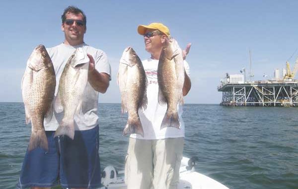
Grand Isle offshore
Here are several locations that could produce. I can’t guarantee any of them at a specific time, so keep that in mind.
There are several rig platforms in the Sandy Point area, but the all-time favorite rig in that area is referred to as the Green Monster, WD-23-3 CMP, which is located at or about N29º 10.547 x W89º 34.555.
It is about 21 miles from the green No. 1 Aid to Navigation (ATON) can at the beginning of the Barataria Pass entrance channel in the Gulf of Mexico (N29 14.436 x W89 54.753) at a bearing of 102 degrees magnetic.
The closest platform to the Empire Jetty in the Gulf is MX-WD 24-4. It is at or about N29º 12.538 x W89º 32.375, and is about 4.9 miles from the red No. 2 ATON at the jetty.
Near the above platform, there is a “flare” platform, MX-WD 24-FLARE No. 1, at or about N29º11.962 x W89º 32.172.
The southernmost of the series of platforms, MX-WD 24-5D, is at or about N29º 10.707 x W89º 32.044. The easternmost of the series, MX-WD 192-8, is at or about N29º 11.451 x W89º 30.411.
Two of the most popular locations are near the southwest section of the group.
MX-WD 23-3 is located 5.2 miles at a bearing of 159 degrees from ATON red No. 2, and is at or about N29º10.524 x W89º 34.559.
The other, MX-WD 23-FLARE No. 3, is at or about N29º 10.489 x W89º 33.099, and is about 6.2 miles at a bearing of 146 degrees from red No. 2 ATON.
All of these features may be viewed on NOAA charts 11358-Barataria Bay and Approaches and 11361_1 Miss. River Delta. In addition to NOAA chart No. 11316A-leased blocks, Miss. River to Galveston shows the leased blocks from the river to Galveston Bay.
As for the immediate Grand Isle area, the Louisiana Department of Wildlife and Fisheries has an extensive listing of all artificial reefs on their web site.
Once on the site, you can navigate through the fishing information selection to the section on artificial reefs. Once on the artificial reef page, you will note that they have offshore artificial reefs listed by area. There are numerous locations throughout the Louisiana coastal waters. If nothing else, it is interesting to read the information about the reef program. But the big advantage is that they list the latitude and longitude for all of the artificial reef locations.
But be aware that LDWF listed the coordinates as degrees, minutes and seconds, and they are shown using NAD 27 datum for these reefs. If your GPS is set to DD-MM.MMM, or another datum, you must convert them to the same format as your GPS or the GPS to their format. To convert seconds (SS) to thousandths of a minute (.MMM), divide the seconds by 60. To convert thousandths of minutes (.MMM) to seconds (SS), multiply by 60.
The old Freeport-McMoRan sulphur platform, which was located off the coast of Grand Isle, is the center of one of the artificial reefs. The site is about 3.9 miles from the Aid To Navigation (ATON) light green No. 1 at the beginning of the entrance to the Barataria Pass channel, just south of Grand Isle.
The rig site is now an underwater reef. Freeport-McMoRan donated the sulphur rig to the state of Louisiana for use as an artificial fishing reef. It was partly disassembled, and is now completely submerged below the water. The site is about 30 feet below the surface.
This Grand Isle reef is now marked with five buoys. The northernmost of the buoys, FISH FLRA-27-B HAVEN, is located at or about N29º11.6223 x W89º 53.670.
Another buoy, FLRA-27-A, is at or about N29º11.597 x W89º52.990. It is about 3.8 miles south of Barataria channel marker, NUN, RED 2.
The center buoy of the three southernmost buoys is at or about N29º10.948 x W89º 53.335.
To the south and west of the old sulphur mine reef is another set of offshore platforms in the Grand Isle area. These are the Exxon-Mobil Offshore Platforms, and are located to the southwest of ATON green No. 1 at the Barataria Pass channel at a distance of about 11 miles at a bearing of 202 degrees magnetic. They have been known to be productive at certain times of the year.
• “L” Center Platform has living quarters; fish for mangroves, N29 06’05.2 x W89 58’41.7.
• “BB” Platform; fish for reds, N29 09’15.6 x W90 01’07.3.
• “CC” Platform, N29 10’37.5 x W89 59’ 31.02.
• “9M” Platform, N29 10’37.2 x W89 52’30.5.
• “019” Platform, N29 08’59.5 x W89 53’50.7.
• “J” Platform; fish for mangroves, N29 06’02.8 x W89 59’40.0.
• “P” Platform, N29 06’31.1 x W8958’09.2.
• “Q” Platform; fish for mangroves, N29 05’48.9 x W89 05’40.4.
• “R” Platform, N29 07’21.7 x W89 57’58.3.
• “S” Platform, N29 09’ 10.9 x W89 58’02.7.
• “T” Platform, W29 06’39.3 x W90 01’26.2.
• “U” Platform; fish for mangroves, N29 05’48.9 x W89 57’52.7.
• “W” Platform, N29 05’41.2 x W89 56’31.6.
Please note that the positions are stated in degrees, minutes and seconds. No datum was given, but most such platforms are listed using NAD 27 datum.
Got a GPS question for Capt. Paul? Ask it at www.lasmag.com.


