Skip navigation
CLOSE
X
Search
Subscribe
Back To
Submit Reports
Back To
Log In
Back To
Fishing
Back To
Fishing Articles
See All
Freshwater
Bass Fishing
Inshore
Offshore
Tournaments
Weather
Fishing Reports
Fishing Classifieds
Seasons & Regulations
Hunting
Back To
Hunting Articles
See All
Deer
Waterfowl
Other
Hunting Reports
Hunting Classifieds
Seasons & Regulations
Sportsman Products
Back To
New Products
Weather
Back To
Overview
Tidal Ranges
Lunar Tables
Classifieds
Back To
Classifieds Options
View All
Post Ads
Help
Jump to Section
Golf Carts/ATV
Motors
Boats
Hunting
Fishing
Tractors & Equipment
Real Estate
Vehicles & Trailers
RVs & Campers
Household Items
Businesses
Back To
Businesses
Advertise
Media Kit
Magazine
Back To
Learn More
Contents
Digital Issues
Manage Subscriptions
Purchase Back Issues
Gift Louisiana Sportsman
Subscribe
Back To
Submit Reports
Back To
Log In
Back To
April 24, 2024
Home
/ Listings
Listings
Showing 1–20 of 1826 results
A to Z ( title )
Z to A ( title )
Recently added ( latest )
Date added ( oldest )
Most viewed
Less viewed
Price ( low to high )
Price ( high to low )
Add to Favourites
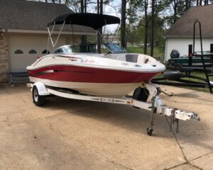
2006 Sea Ray 185 Sport
Featured
Top
1 month ago
by Joseph Manring
Ski
Natchitoches
,
Louisiana
$
11,000
total price
Add to Favourites
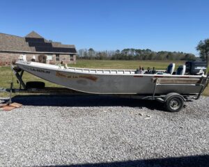
20 foot Solid fabrication boat. Sturdy. Engine runs great. Price NEGOTIABLE
Featured
Top
2 months ago
by Robin Deshotel
Flat/Jon
Elton
,
Louisiana
$
18,000
total price
Add to Favourites
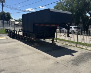
28′ cab over trailer
New
45 mins ago
by t p scott
Trailers
Houma
,
Louisiana
$
8,500
Add to Favourites
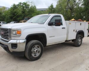
2016 GMC 2500 HD SERVICE TRUCK
New
46 mins ago
by Jessica Cason
Trucks
Livingston
,
Louisiana
Add to Favourites
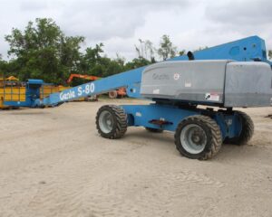
2008 GENIE S-80 MANLIFT
New
54 mins ago
by Jessica Cason
Equipment
Baton Rouge
,
Louisiana
Add to Favourites
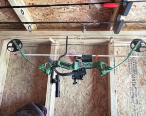
PSE bowfishing bow
New
3 hours ago
by Tony Palmisano
Bows
Madisonville
,
Louisiana
$
150
Add to Favourites
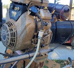
23 hp Copperhead
New
3 hours ago
by Stuart Johnson
Duck/Mud
Walker
,
Louisiana
$
4,500
Add to Favourites
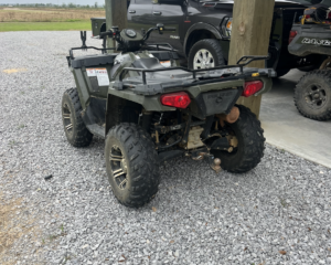
Polaris Sportsman 570
New
4 hours ago
by Benjamin Landry
ATVs & Four Wheeler
Jennings
,
Louisiana
$
3,000
Add to Favourites
AKC LABS
New
Top
4 hours ago
by Emily Garrett
Dogs
Winnfield
,
Louisiana
$
600
total price
Add to Favourites
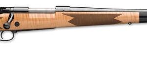
Winchester Model 70 SuperGrade
New
6 hours ago
by Zachary A
Guns
Gonzales
,
Louisiana
$
1,800
Add to Favourites
2013 Ford Edge Limited
New
18 hours ago
by Jake Miller
Cars
Lake Charles
,
Louisiana
$
3,500
total price
Add to Favourites
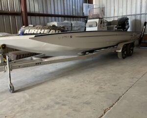
2019 Xpress H24
New
Top
19 hours ago
by Chad Juneau
Fishing
Cottonport
,
Louisiana
$
55,000
Add to Favourites
Free 6 Yr Old Yellow Lab
New
19 hours ago
by JBAIII
Dogs
Lafayete
,
Louisiana
$
0
Add to Favourites
Sig P229 Elite
New
24 hours ago
by John Walker
Guns
Madisonville
,
Louisiana
$
750
total price
Add to Favourites
Glock 43
New
24 hours ago
by John Walker
Guns
Madisonville
,
Louisiana
$
375
Add to Favourites
Glock 42
New
Featured
24 hours ago
by John Walker
Guns
Madisonville
,
Louisiana
$
350
Add to Favourites
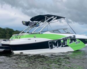
MTX 220 Extreme
New
Featured
Top
24 hours ago
by Mike ***
Ski
Ponchatoula
,
Louisiana
$
31,500
total price
Add to Favourites
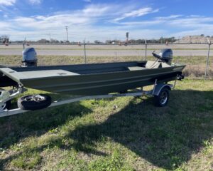
1652 Alweld Marsh Jon with 40 Yamaha
New
1 day ago
by Ryan Sonnier
Flat/Jon
New Iberia
,
Louisiana
$
16,600
Add to Favourites
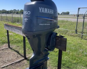
150 Yamaha 4stroke
New
1 day ago
by Ryan Sonnier
Outboard Motors
New Iberia
,
Louisiana
$
7,000
Add to Favourites
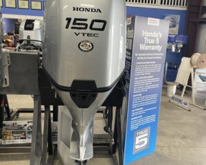
New 2024 150 Honda
New
1 day ago
by Ryan Sonnier
Outboard Motors
New Iberia
,
Louisiana
$
12,900
Add to Favourites
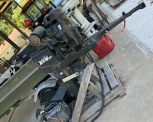
Gatortail Motor only
New
1 day ago
by Triston Bordelon
Outboard Motors
Marksville
,
Louisiana
$
7,000
Add to Favourites
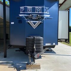
2024 Palomino Puma Destination
New
Featured
Top
1 day ago
by Lauren Shelton
Travel Trailers
Marksville
,
Louisiana
$
50,000
total price
1
2
3
4
…
90
91
92
Log in to post your ad
Search Listings
Search
Filter
Category
Location
Price Range
Apply filters