Skip navigation
CLOSE
X
Search
Subscribe
Back To
Submit Reports
Back To
Log In
Back To
Fishing
Back To
Fishing Articles
See All
Freshwater
Bass Fishing
Inshore
Offshore
Tournaments
Weather
Fishing Reports
Fishing Classifieds
Seasons & Regulations
Hunting
Back To
Hunting Articles
See All
Deer
Waterfowl
Other
Hunting Reports
Hunting Classifieds
Seasons & Regulations
Sportsman Products
Back To
New Products
Weather
Back To
Overview
Tidal Ranges
Lunar Tables
Classifieds
Back To
Classifieds Options
View All
Post Ads
Help
Jump to Section
Golf Carts/ATV
Motors
Boats
Hunting
Fishing
Tractors & Equipment
Real Estate
Vehicles & Trailers
RVs & Campers
Household Items
Businesses
Back To
Businesses
Advertise
Media Kit
Magazine
Back To
Learn More
Contents
Digital Issues
Manage Subscriptions
Purchase Back Issues
Gift Louisiana Sportsman
Subscribe
Back To
Submit Reports
Back To
Log In
Back To
April 19, 2024
Home
/ Listings
Listings
Showing 1–20 of 1788 results
A to Z ( title )
Z to A ( title )
Recently added ( latest )
Date added ( oldest )
Most viewed
Less viewed
Price ( low to high )
Price ( high to low )
Add to Favourites
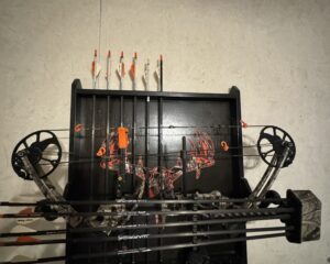
Mission Craze bow by Mathews
Featured
Top
2 months ago
by Brian Taylor
Bows
Covington
,
Louisiana
$
400
Add to Favourites
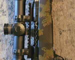
Savage 110 Ultralight- 6.5 PRC
Featured
Popular
Top
3 months ago
by Charles Provost
Guns
Breaux Bridge
,
Louisiana
$
2,300
Add to Favourites
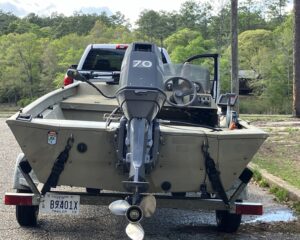
2008 G3 1756sc
New
2 hours ago
by Chad Gould
Flat/Jon
Picayune
,
Mississippi
$
4,800
total price
Add to Favourites
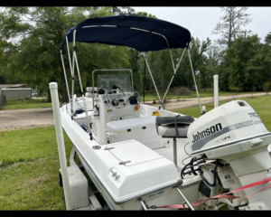
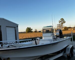
Sea pro 170cc
New
3 hours ago
by Perry Behnken
Fishing
Walker
,
Louisiana
$
7,500
Add to Favourites
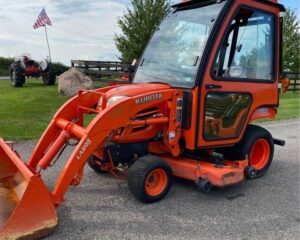
Kubota bx1850
New
3 hours ago
by Christopher T
Tractors
Kenner
,
Louisiana
$
1,800
Add to Favourites
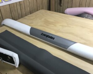
Marine upholstery
New
6 hours ago
by Angela Badali
Boat Accessories
Reserve
,
Louisiana
Add to Favourites
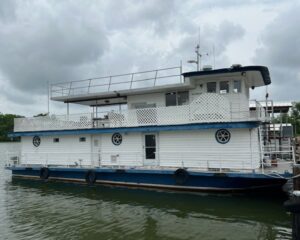
Steel hull self-propelled houseboat
New
7 hours ago
by Marc Felterman
Other Boats
Patterson
,
Louisiana
$
110,000
total price
Add to Favourites
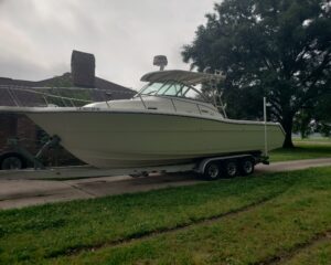
2002 pursuit 3070 os for sale
New
8 hours ago
by Chris Fontenot
Offshore/Center Console
Port Allen
,
Louisiana
$
50,000
Add to Favourites
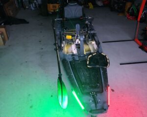
Kayak Native Slayer Max 12.5
New
9 hours ago
by Chris Clement
Fishing
Thibodaux
,
Louisiana
$
3,200
Add to Favourites
Amite County Mississippi Land
New
10 hours ago
by BishopHemphill
Hunting Land
Brookhaven
,
Mississippi
$
622,500
total price
Add to Favourites
2003 Blazer Bay 2170/2023 175 SHO
New
14 hours ago
by Dylan Doucet
Bay
Baton Rouge
,
Louisiana
$
30,000
Add to Favourites
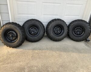
Stock ATV Tires and wheels
New
21 hours ago
by Robert Hall
Motorcycles
Gonzales
,
Louisiana
$
200
total price
Add to Favourites
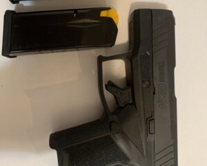
Taurus GX4 Pistol
New
22 hours ago
by Chelsea Moudry
Guns
Sulphur
,
Louisiana
$
275
total price
Add to Favourites
Great for family hunting camp or camping
New
1 day ago
by Doyce Phipps
Campers
Hammond
,
Louisiana
$
6,000
Add to Favourites
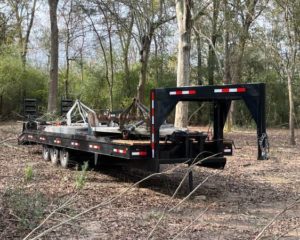
Heavy Duty 32ft Triple Axle Trailer
New
1 day ago
by Quality Equipment
Trailers
Houston
,
Texas
$
10,000
Add to Favourites
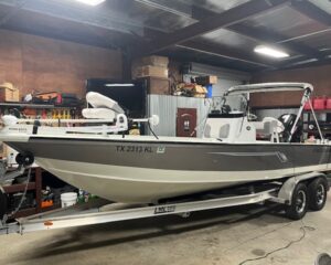
22ft Bay Boat Like New-30 hrs
New
1 day ago
by Quality Equipment
Bay
Houston
,
Texas
$
39,750
Add to Favourites
45Hp Kioti Tractor
New
1 day ago
by Quality Equipment
Tractors
Houston
,
Texas
$
19,000
Add to Favourites
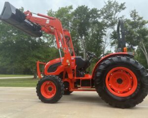
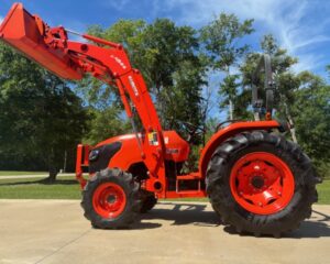
Like New 52Hp Kubota Tractor/HST
New
1 day ago
by Quality Equipment
Tractors
Houston
,
Texas
$
29,500
Add to Favourites
85HP Kubota Tractor
New
1 day ago
by Quality Equipment
Tractors
Houston
,
Texas
$
32,500
Add to Favourites
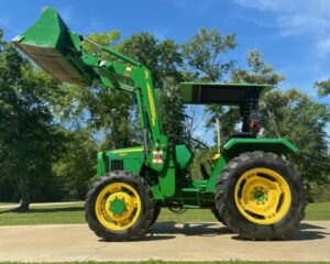
John Deere Farm Tractor
New
1 day ago
by Quality Equipment
Tractors
Houston
,
Texas
$
25,000
Add to Favourites
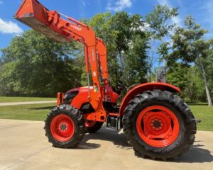
52hp Kubota Tractor-204 hrs
New
1 day ago
by Quality Equipment
Tractors
Houston
,
Texas
$
27,000
Add to Favourites
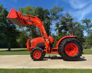
47Hp Kubota Tractor-100hrs/HST
New
1 day ago
by Quality Equipment
Tractors
Houston
,
Texas
$
29,000
1
2
3
4
…
88
89
90
Log in to post your ad
Search Listings
Search
Filter
Category
Location
Price Range
Apply filters