Skip navigation
CLOSE
X
Search
Subscribe
Back To
Submit Reports
Back To
Log In
Back To
Fishing
Back To
Fishing Articles
See All
Freshwater
Bass Fishing
Inshore
Offshore
Tournaments
Weather
Fishing Reports
Fishing Classifieds
Seasons & Regulations
Hunting
Back To
Hunting Articles
See All
Deer
Waterfowl
Other
Hunting Reports
Hunting Classifieds
Seasons & Regulations
Sportsman Products
Back To
New Products
Weather
Back To
Overview
Tidal Ranges
Lunar Tables
Classifieds
Back To
Classifieds Options
View All
Post Ads
Help
Jump to Section
Golf Carts/ATV
Motors
Boats
Hunting
Fishing
Tractors & Equipment
Real Estate
Vehicles & Trailers
RVs & Campers
Household Items
Businesses
Back To
Businesses
Advertise
Media Kit
Magazine
Back To
Learn More
Contents
Digital Issues
Manage Subscriptions
Purchase Back Issues
Gift Louisiana Sportsman
Subscribe
Back To
Submit Reports
Back To
Log In
Back To
April 17, 2024
Home
/ Listings
Listings
Showing 1–20 of 1832 results
A to Z ( title )
Z to A ( title )
Recently added ( latest )
Date added ( oldest )
Most viewed
Less viewed
Price ( low to high )
Price ( high to low )
Add to Favourites
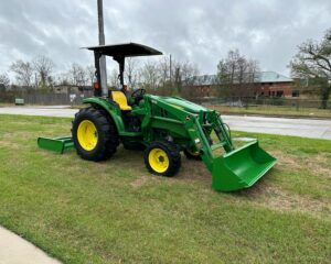
2016 John Deere 4066M
Top
1 month ago
by longwood
Tractors
Baton Rouge
,
Louisiana
$
32,500
Add to Favourites
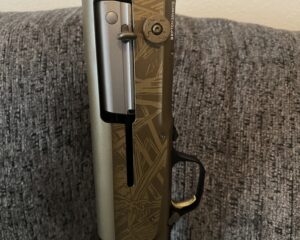
Like New Browning Wicked Wing
Featured
Top
1 week ago
by Scott Robichaux
Guns
Thibodaux
,
Louisiana
$
1,150
total price
Add to Favourites
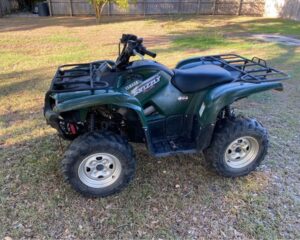
2008 Yamaha Grizzly 700
New
2 hours ago
by James Laws
ATVs & Four Wheeler
Baton Rouge
,
Louisiana
$
5,000
Add to Favourites
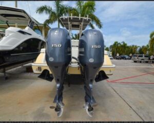
Slightly used Yamaha 150HP 4 Stroke Outboard Motor Engine
New
4 hours ago
by Dave Morris
Outboard Motors
Buffalo
,
New York
$
6,800
Add to Favourites
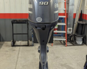
2019 Yamaha 90 HP Outboard Motor Engine
New
7 hours ago
by Minato Kazumi
Boat Accessories
Phoenix
,
Arizona
$
4,800
Add to Favourites
Golden Doodle puppies
New
Featured
Top
13 hours ago
by Bronson Blanchard
Dogs
Morgan City
,
Louisiana
$
1,000
Add to Favourites
Toro TimeCutter
New
13 hours ago
by Andre Fanguy
Lawn Mower
Houma
,
Louisiana
$
2,500
Add to Favourites
Pointador Pups
New
Top
14 hours ago
by Ernest Parsons
Dogs
Lake Charles
,
Louisiana
$
500
Add to Favourites
Beretta 1301 tactical MOD 2 NEW
New
15 hours ago
by Ralph Lucero
Guns
Hammond
,
Louisiana
$
1,200
Add to Favourites
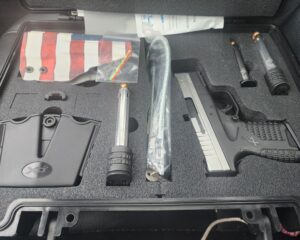
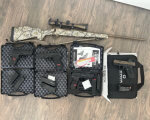
Springfield XDs and Remington 1100
New
17 hours ago
by Luke Arceneaux
Guns
Thibodaux
,
Louisiana
$
300
Add to Favourites
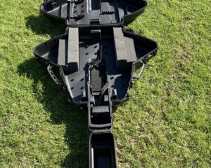
Crossbow Case
New
18 hours ago
by MICHAEL BUCCOLA
Bows
Ponchatoula
,
Louisiana
$
50
Add to Favourites
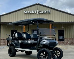
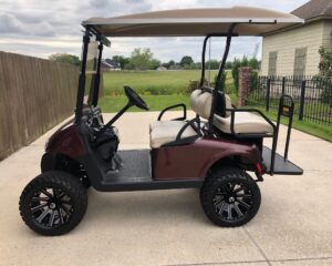
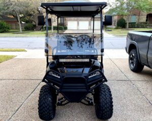
2024 Smart Cart 6L Golf Cart
New
18 hours ago
by Smart Carts
Golf Cart/UTV
Breaux Bridge
,
Louisiana
$
11,499
Add to Favourites
H&K USP 45 Tactical
New
21 hours ago
by Carl Giesselman
Guns
Lafayete
,
Louisiana
$
1,400
Add to Favourites
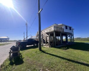
NEW LISTING – 122 Nora Lane, Grand Isle, LA 70358 985-787-3200
New
22 hours ago
by Coastal Realty
Camps for sale
Grand Isle
,
Louisiana
$
329,000
Add to Favourites
2008 EZGO RXV 48v
New
23 hours ago
by Fredrick Gomez
Golf Cart/UTV
Gonzales
,
Louisiana
$
5,500
total price
Add to Favourites
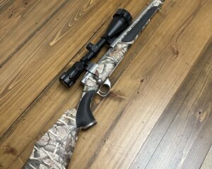
Weatherby .270 with Vortex Scope
New
23 hours ago
by Douglas Champagne
Guns
Thibodaux
,
Louisiana
$
600
total price
Add to Favourites
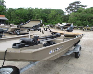
2022 G3 1610 bass boat
New
23 hours ago
by Steven Hicks
Bass
Marksville
,
Louisiana
$
21,000
Add to Favourites
WELDCRAFT 1652 ALUMINUM BASS BOAT
New
24 hours ago
by Johnny LaFleur
Bass
Bogalusa
,
Louisiana
$
15,998
Add to Favourites
Yamaha G29 golf cart
New
24 hours ago
by Ammy Turner
Golf Cart/UTV
Kenner
,
Louisiana
$
1,400
Add to Favourites
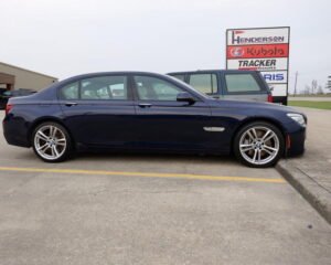
2015 BMW 750LI
New
1 day ago
by Henderson Implement & Marine
Cars
Lake Charles
,
Louisiana
$
21,000
Add to Favourites
Springfield 1911 a-1
New
1 day ago
by Henry Seruntine
Guns
Reserve
,
Louisiana
$
650
Add to Favourites
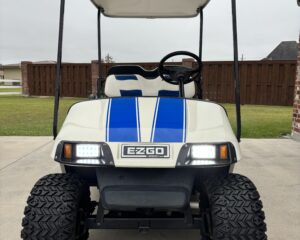
EZ Go Gas Golf Cart
New
1 day ago
by Gregory1
Golf Cart/UTV
Cut-Off
,
Louisiana
$
4,900
total price
1
2
3
4
…
90
91
92
Log in to post your ad
Search Listings
Search
Filter
Category
Location
Price Range
Apply filters