Skip navigation
CLOSE
X
Search
Subscribe
Back To
Submit Reports
Back To
Log In
Back To
Fishing
Back To
Fishing Articles
See All
Freshwater
Bass Fishing
Inshore
Offshore
Tournaments
Weather
Fishing Reports
Fishing Classifieds
Seasons & Regulations
Hunting
Back To
Hunting Articles
See All
Deer
Waterfowl
Other
Hunting Reports
Hunting Classifieds
Seasons & Regulations
Sportsman Products
Back To
New Products
Weather
Back To
Overview
Tidal Ranges
Lunar Tables
Classifieds
Back To
Classifieds Options
View All
Post Ads
Help
Jump to Section
Golf Carts/ATV
Motors
Boats
Hunting
Fishing
Tractors & Equipment
Real Estate
Vehicles & Trailers
RVs & Campers
Household Items
Businesses
Back To
Businesses
Advertise
Media Kit
Magazine
Back To
Learn More
Contents
Digital Issues
Manage Subscriptions
Purchase Back Issues
Gift Louisiana Sportsman
Subscribe
Back To
Submit Reports
Back To
Log In
Back To
April 23, 2024
Home
/ Listings
Listings
Showing 1–20 of 1821 results
A to Z ( title )
Z to A ( title )
Recently added ( latest )
Date added ( oldest )
Most viewed
Less viewed
Price ( low to high )
Price ( high to low )
Add to Favourites
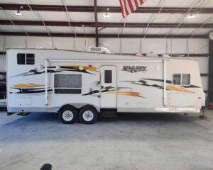
Jayco T28A ZX Toy Hauler Sport Utility Travel Trailer
Featured
Popular
Top
3 months ago
by JAMES BARRETT
Travel Trailers
Houma
,
Louisiana
$
12,000
Add to Favourites
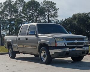
2003 Chevy Silverado 1500HD
Featured
Popular
Top
4 months ago
by Nathan Moore
Trucks
Baton Rouge
,
Louisiana
$
5,000
Add to Favourites
Sig P229 Elite
New
1 hour ago
by John Walker
Guns
Madisonville
,
Louisiana
$
750
total price
Add to Favourites
Glock 43
New
1 hour ago
by John Walker
Guns
Madisonville
,
Louisiana
$
375
Add to Favourites
Glock 42
New
Featured
2 hours ago
by John Walker
Guns
Madisonville
,
Louisiana
$
350
Add to Favourites
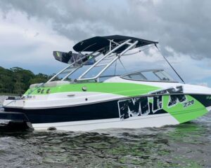
MTX 220 Extreme
New
Featured
Top
2 hours ago
by Mike ***
Ski
Ponchatoula
,
Louisiana
$
31,500
total price
Add to Favourites
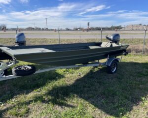
1652 Alweld Marsh Jon with 40 Yamaha
New
2 hours ago
by Ryan Sonnier
Flat/Jon
New Iberia
,
Louisiana
$
16,600
Add to Favourites
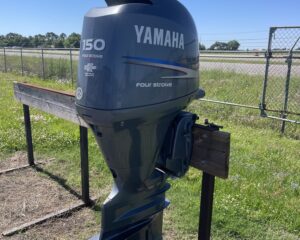
150 Yamaha 4stroke
New
2 hours ago
by Ryan Sonnier
Outboard Motors
New Iberia
,
Louisiana
$
7,000
Add to Favourites
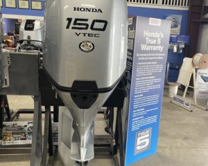
New 2024 150 Honda
New
2 hours ago
by Ryan Sonnier
Outboard Motors
New Iberia
,
Louisiana
$
12,900
Add to Favourites
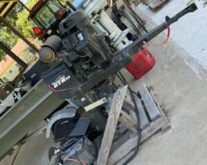
Gatortail Motor only
New
3 hours ago
by Triston Bordelon
Outboard Motors
Marksville
,
Louisiana
$
7,500
Add to Favourites
2024 Palomino Puma Destination
New
Featured
Top
4 hours ago
by Lauren Shelton
Travel Trailers
Marksville
,
Louisiana
$
50,000
total price
Add to Favourites
Fire place with wood rack
New
8 hours ago
by Carson Zaunbrecher
Lawn & Garden
Eunice
,
Louisiana
$
700
Add to Favourites
Want to Buy
New
11 hours ago
by LARRY G ROBICHAUX
Guns
Plaquemine
,
Louisiana
Add to Favourites
Shotguns mossberg browning stoeger 12 28 gauge
New
19 hours ago
by David King
Guns
Raceland
,
Louisiana
$
400
Add to Favourites
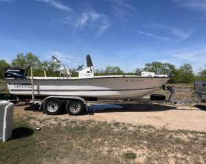
Triton sea flight
New
21 hours ago
by Patrick Burns
Bay
San Antonio
,
Texas
$
18,000
Add to Favourites
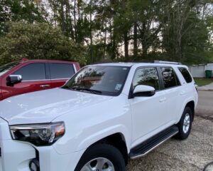
2019 TOYOTA 4-RUNNER SR-5
New
Featured
Top
23 hours ago
by Jean Junius
SUVs
Mandeville
,
Louisiana
$
34,500
Add to Favourites
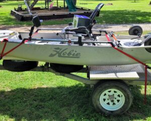
2018 Hobie PA12
New
1 day ago
by James Schopper
Fishing
Center Point
,
Louisiana
$
2,500
Add to Favourites
$350,000.
New
1 day ago
by Randy Scrantz
Camps for sale
Houma
,
Louisiana
$
350,000
Add to Favourites
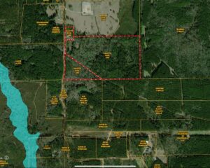
96.3 AC ASH RD, CENTREVILLE, MS – $549,000
New
1 day ago
by Murray Land and Homes Realty
Hunting Land
Natchez
,
Mississippi
$
549,000
Add to Favourites
2019 JOHN DEERE 6105 E CAB AIR TRACTOR
New
1 day ago
by Buck Hornsby
Tractors
Clinton
,
Louisiana
$
72,500
Add to Favourites
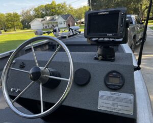
Hanko 1958PV
New
1 day ago
by GARY BERNARD
Bass
Donaldsonville
,
Louisiana
$
30,000
Add to Favourites
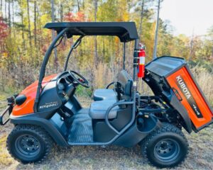
Kubota RTV 400 4WD
New
1 day ago
by Tom H
Golf Cart/UTV
Lafayete
,
Louisiana
$
1,400
1
2
3
4
…
90
91
92
Log in to post your ad
Search Listings
Search
Filter
Category
Location
Price Range
Apply filters