Skip navigation
CLOSE
X
Search
Subscribe
Back To
Submit Reports
Back To
Log In
Back To
Fishing
Back To
Fishing Articles
See All
Freshwater
Bass Fishing
Inshore
Offshore
Tournaments
Weather
Fishing Reports
Fishing Classifieds
Seasons & Regulations
Hunting
Back To
Hunting Articles
See All
Deer
Waterfowl
Other
Hunting Reports
Hunting Classifieds
Seasons & Regulations
Sportsman Products
Back To
New Products
Weather
Back To
Overview
Tidal Ranges
Lunar Tables
Classifieds
Back To
Classifieds Options
View All
Post Ads
Help
Jump to Section
Golf Carts/ATV
Motors
Boats
Hunting
Fishing
Tractors & Equipment
Real Estate
Vehicles & Trailers
RVs & Campers
Household Items
Businesses
Back To
Businesses
Advertise
Media Kit
Magazine
Back To
Learn More
Contents
Digital Issues
Manage Subscriptions
Purchase Back Issues
Gift Louisiana Sportsman
Subscribe
Back To
Submit Reports
Back To
Log In
Back To
April 19, 2024
Home
/ Listings
Listings
Showing 1–20 of 1791 results
A to Z ( title )
Z to A ( title )
Recently added ( latest )
Date added ( oldest )
Most viewed
Less viewed
Price ( low to high )
Price ( high to low )
Add to Favourites
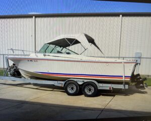
24′ 1973 Stamas Cuddy Cabin
Featured
Top
2 months ago
by chris Lindsay
Other Boats
Houma
,
Louisiana
$
7,200
total price
Add to Favourites
Buy Now, Build Later!
Featured
Top
2 weeks ago
by WALLACE MYERS
Lots for Sale
Lake Charles
,
Louisiana
$
80,000
–
$
230,000
Add to Favourites
Amite County Mississippi Land
New
46 mins ago
by BishopHemphill
Hunting Land
Brookhaven
,
Mississippi
$
622,500
total price
Add to Favourites
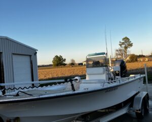
2003 Blazer Bay 2170/2023 175 SHO
New
5 hours ago
by Dylan Doucet
Bay
Baton Rouge
,
Louisiana
$
30,000
Add to Favourites
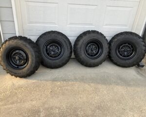
Stock ATV Tires and wheels
New
12 hours ago
by Robert Hall
Motorcycles
Gonzales
,
Louisiana
$
200
total price
Add to Favourites
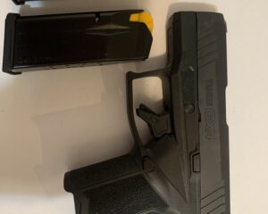
Taurus GX4 Pistol
New
13 hours ago
by Chelsea Moudry
Guns
Sulphur
,
Louisiana
$
275
total price
Add to Favourites
Great for family hunting camp or camping
New
15 hours ago
by Doyce Phipps
Campers
Hammond
,
Louisiana
$
6,000
Add to Favourites
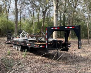
Heavy Duty 32ft Triple Axle Trailer
New
16 hours ago
by Quality Equipment
Trailers
Houston
,
Texas
$
10,000
Add to Favourites
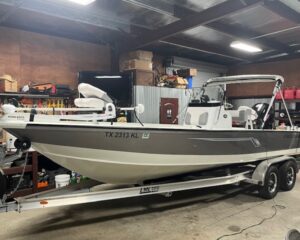
22ft Bay Boat Like New-30 hrs
New
16 hours ago
by Quality Equipment
Bay
Houston
,
Texas
$
39,750
Add to Favourites
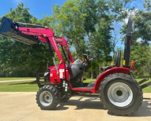
45Hp Kioti Tractor
New
16 hours ago
by Quality Equipment
Tractors
Houston
,
Texas
$
19,000
Add to Favourites
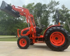
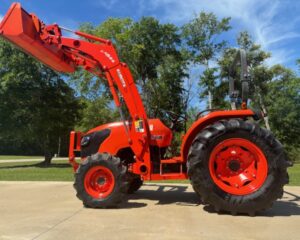
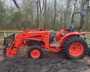
Like New 52Hp Kubota Tractor/HST
New
16 hours ago
by Quality Equipment
Tractors
Houston
,
Texas
$
29,500
Add to Favourites
85HP Kubota Tractor
New
16 hours ago
by Quality Equipment
Tractors
Houston
,
Texas
$
32,500
Add to Favourites
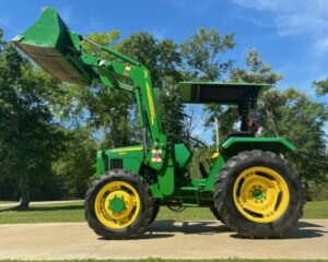
John Deere Farm Tractor
New
16 hours ago
by Quality Equipment
Tractors
Houston
,
Texas
$
25,000
Add to Favourites
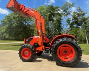
52hp Kubota Tractor-204 hrs
New
16 hours ago
by Quality Equipment
Tractors
Houston
,
Texas
$
27,000
Add to Favourites
47Hp Kubota Tractor-100hrs/HST
New
16 hours ago
by Quality Equipment
Tractors
Houston
,
Texas
$
29,000
Add to Favourites
2018 55hp Kubota Farm Tractor
New
16 hours ago
by Quality Equipment
Tractors
Houston
,
Texas
$
27,000
Add to Favourites
28hp Mahindra Tractor-25 hrs
New
16 hours ago
by Quality Equipment
Tractors
Houston
,
Texas
$
13,750
Add to Favourites
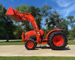
43Hp Kubota Tractor
New
16 hours ago
by Quality Equipment
Tractors
Houston
,
Texas
$
27,000
Add to Favourites
2008 Champion
New
19 hours ago
by 110prop
Bay
Port Allen
,
Louisiana
$
38,500
Add to Favourites
BERETTA COLLECTORS! 8040 Cougar – NRA # 315 of only 650
New
19 hours ago
by GEORGE SNYDER
Guns
Kenner
,
Louisiana
$
775
Add to Favourites
6201 Delacroix Hwy
New
20 hours ago
by The Camp Man
Camps for sale
Denham Springs
,
Louisiana
$
350,000
total price
Add to Favourites
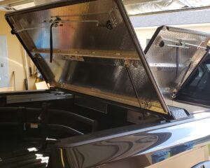
Diamond Back 270 tonneau cover for 2018 Nissan Titan XD with 6’7″ long bed.
New
21 hours ago
by Cary Newnam
Trucks
Lafayete
,
Louisiana
$
1,500
total price
1
2
3
4
…
88
89
90
Log in to post your ad
Search Listings
Search
Filter
Category
Location
Price Range
Apply filters