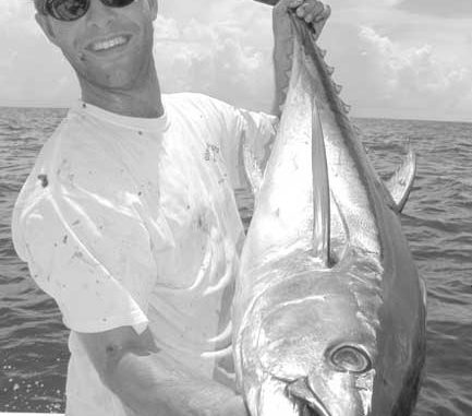
The action on spottails in the Biloxi Marsh is unbeatable for anglers carrying long rods.
Capt. Paul:
What are the coordinates for Truloix Point in Lake Catherine?
Thanks, Claude Cutitto
Capt. Paul’s Response:
I believe that the present position of Truloix Point on the southeast side of Lake St. Catherine is at or about N30 07.055 Lat./W89 43.878 Long.
I say present, because the shoreline has receded eastward from where the point was several years ago by about 50 yards. The above point is located at the present shoreline.
I will send you a current Maptech Terrain Navigator Aerial photo map of Truloix Point that will indicate the position I have plotted for you.
Capt. Paul:
Please give me the location of rigs Lena and Cognac, and please include the chart you use.
Thanks,Gerald Guillory
Capt. Paul’s Response:
Cognac is at or about N28 47.226 Lat./W89 03.639 Long. It is about 16.7 miles from land’s end at South Pass at a bearing of 161 degrees, and is in block 194 of the Mississippi Canyon. It is about 13 miles northwest of Ensco 7500.
Lena, I believe, is located in block 280-1 of the Mississippi Canyon at N28 39.820 Lat./W89 08.110 Long. It is about 17.5 miles to the southwest of Ensco 7500.
Ensco 7500 is a semi-submersible rig in Leased Block 243 of the Mississippi Canyon. It is about 26 statute miles at a bearing of 138 degrees magnetic from land’s end at the mouth of South Pass. The position is at or about N28 43.973 Lat./W88 49.935 Long. It is in about 3,400 feet of water.
All positions are stated as DDD,MM.MMM, and were determined by using WGS 84 datum. All bearings are in magnetic degrees.
Several charts will show the locations of all of the above platforms. Try NOAA chart 1115A Leased Blocks, Cape St. George to Miss River; 11366 Approaches to Miss River; 11360 Cape St. George to Mississippi River.
I must warn you that not all rigs are shown on these charts.
The actual positions came from the U.S. Department of the Interior, Mineral Management System. They list all of the platforms in federal waters in the Gulf of Mexico.
Capt. Paul:
You stated in a post on louisianasportsman.com that you created routes for a fisherman in the Bassmasters Classic using Maptech marine software, and e-mailed him the routes.
All of the boats in the Classic were outfitted with Lowrance X15 MTs, which is a unit that I have. I know from talking to Maptech that their software is compatible with a lot of Lowrance models, but the X15 MT is not one of them.
How did the angler load these routes?
Thanks,Will Homes
Capt. Paul’s Response:
O.K., Will, here it is. But I have to warn you it is a mouthful.
After agreeing to do the GPS waypoints and routing for one of the contestants, who lives in Tennessee, I advised him to purchase the Maptech Terrain Navigator mapping software for Southeast Louisiana. He did so.
I then designed the routes using a combination of Maptech Terrain Navigator Pro and Maptech Offshore Navigator mapping software using their digital charts.
By using a combination of the Maptech topo and marine-type mapping software, I marked the waypoints and configured 15 different routes to a variety of fishing locations within the fishing range of the tournament.
The aerial features in the Terrain Navigator Pro and Offshore Navigator allowed me to really fine-tune some of the critical parts of the routes as well as to supply precise up-to-date information on the waterways. In addition, the aerial photos allowed an actual “view” of the intended fishing areas.
I then saved (exported) the waypoints and named and saved all of the routes individually, each as a separate file. I then e-mailed the contestant these saved files.
Using the Maptech Terrain Navigator mapping software, the contestant opened (imported) first the waypoints then individually each of the different routes.
After viewing the software maps with the waypoints and routes displayed, we spent many telephone hours discussing the how’s and why’s of each route.
Using his Lowrance iFinder, he first downloaded the Lowrance MapCreate mapping software on a MMC memory card. Then using another MMC chip coupled to a MMC reader/writer, he downloaded the Maptech waypoints and routes that I furnished into the second card as data.
He did so by using the Maptech GPS setup menu, and using the settings for the Lowrance Globalmap 100. I believe that this setting is comparable to the Lowrance Globalmap 100, the iFinder, LMS 240 and X15.
Once the waypoint and route data was written to the MMC card, he inserted the card into the GPS unit and, by going to the iFinder’s menu page and then selecting data then load, transferred the waypoints and routes into the memory of his iFinder unit.
After using the iFinder for his practice sessions, he simply used the same MMC card to load the same data into the X15 unit in the same way when he was assigned a boat. He carried the iFinder as a backup loaded with the Lowrance MapCreate Maps and the downloaded waypoint and route data.
In short, the waypoints and routes gave him a precise way to navigating one route from Bayou Segnette to Delacroix, a one-way course of over 120 miles, without ever having been in the area before. He made the route, through two locks, in a timed run of two hours. His comments were that the routes were flawless.
For the latest version of these Maptech products, go to the following URL: www.maptech.com/products/index.cfm?&bpid=PAU0197015901
Save it as a favorite.
If you need anything additional or have the need for such a routing service, contact me via louisianasportsman.com. I will be glad to help you any way I can.


