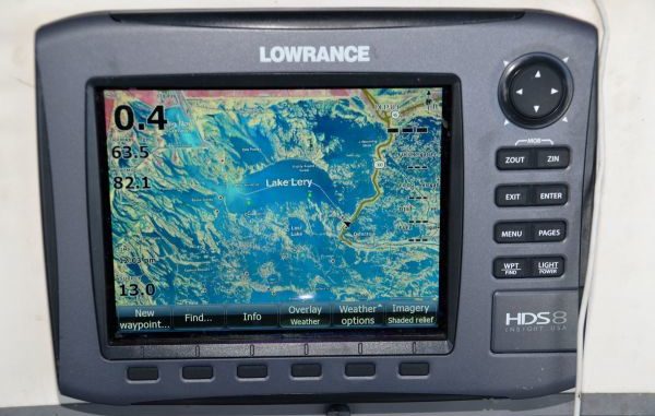
Stevie Nick’s enthusiasm about the Standard Mapping E-card doesn’t stem from his employment with the company. Rather, he works for the company because he is a big fan of the e-card itself.
Of course, it helps that the job is flexible enough to allow him to fish more than most people can imagine.
Standard Mapping Services has long been known for producing detailed, laminated fishing maps from high-altitude aerial photography. The maps were, and still are, updated every two or three years because of Louisiana’s ever-changing geography.
E-cards, also called “GPS chips,” put the same information on fishermen’s GPS units, with the added benefit of allowing a fisherman or boat operator to zoom in electronically on any spot.
“The zoom-in feature is what allows me to pick out the small drains and lee shores that I could never see by any other means,” Nick said.
Standard Mapping Services owner Glenn Schurr said the problem in the past has been that the state’s coastal waters change so quickly that the only GPS screens available to boat operators showed their boats traveling over land masses that in actuality no longer exist.
“(Other company’s) software is based on government charts,” he said, “that are outdated. You can’t get lost with the E-cards. You have the confidence to go to new areas and explore. It broadens your horizons.
“You can bounce in and out of the card to see the old GPS display. The old, eroded islands are now often submerged reefs that offer good fishing.”
The mapping information is contained on an SD card that is inserted into a compatible GPS receiver. Schurr noted that the cards will work with Lowrance HDS, Simrad and B&G Marine Electronics.
Available for less than two years, Standard Mapping E-cards can be purchased anywhere that sells Standard Mapping Services traditional maps, such as independently-owned tackle stores and marinas.
Prices, according to Schurr, range from $79 for smaller cards up to $299 for the areal equivalent of what is now on a laminated map. Standard Mapping Services, he added, will take trade-ins of outdated cards when updated ones are purchased.
Glenn Schurr can be reached at 985-898-0025 or his cell 985-807-3765 to answer questions about his E-cards.
