Trout, reds await at popular hotspot
Dear Capt. Paul:
Where is Wreck Bay out of Point a la Hache? What are the coordinates for the bay? I can’t seem to find it on my map.
Capt. Paul’s response:
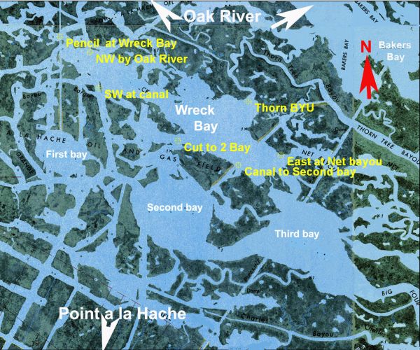
Wreck Bay is located in Plaquemines Parish, north of Point a la Hache. It is a body of water that is about 2.25 miles long by 0.4 of a mile wide. It is south of Oak River (River aux Chenes) at the Little Crevasse, southwest of Bakers Bay, and it joins the Pencil canal at the bay’s west end. It is also just north of First, Second and Third bays.
It is in an area that has many small oil and gas platforms, and has many oyster reefs in and around these aforementioned lakes and bays.
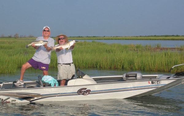
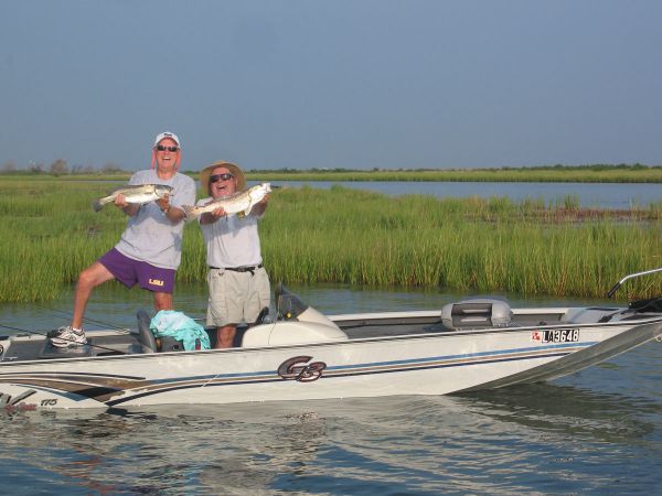
The entire area is noted for trout and reds in the winter months. I have had several requests for information about Wreck Bay, and in plotting my positions I found that the bay is not listed on many maps and charts. This is probably why you were unable to find anything.
The entire shoreline offers excellent fishing, as does drifting or slowly trolling the bay. You have over eight miles of shoreline to fish.
But be sure to try the numerous small islands and the deeper cuts that are throughout the bay area.
It can be reached by boat from Point a la Hache, which is about a 5.5 mile trip from Beshel’s Boat Launch, (504-333-4469, @ 29°33.6750’N ~ 089°46.2156’W) via the Back Levee canal and some of the north-south canals to Third Bay and then entering Wreck Bay on its eastern end.
This would be a route without going into any of the really large bodies of water in the area. You would be running in the weather protected canals and small lakes.
Of course, you can also get there from Delacroix Isle at the Sweetwater Launch (504-342-2368) on Bayou Terre Boeufs by using Bayou Gentilly to Little Lake to the Pencil Canal, crossing Oak River to the western end of Wreck Bay. This would be about a 13.5 mile journey in mostly protected small bodies of water.
Asking for the coordinates for the bay is like asking for the coordinates for I-49 by Alexandria, so I will give you some of the entrance bayous, canals and cuts for the bay, as well as the rough center of that body of water.
The coordinate format is degrees/minutes, and the datum used is World Geodetic System 1984.
Northwest by Oak River — 029° 37.3254’ N, 089° 47.1051’ W
Canal entering southwest of bay — 029° 37.0812’ N, 089° 47.0341’ W
East end at Net Bayou — 029° 36.6136’ N, 089° 45.5827’ W
Canal to Second Bay — 029° 36.5433’ N, 089° 45.9184’ W
Thorn Bayou — 029° 36.9856’ N, 089° 45.8397’ W
Cut to 2 Bay — 029° 36.7145’ N, 089° 46.4022’ W
Pencil Canal at Wreck Bay — 029° 37.4352’ N, 089° 47.3450’ W
Approximate center of the Bay — 029° 36.9512’ N, 089° 46.3427’ W
Don’t pass any of the other really good fishing locations just to get to Wreck Bay, as many of the canals and larger bayous have deeper water when compared to Wreck Bay and would normally hold fish in cold weather. I remember a time when we really loaded up by drifting Thorn Tree Bayou with the current. That was a really great trip.
Capt. Paul
