Fishing locales removed from NOAA maps to reflect reality of eroded coastline.
“Accuse not Nature, she hath don her part.” —Paradise Lost, John Milton, 1667
It’s a busy morning off the floor of the state House of Representatives, where lobbyists and reporters are bird-dogging lawmakers, looking for votes and quotes. Still new to freshman Rep. Chris Leopold, a Republican from Belle Chasse whose district follows the winding Mississippi River well below Venice, the pace and stress of ongoing budget hearings are beginning to show.
He hasn’t shaved, his sleeves are rolled up and his collar is unbuttoned.
In some respects, the mood is just as hectic back home in his district, where his family and neighbors recently learned of 31 Plaquemines Parish locales that are being removed from the charts and maps maintained by the National Oceanic and Atmospheric Administration.
There are few ways to describe the event other than as a defeat: Mother Nature — along with some man-made factors — pushed the bayous, bays, passes and ponds past extinction before government and community could properly respond.
Leopold said he’s still learning about the science and NOAA’s bureaucracy and the state’s ongoing coastal restoration and hurricane protection efforts.
But he added that he refused to be dispirited or sentimental. For future generations, he’ll gladly take a boat out over open water and explain that this is where Yellow Cotton Bay used to be, or that run over there was once Venice Canal.
“Our world is changing,” he said, head shaking and hands on hips. “But these feelings will pass. What’s important to remember right now is that challenges give way to opportunity.”
It all started in the wake of Hurricanes Katrina and Rita in 2005. The feds knew the storm surges and winds wreaked havoc on Louisiana’s southernmost landscape, so they began surveying and studying. The end results have been a surprise for many, but not for those who have been tracking the erosion issue over the past few generations.
Islands and low-water features were completely gone, NOAA scientists and biologists learned, and now they’re being decommissioned.
The list of the missing map points is stunning, including hotspots stretching from Empire to Venice:
• Andres Pond
• Bay Cheri
• Bay Crapaud
• Bay Jacquin
• Bay Pomme d’Or
• Bayou Auguste
• Bayou Caiman
• Bayou Dum Barr
• Bayou la Chute
• Bayou le Boon
• Bayou Long
• Bayou Petit Liard
• Bob Taylors Pond
• Bayou Tony
• Cyprien Bay
• Drakes Bay
• Dry Cypress Bayou
• English Bay
• English Bayou
• Fleur Pond
• Grand Bayou Carrion Crow
• Little Pomme d’Or
• Little Pass de Wharf
• Locust Pond
• Pass de Wharf
• Scofield Bay
• Skipjack Bay
• Tom Loar Pass
• Venice Canal
• Williams Pass
• Yellow Cotton Bay.
Click here to see a graphic.
While hurricanes and tropical storms are culprits for their collective demise, Tim Osborn of NOAA’s Office of Coast Survey for the Eastern Gulf in Lafayette, added there are others. Worldwide sea-level rise, saltwater intrusion, industry and subsidence — which, in its most basic form, refers to the sinking of land — are all contributors.
“It’s a trend, and it’s a natural process,” said Osborn, adding that more changes in the near future to documents mapping South Louisiana are inevitable.
It’s more troubling on the east side of the Atchafalaya River, and can be seen below the Terrebonne-Lafourche region, as well, he said.
For instance, Wine Island was washed away after Hurricane Gustav dealt a final blow in 2008, and there are animated graphics that show the whittling of Wonder Lake.
“There have been changes around the nation, up in the northeast after Hurricane Sandy most recently,” Osborn said. “But nothing to the extent of what we’re seeing here.”
You can get the same kind of informed assessment from Garrett Graves, chairman of the Coastal Protection and Restoration Authority and Gov. Bobby Jindal’s top coastal advisor.
Graves told the House Natural Resources Committee in May that there’s more than just passes and lakes at stake: The tide could one day swallow whole communities and change human lives forever.
“The reality is we’re projected to lose 1,800 additional square miles of our state over the next 50 years. It’s not a sustainable trajectory,” Graves said. “Nothing’s going to stay the same no, matter what we do.”
Prevention is the key, he said, and Louisiana has created a successful model in recent decades, previously unprecedented, for attacking the root issues.
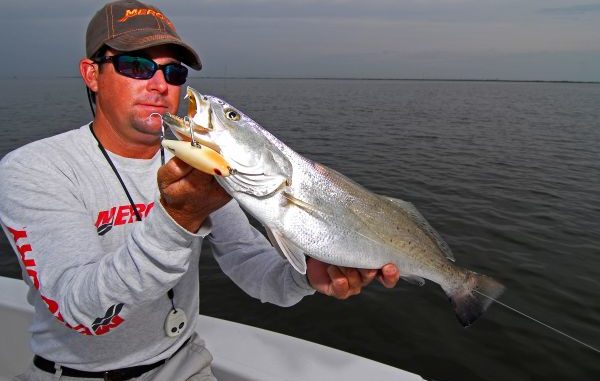
If there’s a silver lining —albeit unwanted and darkened — for recreational anglers, it’s that the fisheries in these vanishing areas are adaptable, despite the loss of habitat.
“They will move to other areas,” added Graves. “We know they’re going to move farther up (the coastal estuaries), and they have been for the past 80 years.”
Leopold, a member of the House Natural Resources Committee, asked Graves what is being done on the ground in Plaquemines Parish. Graves replied that state and federal dollars have been following need, which has amounted to more than $3 billion worth of construction over the past few years in Plaquemines.
Moving forward — the only direction Leopold said he wants — Graves vowed the commitment will continue, as outlined in the state’s Coastal Master Plan, Louisiana’s official blueprint for restoration and protection.
“Plaquemines Parish is probably the greatest beneficiary of work that’s underway right now,” Graves said. “It’s estimated that we have close to $300 million worth of work there just on the restoration and protection side.”
The Master Plan also calls for freshwater diversions, which commercial fishermen fear will negatively and irreparably affect their fisheries due to lowered salinity.
But there’s much more going on. In the annual plan for the next fiscal year that begins July 1, there are several projects anticipated to begin or continue.
The annual plan is basically how the objectives in the coastal master plan, the blueprint, are carried out.
There’s the Bayou Lamoque floodgate removal, marsh and ridge restoration work at Grand Liard, a planned sediment pipeline, non-rock alternatives for shore protection, more sand for the east side of Shell Island and renovations on Lake Lery’s south shoreline. Work is also ongoing for Pelican and Scofield islands.
With BP fines expected to begin trickling down soon and increased offshore revenues coming in 2017, Leopold said he expected the pace of progress to quicken in coming years.
While Yellow Cotton Bay and 30 other spots in Plaquemines are gone, he said the future federal money, couple with the vision of the state’s Master Plan, will offer an avenue for saving some of the other locales that can still be enjoyed.
“The decisions by NOAA (to remove locations from its charts) just reiterate our goal of protecting and restoring the coast,” he said. “This is no time to give up.”
