Dear Capt. Paul:
Do you have the locations for the headquarters and the camping-mooring sites in the Pass-a-Loutre WMA?
B.V.
Capt. Paul’s response:
have the LDWF headquarters complex located on a 1,000-foot-by-300-foot strip of land between Dennis and Johnson’s passes. It is at or about 29°07.0734′ N. Latitude ~ 89° 12.4584′ W. Longitude.
One of the camping sites is the Loomis Pass No. 2 site is at or about 29° 7.3806′ N. Latitude ~ 89° 10.7220′ W. Longitude.
The LDWF Web site at www.wlf.louisiana.gov/wma lists the Pass-A-Loutre WMA as having five designated tent-camping areas on the area — three of which have been designated to allow the mooring of recreational houseboats.
Prior to mooring, however, houseboats must receive permits from the department. All campers must have sanitary waste-disposal systems. Get a copy of the current Hunting Regulations booklet for details, hunting hours and other requirements.
More information also can be obtained by calling Wildlife & Fisheries at 337-373-0032.
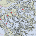
I have located some of the sites from the rough WMA map that is included on their Web site.
Unless otherwise specified, all positions are stated as degrees, minutes and thousandths of minutes (DDD,MM.mmm) and were determined using WGS 84 Datum. All bearings and courses are stated in magnetic degrees.
On Oct. 1, I received the following information from the Louisiana Wildlife & Fisheries. The following positions are for the headquarters area and the camping sites. All coordinates are in decimal degrees and datum NAD83:
Headquarters — 29.11789 N~89.20764 W
South Pass Campground ‘ 29.10537 N~89.23427 W
Cadro Pass Campground’ 29.09091 N~89.21090 W
Loomis No. 1 Campground ‘ 29.12818 N~89.19299 W
Loomis No. 2 Campground ‘ 29.12301 N~89.17870 W
Southeast Pass Campground – 29.13903 N~89.14870 W
My calculations indicate that the positions converted to WGS 84 datum and degrees, minutes and decimal minutes are:
Headquarters ‘ 29°07.0734′ N~89°12.4584’ W
South Pass Campground’ 29° 06.3204′ N~89°14.0562′ W
Cadro Pass Campground ‘ 29°05.4546′ N~89° 12.6540’ W
Loomis No. 1 Campground ‘ 29°07.6908′ N~89°11.5794’ W
Loomis No. 2 Campground ‘ 29° 07.3806′ N~89° 10.7220’ W
Southeast Pass Campground ‘ 29° 08.3418’ N~89° 08.9220’ W
When venturing into the area, be sure you have the latest charts and maps of the Mississippi River and the management area, along with safety equipment. The river can be dangerous, with seagoing traffic, sandbars and other debris. Cellular telephones do not always work in the area, as there are no relay towers nearby. A good VHF marine radio is always a good investment.
The latest NOAA marine chart No. 11361 (Mississippi River Delta), as well as current USGS topographical maps South Pass, Garden Island Pass, Pass a Loutre East and Pass a Loutre West are a must. Aerial photo maps are a real plus to have because they depict the most-current view of the area.
Capt. Paul


