


Instead of allowing stiff winds to ruin your Hopedale fishing trip, have an alternative plan — and put plenty of trout in the boat.
It’s a scenario every angler is familiar with. You heard the fish were biting in the outside waters at the islands and rigs just off the coast. According to all the reports, the action has been spectacular. The fish have been large and plentiful, and so cooperative even mediocre fishermen like your brother-in-law, Clyde, are coming home with limits of whoppers.
You’re drooling at the prospect of bent rods and tight lines, and you have a day off coming up to get out into the middle of the fray.
You plan your fishing trip carefully, knowing exactly what you plan to do: Get to the launch, load up the live baitwell and head straight to the outside, without getting distracted by diving birds or tempting spots on the inside.
That is the plan.
So you arrive at the launch with great expectations, only to step out into brisk winds. Make that stiff winds of the 20 mph variety.
The winds might let up, you tell yourself. But deep down you know that’s wishful thinking. The reality is those winds are going to blow hard all day, and all your hopes of getting to those big fish in the outside waters are dashed.
So what do you do?
Basically you have two options: tuck in your tail and go home, or there’s Plan B.
Plan B is the alternate plan, the fallback plan you resort to when your original plan is shot down. And every angler needs one, because if you’ve fished even just a few times, you know how capricious Mother Nature can be.
Personally, I’ve never much liked Plan B. I get frustrated when the weather prophets falsely foretell of mild winds and calm seas, only to have my visions of big trout slamming baits dashed by gale-force winds and seas.
And, generally speaking, Plan B stinks. It means I have to settle for smaller fish and usually many fewer of them.
And that’s if I can find any at all.
So, no, I’ve never been a fan of Plan B.
But when I showed up at the dock of the Breton Sound Marina recently to fish with Capt. Jonathan Sanchez, I knew before I stepped out of my truck it’d be a Plan B day. I knew it when I read my wind gauge before I even left home (I look at the palm trees in my neighbor’s yard. If they’re bent over and I can hear the wind howling through their leaves, that’s my wind gauge saying it’s a stay-at-home or Plan B day).
Now Sanchez is quite a bit younger than I am, and with that youth comes much enthusiasm — and he was certain we could find fish and still have a good day on the water despite the winds.
I caught some of his enthusiasm, and we all piled into his 25-foot Privateer, and he pointed the bow up the bayou.
“So, what’s your Plan B?” I asked him, as we headed up Bayou LaLoutre toward Bakers Canal.
“Get as close to the outside as we can, and find some clean water on a lee shoreline,” Sanchez said. “But before we head all the way out, I want to try a few spots closer in, starting with the backside of the dam.”
We made the meandering trip around the dam and came out in the MRGO behind it. Sanchez motored in slowly and dropped a heavy steel pole over to hold us in place.
“Fish as close as you can get to the rocks, hopefully without getting snagged on them,” he said, and we all tossed our live shrimp under a cork as instructed.
“The dam is hit-and-miss,” Sanchez said. “Sometimes we nail the fish right here, and we catch some nice-sized trout here.”
Determining where to fish is pretty elementary.
“I look for signs of bait and fish anywhere along the dam, in the middle and on both corners,” Sanchez explained. “We’ll give it 15 minutes or so, and if we don’t get any action we’ll move on.”
There was a lot of bait in the water. Maybe too much bait: We saw plenty of signs that indicated fish, but we didn’t get a bite.
We moved from one end of the dam to the other and fished the middle, as well, before throwing in the towel and heading down the MRGO.
Plan B wasn’t looking too good, so far.
The next stop was at a huge pile of rig trash and rubble. Sanchez was intently watching the shoreline as we traveled down the MRGO, looking for something that might indicate fish.
“On a Plan B day, you look for anything — a slick on the surface, a current line around a point, bait moving on the surface, or even a line of demarcation between dirty water and cleaner water, birds diving, anything that looks promising,” he said.
Something along that trash pile must have looked promising because he motored slowly toward it and dropped that pole anchor over to stick us there.
We gave it a few minutes, and then moved into the cut alongside it, and that’s where we bumped into the trout.
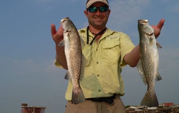
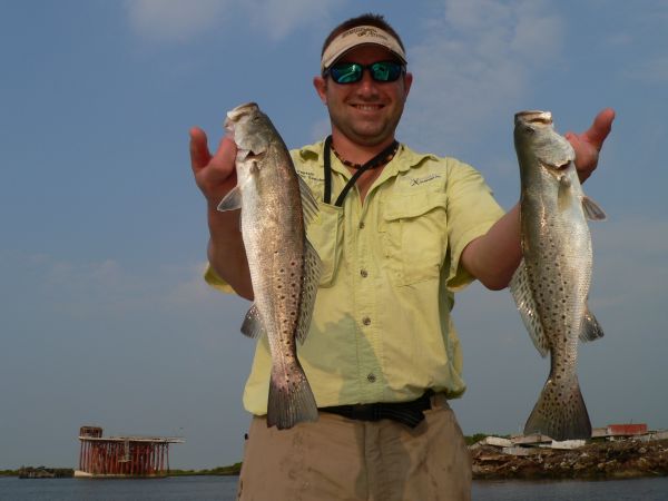
They weren’t huge like the fish we hoped to find at the rigs and islands, but they were certainly respectable, and all four of us caught quite a few specks and several white trout before the action died.
I told Sanchez that common sense would say the Ship Channel ought to hold a lot of fish. The bait boats and shrimp trawlers like to drag it for shrimp, so it must have a good supply of bait — and where there’s bait there should be fish.
“My dad says if you’d learn to fish the MRGO, I mean really learn it, fishing the ledges and flats and shells and drop offs, you’d never have to fish anywhere else, all year round,” he said.
“I’d agree with your dad,” I said, as he moved us farther down the MRGO toward the outside.
Now that we had a good number of trout in the box, Plan B wasn’t looking all that bad, I thought to myself.
“From here we have several options,” Sanchez said. “We have a strong west-northwest wind today, so I can duck out of the MRGO to the south and fish St. Helena Bay and the Pass Fernandez area, where I should be able to find a lee shoreline. I like to fish Lake Machias and Lake Fortuna on my Plan B days, but this west wind will keep us out of there today.
“I could also turn north out of the MRGO into Lake Athanasio and head through Canal Pecal. We’ll take a beating until we pass Point Eloi, but then we’ll have a long lee shoreline all the way to Point Lydia, and hopefully we’ll be able to find some clean water.”
He said there was another choice to be considered, as well.
“Another great option, and one of the best options on a day like today, is to head to the rocks at the end of the MRGO,” Sanchez said. “They are fishable under most conditions, and they’re really the best Plan B.
“But if you’re planning to fish the rocks, a strong southeast wind is bad because it blows straight up the channel, leaving you no place to hide from the wind and seas, and a strong west wind is even worse because it makes the water so muddy, even at the rocks.
“On any other wind, or even on a west wind when it’s not blowing 20 mph, I’d head down the rocks and look for slicks on the surface, which indicate fish underneath, or signs of bait or a good line separating clean water from dirty water, or a wash through. Then I’d anchor and give it some time to produce.”
If conditions allow, there are several options in this area.
“You can fish the long or short rocks on the channel side or the outside and anywhere along their entire length, weather permitting,” Sanchez said. “Fish live shrimp under a cork, and keep in mind the fish can be anywhere from right up against the rocks to 15 to 20 feet out or more.”
Sanchez said the key to fishing the rocks successfully is patience.
“If you catch a few fish at a spot, don’t be in too big of a hurry to leave,” he said. “The action along the rocks often comes in spurts and cycles.
“You’ll catch four or five fish, and then the action slows down, and 10 minutes later you catch three more, and so on. The temptation is to get impatient and take off to hunt for faster action, and what often happens is you run all over the place, burn a ton of gas and wind up coming back to the rocks to try to add a few more fish to the box before heading in.”
The patient angler just waits the fish out.
“If you’d have stayed at the rocks to begin with, you’d have been steadily adding to your box of fish all day, and you’d have a real nice mess of fish at the end of the day,” Sanchez said.
He said yet another windy-day option is to run the length of Bayou LaLoutre and exit through Treasure Pass into Christmas Camp Lake, where you have a huge lee shoreline to work over.
Look for clean water at points, cuts and drains, and current lines, slicks or signs of bait in the water are all indications of fish under the surface.
“There are more spots to fish than you can count; we just have so many options, even on Plan B days,” Sanchez said. “You just have to work at it more. You might have to move around a bit more to find clean water, and when you find fish you might have to cull through the small ones for the keepers.
“But if you keep working at it you’ll put together a very nice box of fish.”
Sanchez opted to take the northern route and head us through Athanasio to whatever lee shorelines looked promising.
The winds remained steady and unrelenting, and finding clean water was a challenge. But we’d duck behind points and wherever we found calmer, cleaner water — and we pecked away at the fish.
They weren’t all ganged up in one place, but we caught plenty almost at every spot we tried.
The blustery winds kept us pretty cool, and occasional clouds overhead made our day downright comfortable. We headed back to the dock with a very nice box of respectable-sized speckled trout, despite the windy conditions.
Not bad for a Plan B day.
Note to self: Don’t cancel a fishing trip simply due to blustery winds. Those Plan B trips can be very productive.
Capt. Jonathan Sanchez can be reached at 504-232-6227.
Destination Information
The best launch sites to reach these fishing areas are either from Hopedale or Shell Beach, and both are about a one-hour drive from Downtown New Orleans.
Take I-10 east from downtown toward Slidell and exit on I-510 south towards Chalmette. Turn left on Highway 39 (Judge Perez Drive), and follow it over the Violet overpass to the blinking light at the four-lane intersection just before the intersection with Highway 46.
Turn left on the four-lane, and go about nine miles to the four-way stop. Turn left and drive about five miles, cross the Yscloskey bridge and take a right on Highway 624 to Hopedale, or turn left to Shell Beach.
Marinas
In Hopedale, Breton Sound Marina has a hoist, a double backdown, ice, bait, accessories and a nearby fuel dock. The old Pip’s Place Marina is closed, but a few anglers still use the backdown (although the ramp is very steep and it is inadvisable to launch there).
In Shell Beach, Campo’s Marina has a backdown, live bait, ice, fuel and some accessories.
Maps/Charts
Standard Aerial Map No. 4F, No. 302 (post-Katrina) or No. 304
Guides
Capt. Jonathan Sanchez can be reached at 504-232-6227.
Other excellent guides also fish out of Hopedale and Shell Beach. Check the Louisiana Guides section in this issue or call the marinas for recommendations.
Overnight accommodations are available in both Hopedale and Shell Beach. Check with the guides and marinas.
