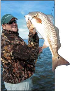
You don’t have to run far to catch bass in this productive area of Southcentral Louisiana.
Dear Capt. Paul:
How do I get to the Sulphur Mine from Golden Meadow’s public landing?
Thanks,
Butch Landry
Capt. Paul’s response:
The Sulphur Mine in Lafourche Parish is west of Galliano in the middle of the Point-au-Chien, Golden Meadow and Larose area. It is just northeast of Lake Bully Camp in the Pointe-au-Chien WMA, and is north of the Leeville area.
I am not quite sure where the public launch that you are referring to is located, but you can access the Mine by proceeding west in the Plaisance Canal from Highway 3235 for a distance of about 2.5 miles.
My positions for the Galliano Sulphur Mine are as follows:
The south side of the Sulphur Mine lake located in the Pointe au Chien WMA at a point where Bayou Bouillon (now a canal) enters the lake is at or about N29º 27.465 x W90º 22.652.
There is another canal that leads from the lake on the west side to Grand Bayou. Grand Bayou then leads southerly to Cut Off Bayou, which intersects Bayou Pointe au Chien near the southern end of Highway 655. It is near the Wildlife & Fisheries Headquarters. The lake at the first mentioned canal is at or about N29º 27.751 x W90º 23.404.
The center of the Sulphur Mine is at or about N29º 27.765 x W90º 22.936. I do not believe that the center is the deepest part of the lake.
The map that I have shows several pilings and some small production platforms thoughout the area.
There is, however, another Sulphur Mine to which you may be referring. The old Freeport McMoRan main Sulphur Rig, which was located off the coast of Grand Isle, is the center of one of the Louisiana offshore artificial reefs.
The site is about 3.9 miles from the Aid To Navigation (ATON) light Green No. 1 at the beginning of the entrance to the Barataria Pass channel, just south of Grand Isle and about 22 miles at a bearing of 67 degrees from the red No. 2 buoy at the end of Belle Pass (Pass Fourchon) in the Gulf of Mexico.
Use caution in navigating this course as a direct line is it passes near and in three cases directly though some of the many oil/gas platforms in the area.
The rig site is now an underwater reef. Freeport-McMoRan Corp donated the rig to the state of Louisiana for use as an artificial fishing reef. It was partly disassembled, and is now completely submerged below the water. The entire superstructure of the site is about 30 feet below the surface.
The reef is now marked with five buoys.
FISH FLRA-27-B HAVEN, I believe, is located at N29º 11.623 x W89º 53.670. It is the northwestern of the five.
Another buoy, FLRA-27-“A,” is at N29º 11.597 x W89º 52.990. It is about 3.8 miles south of Barataria channel marker red No. 2.
These are the northernmost of the five buoys. The center buoy of the three southernmost buoys is, I believe, at N29º 10.948 x W89º 53.335.
There are several oil/gas platforms also in the immediate area.
Unless otherwise specified, all positions are stated as H,DDD,MM.mmm, and were determined using WGS 84 datum. All headings, bearings and courses are stated in magnetic degrees.
Dear Capt. Paul:
I recently purchased a Magellan eXplorist 600. I would like to know what mapping software you recommend for this unit. I use this GPS for duck hunting in the marshes south of Venice and the Atchafalaya Delta/Wax Lake areas. I also fish those areas.
Thanks for your help.
Thomas
Capt. Paul’s response:
I suggest that you first consider the Magellan MapSend Topo 3D USA.I prefer the topo mapping versions of GPS mapping whenever you are off-road inland and in the coastal marshes. I believe the programs based on USGS topographical maps show more detail in the marshes than do those programs based on NOAA marine charts.
The MapSend Topo 3D USA offers you topo-type maps of the entire United States. It allows you to load on secure digital (SD) memory cards. A 512MB card will hold MapSend topo maps of most of Louisiana, Mississippi and Alabama. Several cards of this or lager sizes will allow you to have topo maps of several other states at the ready if your travels or needs so require them.
In addition, another program, the MapSend DirectRoute 3.0 software, will allow you to use the unit as a turn-by-turn auto navigation program in your eXplorist 600.
These MapSend programs, when coupled with several SD memory cards, allow you to use your very fine GPS unit in a variety of different ways.
As a start, first consider the MapSend TOPO mapping.
Got a GPS question for Capt. Paul? You can ask it on the reports page of the Louisiana Sportsman web site (lasmag.com).
")