Word from Capt. Paul
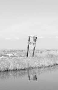
In the wakes of Katrina and Rita, many landmarks that were the backbone of our “dead-reckoning” system of getting around in the marshes are no longer there. Points of land, tree lines, radio towers, reefs, reef markers, production platforms as well as some buildings were simply stripped away by the roaring winds and ravaging storm surge.
In addition, many of the official and privately maintained navigation aids (NAVAIDS) that once marked the channels, cuts and points throughout the area were also destroyed.
Do not rely on floating NAVAIDs, as the winds and water may have moved these markers from their original positions to locations that are not now proper.
Fixed NAVAIDs are generally considered to be more reliable, but to make matters worse, the channels and safe water in some of the bayous, canals, lakes and bays they once marked are now filled in with silt and debris, making the water impassible or dangerous to boat traffic.
In many locations, there will be no assistance available to help a grounded or disabled boater.
Cellular phone towers as well as the land-based telephone lines connecting them together have been damaged.
Enjoy our outdoors, but be careful.
Capt. Paul
Dear Capt. Paul:
I would like to get the coordinates for the boat launch behind the hospital in Port Sulphur. I’m trying to figure out how far I would have to run to get to Happy Jack Canal.
Sincerely,
Tom Houston
Capt. Paul’s response:
There are several backdown locations near the hospital in Port Sulphur, most of which are private, but the opening at the canal of the one you want, I believe, is located at or about N29 28.423 x W89 41.837.
That would make it about 6.25 miles from the Happy Jack Canal using Grand Bayou.
All positions are stated as DDD,MM.mmm and were determined using WGS datum.
Dear Capt. Paul:
I am going to be purchasing a new bay boat, and I am wanting a flush-mount GPS/fish finder. I fish mainly in the marshes of Southeast Louisiana, and want the best unit and maps available.
I currently use a Garmin Map76, and I have all the CD maps, but they are several years old and Garmin says they are not working on any current maps of our area.
Please help,
Clint Schexnaydre
Capt. Paul’s response:
Although Garmin is not planning any immediate updates in their MapSource U.S. TOPO mapping for South Louisiana, neither is any other GPS maker that I know of other than those for and in Maptech’s i3 Touch Screen Navigation System.
That is because the system uses Maptech’s fine line of mapping software. Their Marine Chart Kit is second to none.
Check it out at www.maptech.com/products/i3/index.cfm.
The unit uses Maptech’s fine digital charts, which are very frequently updated.
Their program for the i3 consists of the most recent NOAA marine-type charts, U.S.G.S. topographical maps for the area along the coastline and certain inside waterways and the latest aerial photos of these same areas.
Although I don’t personally own one, I believe that is a quantum leap forward in coastal navigation that is accomplished with a touch of your finger on the screen rather than having to press buttons to navigate the different menus.
The unit has impressive features, and the Maptech mapping programs are second to none.
Got a question for Capt. Paul? Ask it at www.lasmag.com, and he’ll answer it as soon as possible.


