Dear Capt. Paul:
I recently purchased a Lowrance IFinder H20. The software I am operating with it is MapCreate 6 of which I have not updated to MapCreate 6.2 as yet.Before doing so, I thought I would write to see what software you recommend for heavy marine use with a pleasure vessel. I seek your advice because I feel as though you would know which software is more marine-oriented for South Louisiana.
Please advise at your earliest convenience.
Thank you and good fishing,
Jed A. Gussoni
Capt. Paul’s response:
Your needs for “heavy marine use” may be different from mine, especially since I am not sure how, with what and where you will doing your “heavy marine use.”
If your marine use is mainly offshore and traveling the established commercial waterways that are marked by USCG Aids to Navigation lights, markers, buoys, nuns and cans (Navaids), then you should consider the Lowrance adaptable NauticPath or Navionics mapping software. These programs are based on NOAA marine charts.
While these charts and the software derived from the charts are the best in the world for guiding the mariner to and in the established Navaid commercial waterways, the physical land representations are notoriously poor.
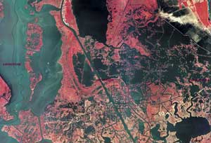
The 2005 issue of the NOAA River Chart (11364: Mississippi River/Venice to New Orleans) still shows Snake Island in Black Bay and Raccoon Island by Lake Fortuna as land masses even though they both have not been islands for the last 25 years that I know of. These types charts are the best for showing those waterways marked with Navaids, and are used primarily for commercial navigation. But this type of mapping, in my opinion, is lacking in depicting land areas away from these established Navaid routes.
The Lowrance MapCreate Series 6 (6.3) USA Topo mapping software is based on USGS topographical maps, and as such depicts land masses much more accurately than mariner charts. This type of mapping software is what I use when fishing or navigating the Louisiana coastal marshes. I believe it offers the boater a more accurate representation of the marshes than does the marine chart version.
The two MapCreate Series 6 CDs are divided as USA East and USA West. The software integrates land-based topographical data with U.S. state mapping detail, and includes 2 million points of interest, a hunting-specific database and much more. It includes Navaids for inland and coastal waters.
If you already have the MapCreate 6 version, I suggest you check out the Lowrance web site at lowrance.com/Mapping before you update your software. The site allows you to view the maps in the 6.3 version. Pick out an area that you are familiar with on your 6.0 version, and zoom in to a tight view. Then compare your version with the Series 6.3 updated version.
In doing so, you may find that you don’t really have to update to the newer version, but if you do, be sure to get the Lowrance accessory package that includes the Series 6.3 USA Topo software, the Lowrance card reader writer and a Lowrance Secure Digital (SD) memory card. The H2O will only recognize maps in the Series 6.3 mapping version when the card is loaded using the Lowrance card reader writer.
Also, the program will allow you to load only five memory cards. You can use the cards over and over again, but only those five. Almost any commercial Secure Digital card will work, so when selecting your cards, purchase them with at least 128mb of memory. I personally use 512mb cards, and am able to load all of my mapping needs on the five allotted cards. You can find some real bargains at computer or camera stores that handle the SD memory cards in the 512mb range.
Having the MapCreate 6 and the Series 6 (6.2) available on my computer, I was able to compare the features side by side, and although I have both programs, sometimes I use the older 6.0 version.
So the bottom line is that you have to make the decision as to the type of mapping software you want or need in your iFinder H2O. Compare both types, and select the one that is best for your specific needs.
Dear Capt. Paul:
I can download Google Earth on my PC, and there is a lot more detail than on my Garmin maps.
Is there anyway I can put the Google Earth maps on my Garmin GPS?
Capt. J.S.
Capt. Paul’s response:
I KNOW WHAT YOU MEAN!
Do you have an accessory mapping software in your unit? Most units only come with a basemap to get you started. The accessory mapping software greatly improves the map details that are lacking on the basemap.
But use caution before plunking down your money for any type of mapping software.
I have several computer mapping programs that can show topo mapping as well as aerial photos down to 1-meter scale, but these programs will not work in the internal mapping feature of your GPS.
The best you can do, with one exception, is to consider the Garmin MapSource US Topo for land use and their blue charts for offshore use.
The exception is to get a copy of one of Maptech’s mapping programs (Chart Navigator Pro or Terrain Navigator Pro) that includes charts, topos and aerials for the chart version and two-scale topo and aerials for the Terrain Pro version, load it into your laptop and connect the laptop to your Garmin.
This configuration will give you the ability to see your movements on one of the best mapping programs available.
So for the most part, you must use Garmin software maps when installing GPS maps in the Garmin unit. Only the Garmin MapSource software will work.
Got a GPS question for Capt. Paul? Post it at lasmag.com, and he’ll respond promptly. Your question may even be featured in a coming issue of Louisiana Sportsman.