The Red River is like an entirely different waterway than it was just two years ago. Here’s how to catch bass there this summer.
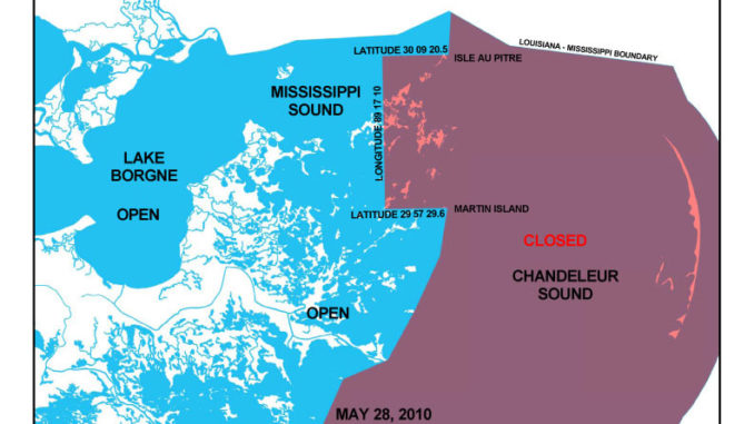
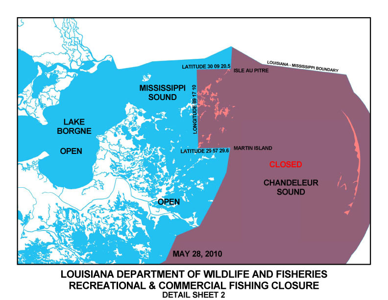
The string of islands between Martin Island and Isle Au Pitre in northeastern St. Bernard Parish have been closed today (May 28) to all fishing after oil was confirmed in the area, the Louisiana Department of Wildlife and Fisheries reported.
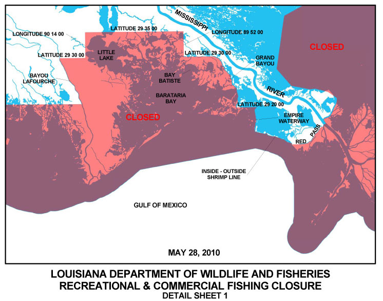
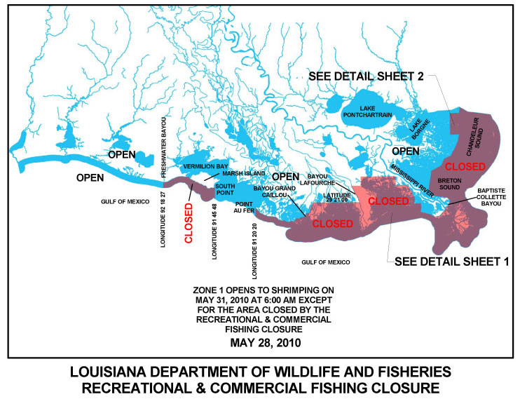
Click here for a detailed map of the area. A map of all state closures can be viewed here, while a detailed map of the Barataria Bay and Venice closures can be viewed here. Closures of federal waters can be viewed here.
The latest action closed waters extending north of Martin Island on the eastern shore of the Biloxi Marsh at 29 degrees 57 minutes 29.6 seconds north latitude; thence northward to Isle au Pitre at 30 degrees 09 minutes 20.5 seconds north latitude from the double rig line westward to 89 degrees 17 minutes 10 seconds west longitude.
All other closures remain in effect.
The agency reported that precautionary closures of recreational and commercial fishing are being implemented based on the best information agency Secretary Robert Barham receives from field biologists, staff and trajectory models from NOAA.
