“What are the best types of maps?” That is a question I am asked over and over again. It is similar to trying to answer, “What is the best truck?”
I could answer the question a hundred different ways and still be correct or entirely wrong. It all depends on how, where and what function you need the truck (and the map) to perform.
The variety of maps makes the question even harder to answer. My first response is to ask, “What type of map do you need?” By that, I mean is the map for navigating a boat in offshore waters, coastal waters, for use in an auto while traveling the highways, roads and streets? Or is it for hunting an area where there are hills, streams and creeks? Or maybe it is for plotting positions on your hunting lease, or for navigating the maze of waterways in the Louisiana coastal marshes. And it could be for documenting property lines or for piloting an airplane.
Before I get an answer, I usually follow up with, “How will you be using the map and can you actually ‘read’ and understand the map?”
The map questions vary somewhat, but most all are inquiring about the proper maps to use with a global positioning system (GPS) receiver. That means it’s really asking two different questions: What is the best “map” to be use as a paper or hard copy map, and what is the best map to use with my GPS receiver?
Paper maps
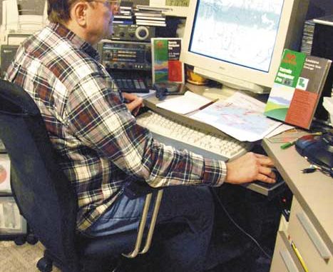
If you were to see my office work area, the first thing you would notice is a very extensive inventory of many different types of maps and charts.
Loving the outdoors as I do, I have literally hundreds of United States Geological Survey (USGS) topographical maps in 1:250,000, 1:100,000 and 1:24,000 (7.5-minute Quad series) scale, and a significant amount of NASA high-altitude photos of my hunting and fishing areas. Couple this with many, many NOAA Marine Charts that cover the Gulf of Mexico coastal waters from here to Timbuktu, and the amount of my map inventory grows to a considerable amount of rolled “paper” tubes in my office.
The charts, as you know, are quite large and are the “official” marine navigation mapping standard. I even have the NOAA “instructional” chart that is used in the navigational part of the test for a Coast Guard license.
My wife calls them all dust catchers, and says that I never throw things away. Every time she sees them, I have to double the guard to protect them.
Luckily the cost of purchasing these maps was spread out over the years, as it would be a financial impossibility to have to purchase them all at one time. I was lucky that Katrina spared my office from major damage, and the map collection remained intact.
All of these maps and charts naturally were the latest issue when they were purchased, but most are now obsolete. However, these maps and charts are definitely not worthless, as these older maps show features that were there at the time they were drawn. They offer a unique historical perspective as how the features looked at that time.
But they are not the maps that I would use on a current trip. Yes, I would consult them, but I would not bring them with me on a current venture. I would naturally bring the most current map of the area that I could find.
The cost of always having an updated version of all of these maps and charts makes it an impossible quest for all but a recent Powerball winner. Again, what to you do? How do you get the most recent maps that are available without having to give up an arm and a leg or cash in your IRA?
Fortunately there is an alternative. Modern technology has made that possible. Yes, that’s correct. All of these maps can be yours in a consumer-orientated computer program that you can install on your own personal computer.
A company has put all of those maps in a package for the consumer, and you don’t need a separate room in your house to store these different maps. All you need is a computer and a printer. A color printer, while not mandatory, will provide you the means of printing your own maps. You can print maps and photos on standard or large-format printers, with or without USGS borders and legends, limited only by the size of your printer.
Maptech
Maptech has recently released their newest version of Terrain Navigator Pro, Version 8.0, which provides all of these maps plus more.
Maptech scans official USGS topo maps to produce the highest quality maps available. It provides two topo scales for the continental US: 1:24/25,000 (7.5 minute series) and 1:100,000 scale. Alaska is 1:63,360 and 1:250,000 scale. These maps can be copied and stored on your internal hard-drive or even an external USB hard drive.
These high-quality digital USGS maps and aerial photos can be viewed in either 2-D or 3-D. You can create a “3D fly-around” or “fly-through” (following a preset route) as a short video clip. Email the video clip for use in Windows Media Player, or copy and paste into PowerPoint to spice up a presentation.
Maptech’s Internet servers store the official government-released aerial photo coverage for more than 95 percent of the United States. Most major metropolitan areas are now in color, and 1-meter black-and-white photos are available for all other areas. Naturally if your computer space allows you to do so, these aerial photo-maps can also be stored on your hard drive. A one-year subscription for photo downloads is included in the price of the software. Any photos you download are yours to keep using after the subscription ends. If you need more photos in the future, additional subscriptions are available on a per-year basis.
And the Maptech Terrain Navigator Pro has an instant link and interphases, via the internet, with Google Earth in a synchronized display with all the different types of maps. These different images can be viewed as a single screen or as a side-by-side split screen format on the computer and, of course, be printed.
Now that you know you can get the maps, you should also know that the program will allow you to quickly find specific maps very quickly. You can locate a certain map by using the graphical index map, or search by address, map name, latitude, longitude and ZIP code, or by using more than 50 different types of place names such as rivers, lakes, cities, etc.
By using the seamless “View” mode, you are able to stitch multiple maps into a single, continuous map you can actually view and, of course, print. This method allows for portions of several topo maps to be viewed as one map, or you can view maps as individuals with the normal collars (borders), legends, scale and latitude/longitude and UTM markings.
You can even search the maps for locations by typing in an address. And by using your mouse, you can move the cursor over maps or photos, and it will display street addresses when it is over a street. By clicking on streets or structures, you can add custom address labels.
A powerful “auto-text” feature lets you instantly annotate a map or photo with labels containing street name, address, coordinates, elevation, grade, length or area. That means you can mark your favorite fishing holes, hunting stand locations and any other position on the entire map. These labels can be printed on the hard copy or omitted form the printed version. This allows you to make your own personal maps for your own use. I print mine on standard letter paper, and either laminate them or place them in 2-gallon zip-type bags.
Next month, learn how the Maptech Terrain Navigator Pro works with your GPS. In the meantime, if you’ve got a question for Capt. Paul, Louisiana Sportsman’s GPS expert, ask it at www.lasmag.com.