The story of Davis’ hunt for sunken treasure started when he was 17. An acquaintance gave him an old fishing map to help him find speckled trout. As he used the maps, he noticed that the islands holding some of the best fishing spots were eroding away.
Rather than buy later versions of the maps that didn’t show the islands at all, he kept using them long after the islands had disappeared. Davis has refined his treasure hunt over the years, using maps that date back as far as the 1950s.
He gave an example of how he works. “I will look at a map and locate what I want, just for example’s sake, a now-gone island that was 4 ½ miles at 270 degrees from Mozambique Point.
Then I run to it by boat, looking for structure, primarily by watching the depth sounder, until I find shallower water. Once I find the spot, I spend some time running back and forth over the area to find the edges of the structure. The drop-offs hold the fish.
“I inspect the old maps closely to find where the old cuts and trainasses (fur trappers’ ditches) were. I look for these when I am moving over the islands in my boat. They are often still there, but underwater and they hold fish too.
“After I have checked everything out, I mark the spot on my GPS.
“When you fish these spots, you are in the wide open. Other boats pass and the fishermen look at us like we are crazy.”
Gallo, the professional angler gave his take, which didn’t differ much from Davis’.
“I find that with a lot of fishermen, if visible structure isn’t present, they don’t fish a spot. An island can be gone from sight, but the structure is still there — the remnants of the shell base of the island is still there. The average angler doesn’t see it, but it’s there.
“My belief is that what’s there underwater changes water currents. That attracts bait fish and that in turn attracts trout.”
To get a good grip on what has happened, Davis recommends going to Google Earth.
“Look at Stone Island in Black Bay. Then go 1.95 nautical miles south/southeast and back the date up to 1998.
“You can see a little of the islands that are now gone, but that we still fish often. As you move the date forward you can see the islands slowly disappear.
“Just after Katrina they are basically gone. By July 2008, they are completely underwater. This is the reason almost all current maps and updated electronics lack this island information, at least in my belief. The information just is not on current satellite images.”
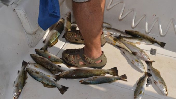
Davis does most of his sunken treasure fishing in Black Bay, out of Delacroix. Best times are May through September.
")